Spuren urgeschichtlicher Beackerung in West-, Mittel-, Ost- und Nordeuropa Traces of prehistoric farming in Western, Central, Eastern and Northern Europe: Forstenrieder Park-Südost, Bayern-Süd Bavaria-South Weiter more...
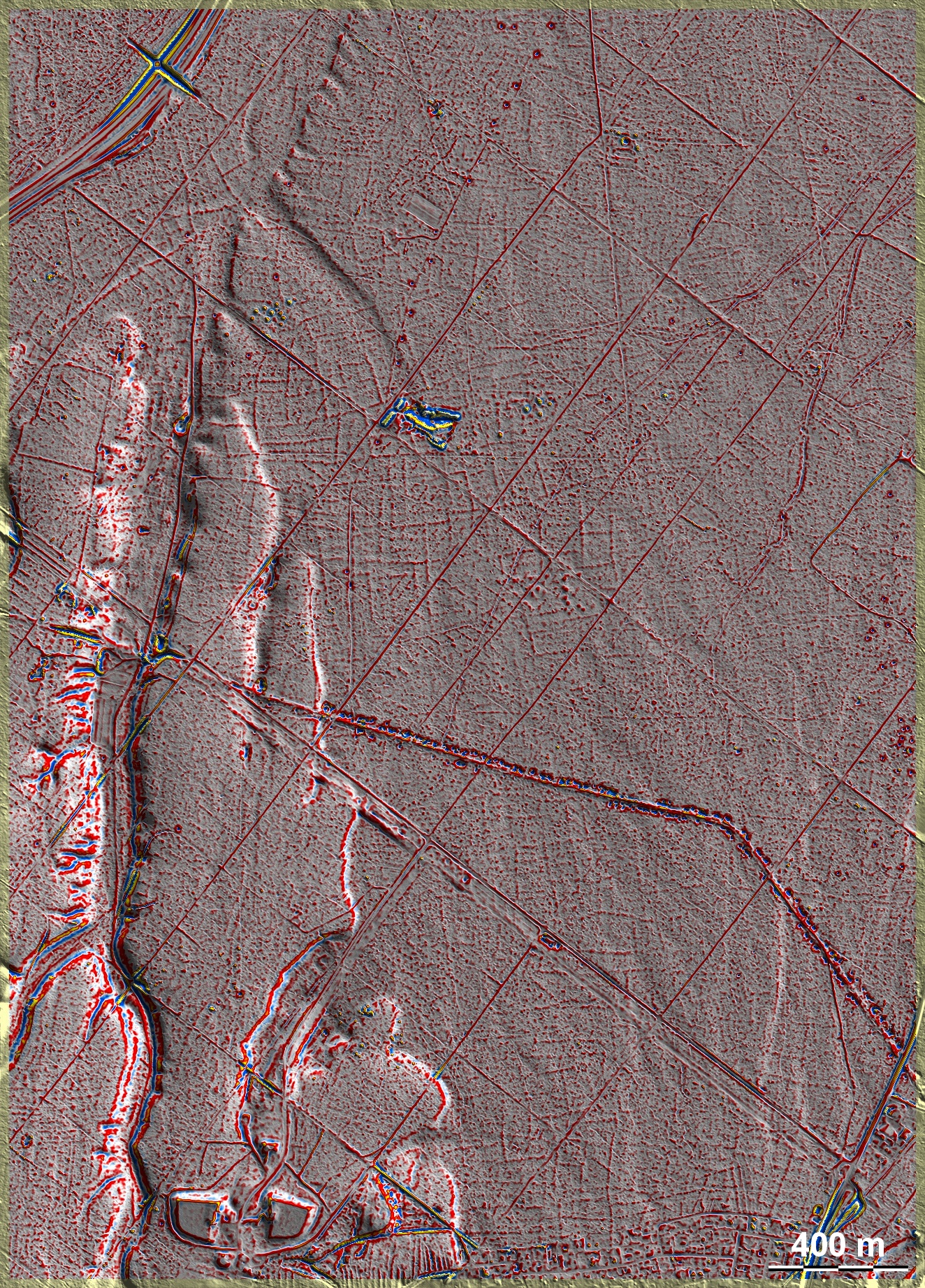
Im Forstenrieder Park in der Schotterebene unmittelbar südlich vom München liegen 'Celtic Fields' in einer Ausdehnung von ca. 10 qkm, die von einer später angelegten römischen Straße durchzogen werden. Hier, im Südostteil des Gebiets, sind allerdings die 'Celtic Fields' im Bereich dieser Straße nur äußerst schwach ausgeprägt und kaum erkennbar, weswegen es in diesem Bereich auch keinen Beleg dafür gibt, dass die Straße mit ihren charakteristischen begleitenden Materialentnahmegruben jünger als die Felder ist. Südlich und nördlich der Bildmitte sind die Parzellenränder der 'Celtic Fields' besser erkennbar. Im Nordteil liegen drei kleinere Gruppen undatierter Grabhügel. Interessant ist, dass die älteren, höher gelegenen Terrassen in der westlichen Bildhälfte trotz lösshaltiger Böden fast keine Spuren von 'Celtic Fields' tragen. In the south-eastern part of Forstenrieder Park, in the gravel plain directly south of Munich, there are 'Celtic Fields' covering an area of about 10 square kilometres, which are crossed by a later Roman road. Here, however, in the south-eastern part of the area, the 'Celtic Fields' in the area of this road are only extremely faint and hardly recognisable, which is why there is no evidence in this area that the road with its characteristic accompanying material extraction pits is younger than the fields. To the south and north of the centre of the image, the edges of the 'Celtic Fields' plots are better discernible. In the northern part lie three smaller groups of undated barrows. It is interesting that the older, higher terraces in the western half of the picture bear almost no traces of 'Celtic Fields' despite loess-rich soils. Weiter more...