Spuren urgeschichtlicher Beackerung in West-, Mittel-, Ost- und Nordeuropa Traces of prehistoric farming in Western, Central, Eastern and Northern Europe: Gailroth-Forlwald, Bayern-West Bavaria-West Weiter more...
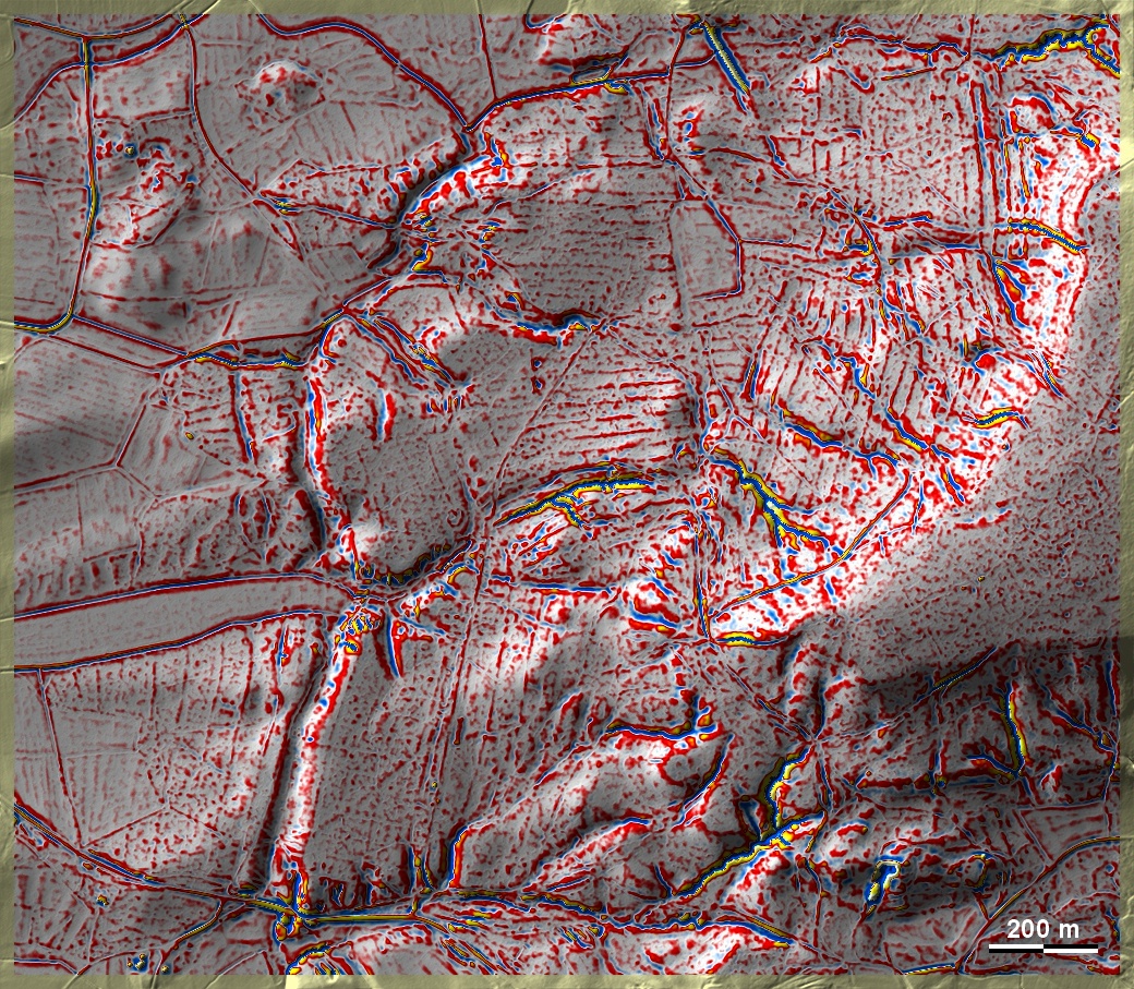
Diese Spuren aus dem Forlwald bei Gailroth im fränkisch-württembergischen Grenzgebiet sind hier deswegen dargestellt, weil sie offenbar von einer Langstreifenflur stammen, deren Ausrichtung nicht unbedingt Bezug auf die Geländeneigung nimmt, anders als bei den Terrassensystemen. Zum Alter dieser Art von Feldsystemen gibt es keine Anhaltspunke, außer dass sie älter als die Katastergrenzen der ersten Hälfte des 19. Jahrhunderts sind. Eine ähnliche Langstreifenflur ist in Zentral- undf Ostpolen verbreitet und scheint dort mittelalterlich zu sein. These traces from the Forlwald near Gailroth in the Franconian-Württemberg border area are shown here because they obviously originate from long strip fields whose orientation does not necessarily refer to the slope of the terrain, unlike the terrace systems. There is no indication of the age of this type of field system, except that it is older than the cadastral boundaries of the first half of the 19th century. A similar long strip field system is widespread in central and eastern Poland, where it appears to be of medieval origin. Weiter more...