Spuren urgeschichtlicher Beackerung in West-, Mittel-, Ost- und Nordeuropa Traces of prehistoric farming in Western, Central, Eastern and Northern Europe: Rübling-Kohlmarter-Sauleite, Bayern-West Bavaria-West Weiter more...
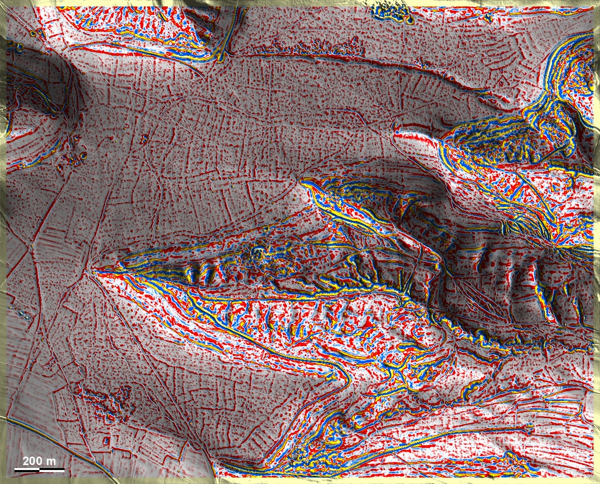
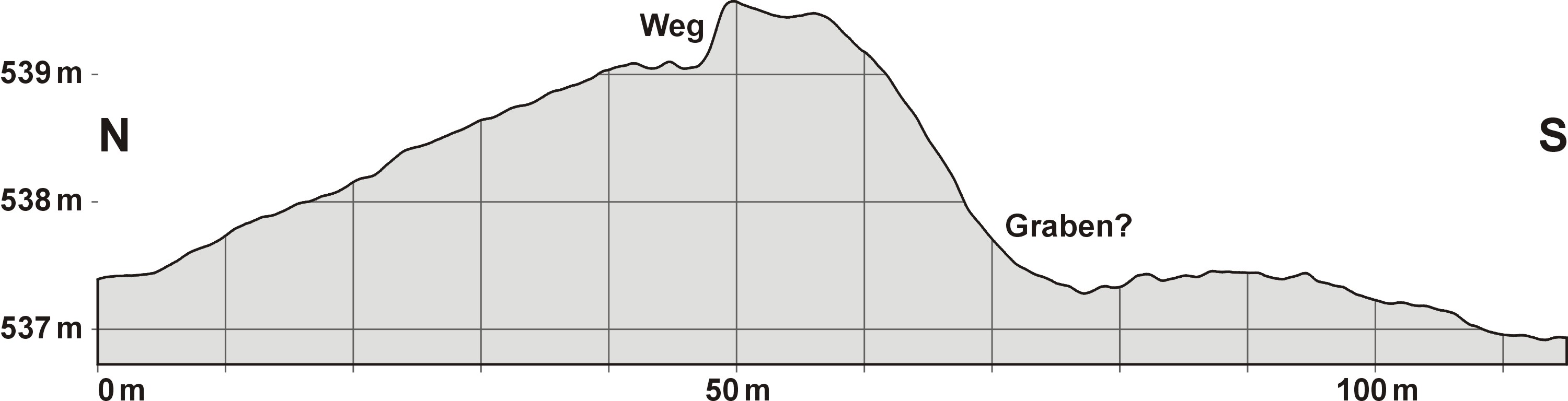
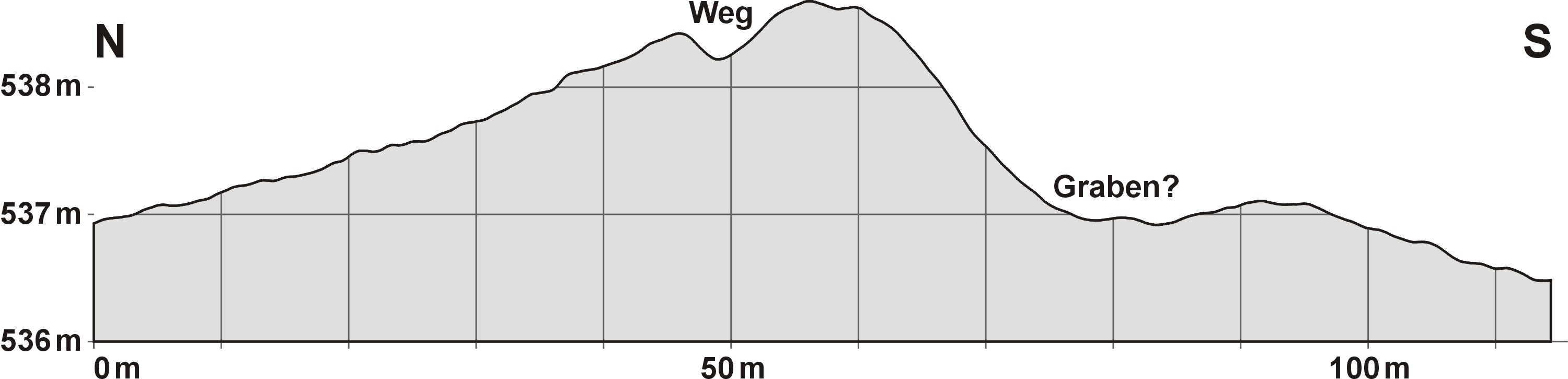
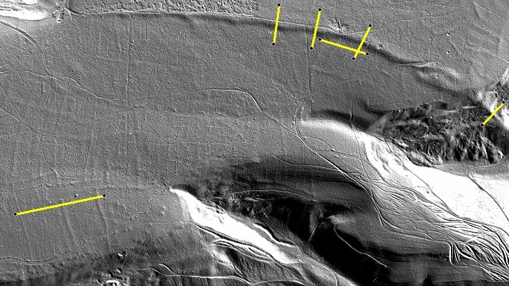
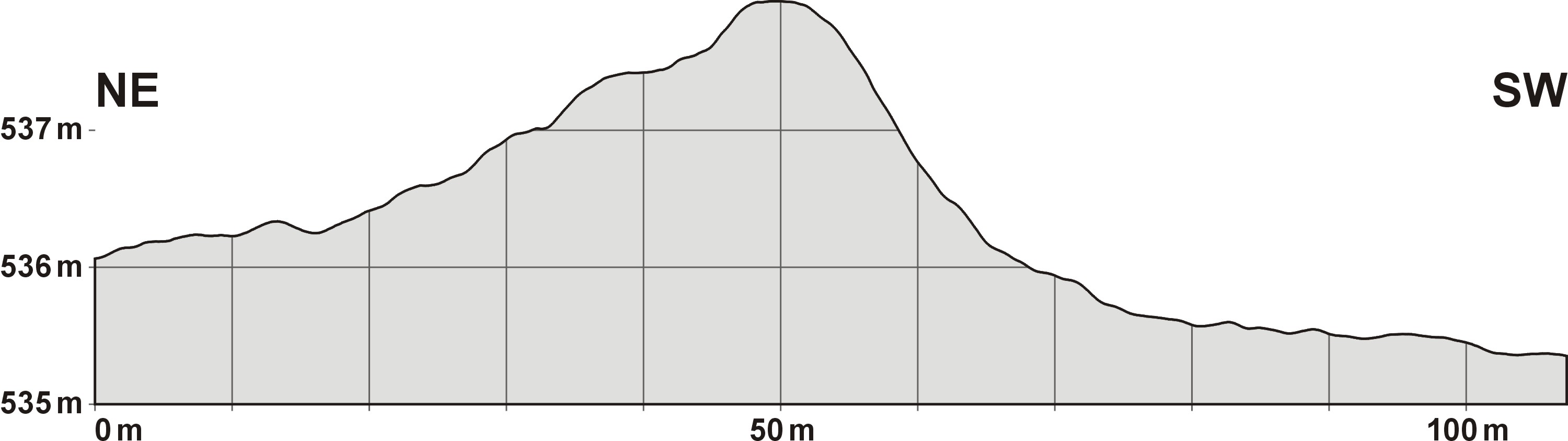
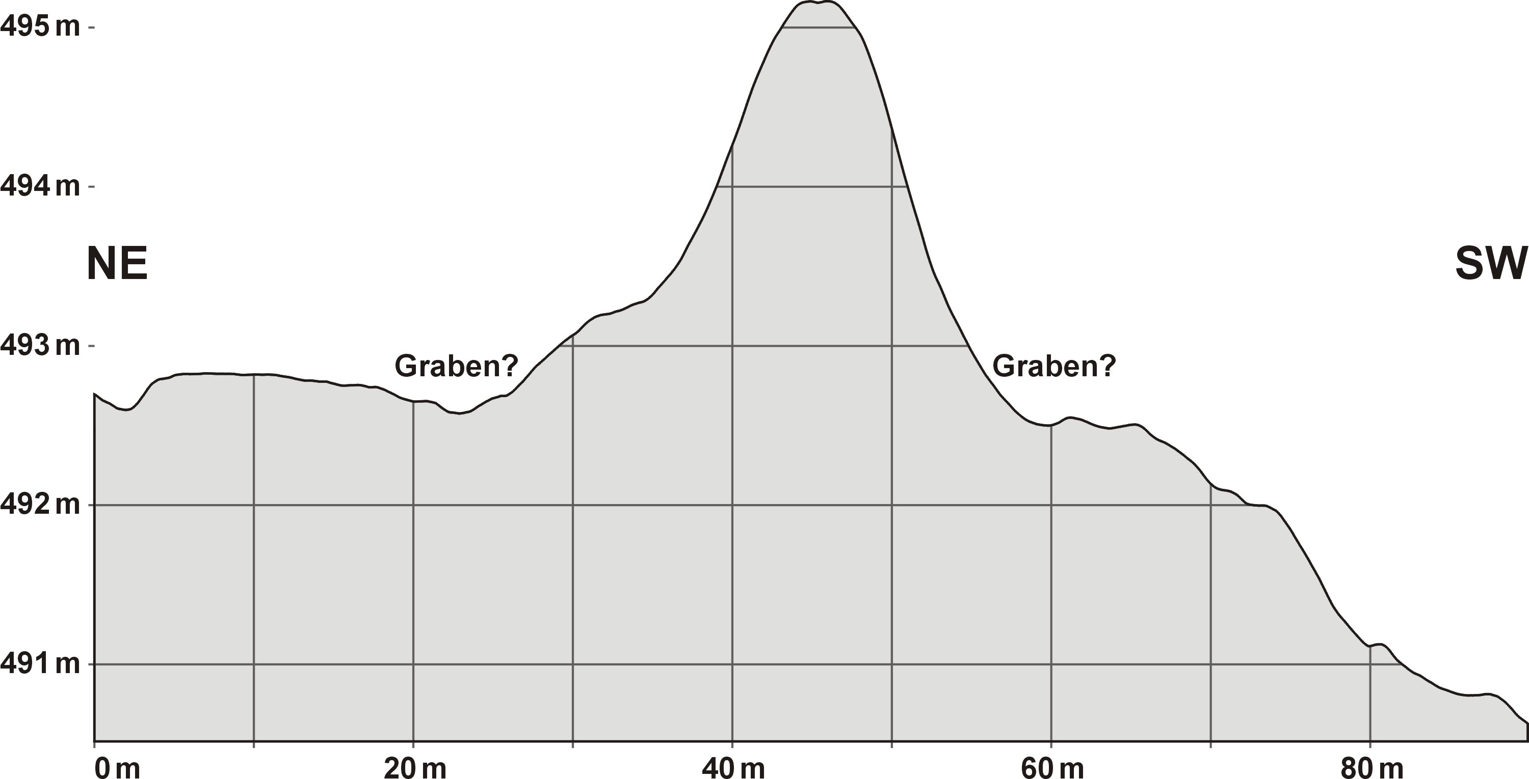
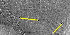
Um den Waldbezirk Kohlmarter und über der Sauleite bei Rübling finden sich zahlreiche 'Celtic Fields'. Sie liegen auf einem Vorsprung der Fränkisch-Oberpfälzer Alb, die hier steil nach Norden und Osten zum Sulztal abfällt, teils auf Sandlehm, teils auf Flugsand über dem Jurakalkmergel. Die dammartige Erhebung im Norden der Grafik ("Ehekamm") gilt als Dünenbildung, wird aber vom Lokalforscher Werner Robl als Befestigungswall gedeutet, der bei dem Militärunternehmen Caligulas gegen die Juthungen eine Rolle gespielt haben soll. Am Nordhang des am weitesten nach Westen reichenden Taleinschnittes liegt ein in der Grafik kaum erkennbarer Burgstall, darüber reihen sich Grabhügel, die ebenfalls kaum zu identifizieren sind. Werner Robl erwähnt den Namen "Gödenäcker" für dieses Gebiet. Die 'Celtic Fields' zeigen Ansätze übergeordneter Parzellen und teilweise eine Kammerung. Numerous 'Celtic Fields' are found around the forest district of Kohlmarter and above the Sauleite near Rübling. They are located on a promontory of the Franconian-Upper Palatinate Alb, which here drops steeply to the north and east towards the Sulz valley, partly on sandy loam, partly on drifting sand above the Jurassic limestone marl. The dam-like elevation in the north of the graphic ('Ehekamm') is thought to be a dune formation, but is interpreted by local researcher Werner Robl as a fortification rampart that is supposed to have played a role in Caligula's military enterprise against the Juthungs. On the northern slope of the valley that extends furthest to the west is a castle site that is hardly recognisable in the diagram, above which are rows of burial mounds that are also hardly identifiable here. Werner Robl mentions the name 'Gödenäcker' for this area. The 'Celtic Fields' show fragments of superior plots and partly a chambering. Weiter more...