'Celtic Fields' – Stiefkinder der
Archäologie Archaeology's stepchildren
Spuren urgeschichtlicher Beackerung in West-,
Mittel-, Ost- und Nordeuropa Traces of prehistoric farming in Western,
Central, Eastern and Northern Europe:
Hjortdal/Fosdal, Nordjütland
Weiter more...
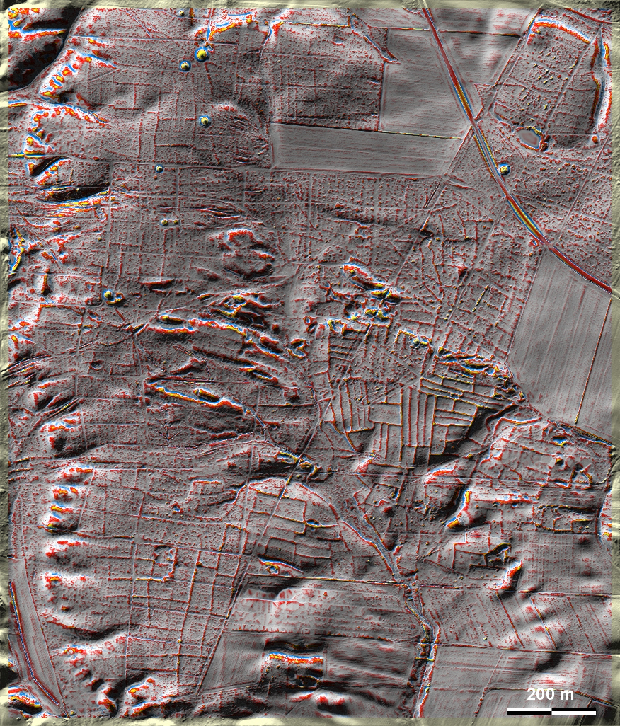
In der Fosdal Plantage bei Hjortdal nordöstlich von Thisted, unweit der
Jammerbucht, liegen außer einigen Grabhügeln zahlreiche überwiegend mäßig
ausgeprägte 'Celtic Fields', am besten ausgeprägt und erhalten östlich der
Bildmitte in der Rødland Hede. In the Fosdal Plantation near Hjortdal
northeast of Thisted, not far from the Jammer Bay, there are, apart from a few
burial mounds, numerous mainly moderately pronounced 'Celtic Fields', best
pronounced and preserved east of the centre of the picture in the Rødland Heath. Weiter more...
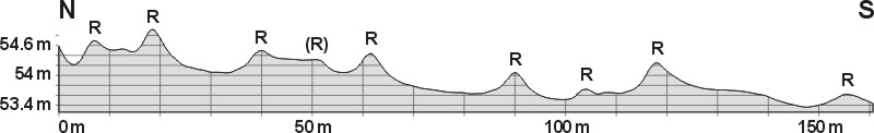
Schnitt N-S durch mehrere Parzellen Section N-S through several
plots |
 |
 |
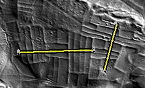
Lage der Schnitte
Position of sections
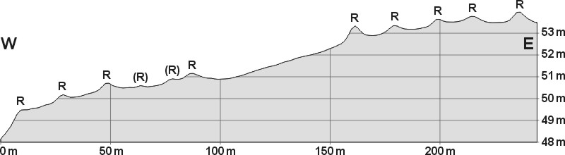
Schnitt W-E durch zahlreiche Parzellen. Die
besonders hohen Randwälle (bis zu 40 cm) könnten hier durch
intensive Ablagerung verdrifteten Sands im Bewuchs der Feldränder
entstanden sein. Section W-E through numerous plots. The
particularly high boundary walls (up to 40 cm) could have been
formed here by intensive deposition of drifted sand in the
vegetation of the field margins. |
Daten © sdfi.dk. Wenn Sie diese Grafik herunterladen, müssen Sie zur Georeferenzierung mit Global
Mapper oder Mapinfo auch das TAB-File
laden und stets im gleichen Verzeichnis speichern. (Rechte Maustaste; Ziel
speichern unter... Bei Umbenennung darauf achten,
dass auch innerhalb des Tab-Files der Dateiname entsprechend umbenannt wird!)
If you download this graphic, you must also load the TAB-File
for georeferencing with Global Mapper or Mapinfo and save it always in
the same directory. (Right mouse button; save target as... When renaming, make
sure that the file name is also renamed within the tab file accordingly).
Grafik georeferenziert als GEOTIFF herunterladen oder als
KMZ-File für Benutzung
mit Locus Map + Smartphone oder Google Earth. Download georeferenced graphics
as GEOTIFF e.g. for Avenza Maps + Smartphone or as
KMZ-File for use with Locus
Map + Smartphone or Google Earth.
Zurück
Back Übersicht Nordjütland Overview Jutland-North © Volker Arnold 2023