'Celtic Fields' – Stiefkinder der
Archäologie Archaeology's stepchildren
Spuren urgeschichtlicher Beackerung in West-,
Mittel-, Ost- und Nordeuropa Traces of prehistoric farming in Western,
Central, Eastern and Northern Europe: Ålum-Vesterskov, Ostjütland-Nord
Weiter more...
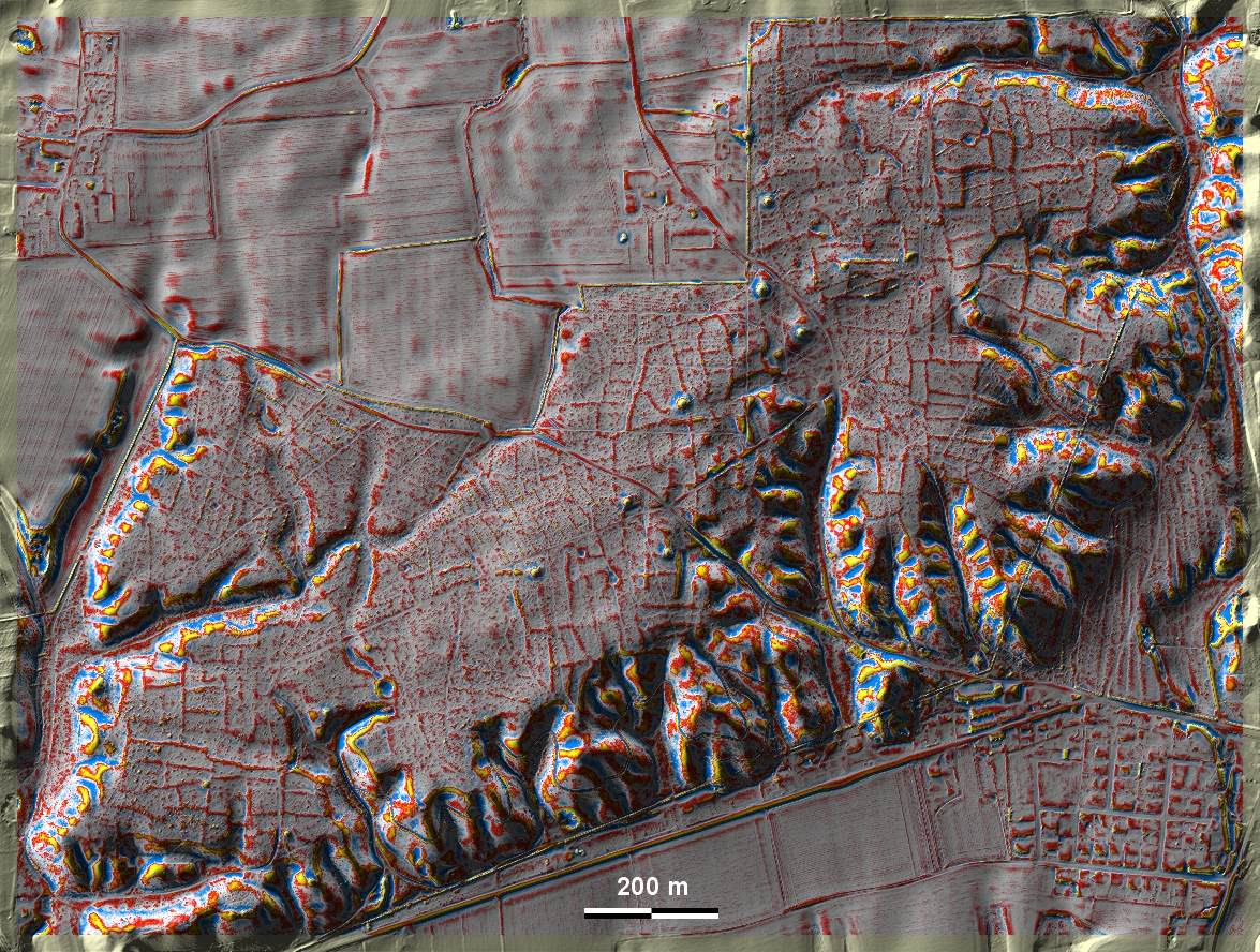
Im Vesterskov am Ortrand von Ålum westlich von Randers gibt es gut ausgeprägte
'Celtic Fields' über dem Tal der Nørreå, außerdem einige Grabhügel. Im Tal am
östlichen Bildrand liegen Wölbbeete. In Vesterskov on the periphery of Ålum
west of Randers there are well-defined 'Celtic Fields' above the valley of the
Nørreå, as well as some burial mounds. In the valley at the eastern edge of the
picture are ridge-and-furrow beds. Weiter more...
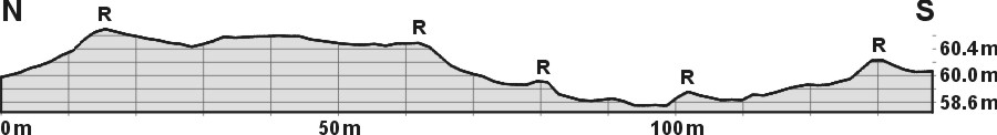
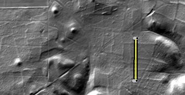
Ålum-Vesterskov, Schnitt N-S 10fach überhöht und
Lage des Schnittes. R: Raine
Ålum-Vesterskov, section N-S 10 times exaggerated and position of
the section. R: Plot rims |
 |
Daten © sdfi.dk. Wenn Sie diese Grafik herunterladen, müssen Sie zur Georeferenzierung mit Global
Mapper oder Mapinfo auch das TAB-File
laden und stets im gleichen Verzeichnis speichern. (Rechte Maustaste; Ziel
speichern unter... Bei Umbenennung darauf achten,
dass auch innerhalb des Tab-Files der Dateiname entsprechend umbenannt wird!)
If you download this graphic, you must also load the TAB-File
for georeferencing with Global Mapper or Mapinfo and save it always in
the same directory. (Right mouse button; save target as... When renaming, make
sure that the file name is also renamed within the tab file accordingly).
Grafik georeferenziert als GEOTIFF herunterladen oder als
KMZ-File für Benutzung
mit Locus Map + Smartphone oder Google Earth. Download georeferenced graphics
as GEOTIFF e.g. for Avenza Maps + Smartphone or as
KMZ-File for use with Locus
Map + Smartphone or Google Earth.
Zurück
Back Übersicht Ostjütland-Nord
Overview Eastern Jutland-North © Volker Arnold 2022