'Celtic Fields' – Stiefkinder der
Archäologie Archaeology's stepchildren
Spuren urgeschichtlicher Beackerung in West-,
Mittel-, Ost- und Nordeuropa Traces of prehistoric farming in Western,
Central, Eastern and Northern Europe: Resen-Knolding Bakker, Ostjütland-Nord
Weiter more...
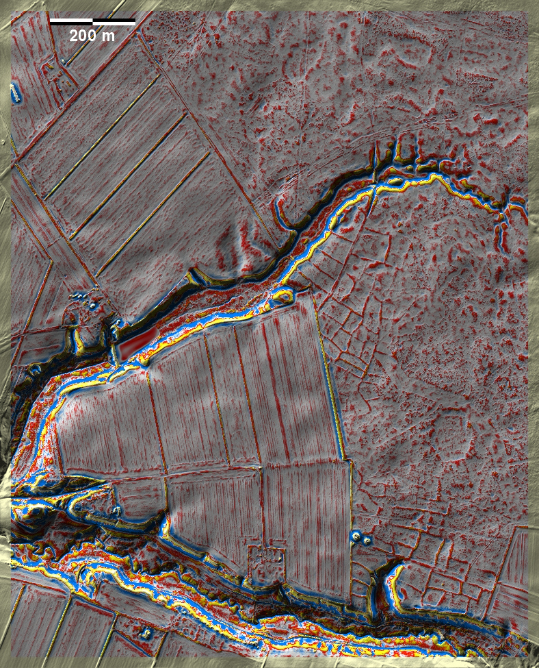
In den Knolding Bakker bei Resen südwestlich von Viborg liegen in der
Kongenshus-Heide gut
ausgeprägte 'Celtic Fields' sowie zwei benachbarte Grabhügel. Leider ist der
Westteil der 'Celtic Fields' moderner Kultivierung zum Opfer gefallen. Das gilt
auch für einen Teil des seltenen Wegs, der sich zwischen gedoppelten Randwällen
nach Nordnordost zieht, hinter einer Furt über den kleinen Bach nach Norden
umbiegt und in diese Richtung insgesamt noch 1.7 km sicher zu verfolgen ist.
In the Knolding Bakker near Resen, southwest of Viborg, there are well-developed
'Celtic Fields' in the Kongenshus heath, as well as two neighbouring burial mounds.
Unfortunately, the western part of the 'Celtic Fields' has fallen victim to
modern cultivation. This also applies to a part of a rare road that runs between
double embankments to the north-northeast, turns north behind a ford across the
small stream and can still be safely followed in this direction for a total of
1.7 km. Weiter more...
|
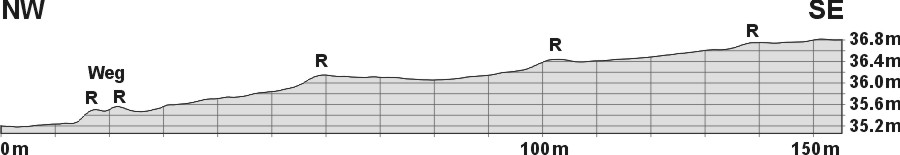
Schnitt NW-SE durch den Weg und
drei Parzellen, 10-fach überhöht. R: Randraine
Section NW-SE through the road (Weg) and three plots, 10
times superimposed. R: Plot rims
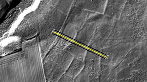
Lage des Wegs und des Schnitt
Position of the road and the section |
 |
Daten © sdfi.dk. Wenn Sie diese Grafik herunterladen, müssen Sie zur Georeferenzierung mit Global
Mapper oder Mapinfo auch das TAB-File
laden und stets im gleichen Verzeichnis speichern. (Rechte Maustaste; Ziel
speichern unter... Bei Umbenennung darauf achten,
dass auch innerhalb des Tab-Files der Dateiname entsprechend umbenannt wird!)
If you download this graphic, you must also load the TAB-File
for georeferencing with Global Mapper or Mapinfo and save it always in
the same directory. (Right mouse button; save target as... When renaming, make
sure that the file name is also renamed within the tab file accordingly).
Grafik georeferenziert als GEOTIFF herunterladen oder als
KMZ-File für Benutzung
mit Locus Map + Smartphone oder Google Earth. Download georeferenced graphics
as GEOTIFF e.g. for Avenza Maps + Smartphone or as
KMZ-File for use with Locus
Map + Smartphone or Google Earth.
Zurück
Back Übersicht Ostjütland-Nord
Overview Eastern Jutland-North © Volker Arnold 2022