'Celtic Fields' – Stiefkinder der
Archäologie Archaeology's stepchildren
Spuren urgeschichtlicher Beackerung in West-,
Mittel-, Ost- und Nordeuropa Traces of prehistoric farming in Western,
Central, Eastern and Northern Europe: Skive-Süd, Ostjütland-Nord
Weiter in Ostjütland-Nord more in Eastern
Jutland-North...
Weiter in Westjütland more in Eastern Jutland...
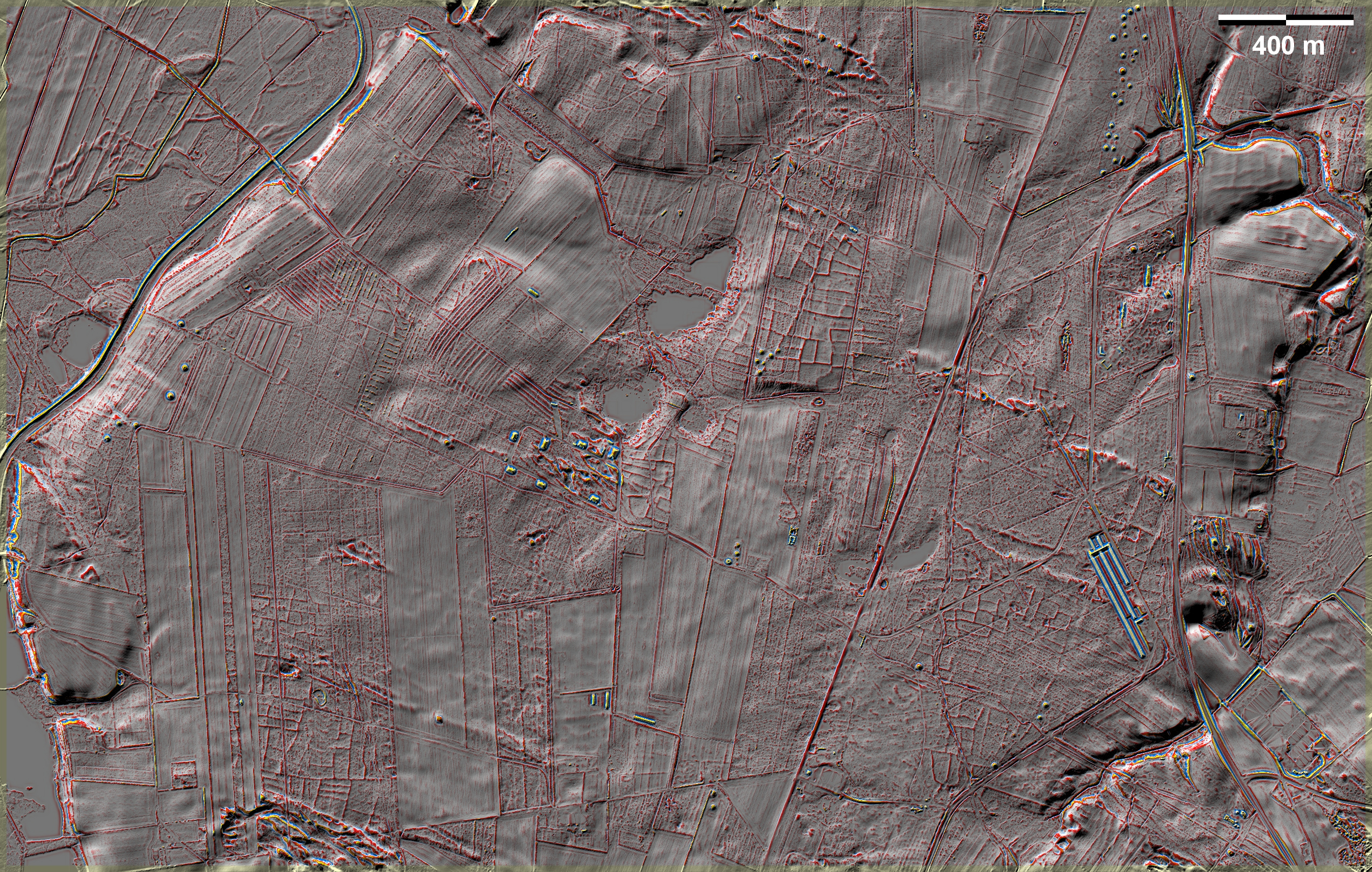
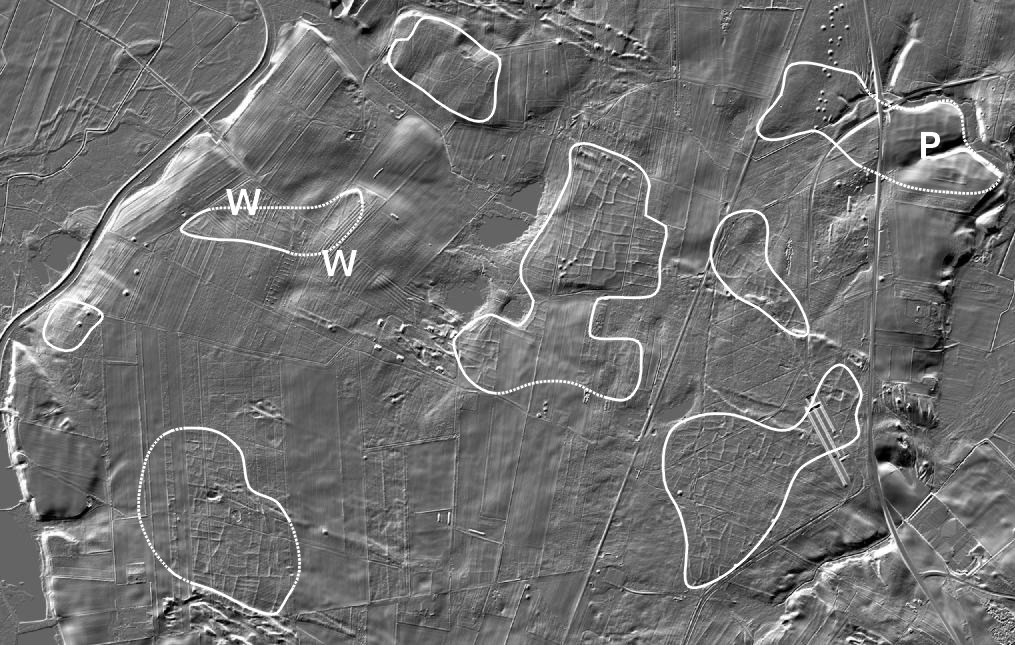
Südlich von Skive gibt es auf früherem
Heideland mehrere Bereiche mit 'Celtic Fields', die auf Heiderestflächen gut
ausgeprägt und erhalten sind, in den Aufforstungen meistens schlechter und im
heutigen Ackerland überwiegend ganz verschwunden sind; überpflügte Reste bei P.
Bei W werden Fragmente von 'Celtic Fields' von Wölbbeeten überlagert. Außerdem
gibt es viele Grabhügel, z. T. in gereihten Gruppen, sowie Störungen durch
Forstwirtschaft und Militäranlagen. South of Skive there are several areas of
'Celtic Fields' on former heathland, well marked and preserved on heath land,
mostly poorer in afforestation and mostly gone in present-day farmland;
ploughed-over remains at P. At W fragments of 'Celtic Fields' are overlain by
ridge-and-furrow beds. There are also many burial mounds, some in aligned
groups, as well as disturbance from forestry and military installations.
Weiter in Ostjütland-Nord more in Eastern
Jutland-North...
Weiter in Westjütland more in Western Jutland...
|
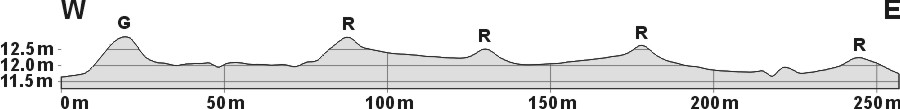
Schnitt W-E, 10-fach überhöht, durch vierParzellen. Bei G liegt ein
kleinerer Grabhügel auf einer Feldgrenze. Die linke Parzelle und ein
Teil der rechten liegen im Wald, der Rest in Heide, wo die Randwälle
bis 40 cm hoch sind. Section W-E, 10 times superelevated, through
four plots. At G there is a smaller burial mound on a field
boundary. The left plot and part of the right plot are in woodland,
the rest in heath, where the boundary walls are up to 40 cm high.
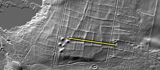
Lage des Schnittes Position
of section |
 |
Daten © sdfi.dk. Wenn Sie diese Grafik herunterladen, müssen Sie zur Georeferenzierung mit Global
Mapper oder Mapinfo auch das TAB-File
laden und stets im gleichen Verzeichnis speichern. (Rechte Maustaste; Ziel
speichern unter... Bei Umbenennung darauf achten,
dass auch innerhalb des Tab-Files der Dateiname entsprechend umbenannt wird!)
If you download this graphic, you must also load the TAB-File
for georeferencing with Global Mapper or Mapinfo and save it always in
the same directory. (Right mouse button; save target as... When renaming, make
sure that the file name is also renamed within the tab file accordingly).
Grafik georeferenziert als GEOTIFF herunterladen oder als
KMZ-File für Benutzung
mit Locus Map + Smartphone oder Google Earth. Download georeferenced graphics
as GEOTIFF e.g. for Avenza Maps + Smartphone or as
KMZ-File for use with Locus
Map + Smartphone or Google Earth.
Zurück
Back Übersicht Ostjütland-Nord
Overview Eastern Jutland-North © Volker Arnold 2023