Spuren urgeschichtlicher Beackerung in West-, Mittel-, Ost- und Nordeuropa Traces of prehistoric farming in Western, Central, Eastern and Northern Europe: Stanghede, Ostjütland-Nord Weiter more...
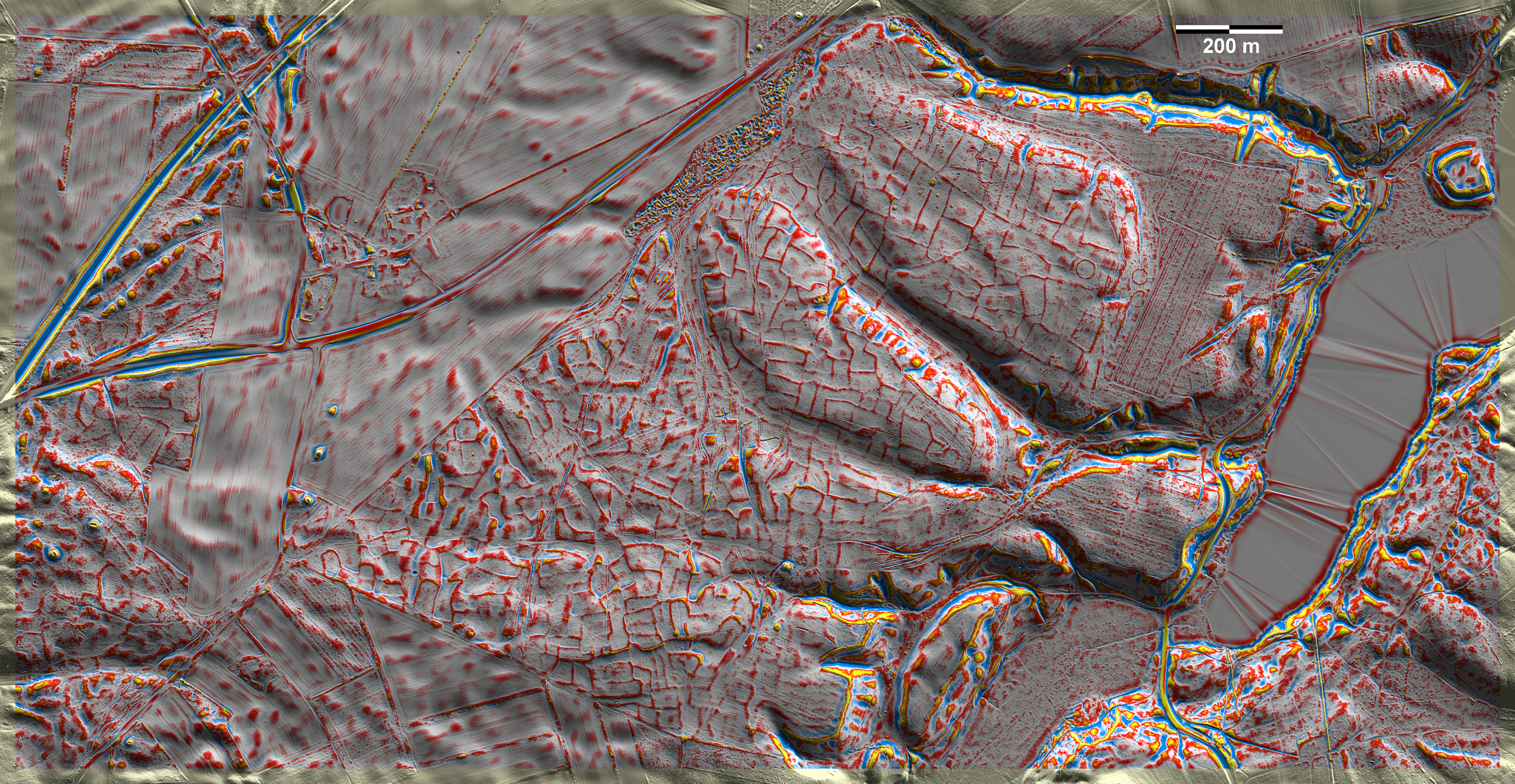
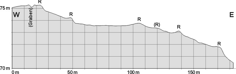
Stanghede am Hald Sø südwestlich von Viborg gehört zu den eindrucksvollsten 'Celtic Fields' auf gut gepflegter Heide in Jütland. Zumindest in westliche Richtung dürfte die 'Celtic Fields' früher viel weiter gereicht haben, wie die Spuren in der Aufforstung am Südwestrand der Grafik nahelegen. Außerdem gibt es mehrere Grabhügel. Aus jüngerer und jüngster Zeit stammen drei kreisförmige Einhegungen am Ostrand der Hochfläche, die auf die frühneuzeitliche Ochsendrift zurückgehen dürften, sowie Schützengräben und andere Eingrabungen aus dem zweiten Weltkrieg. Unklar ist das Alter der chaotischen, dicht an dicht liegenden kleinen Sandentnahmestellen am Nordwestrand der Heide. Es hat unpublizierte archäologische Untersuchungen in mindestens einem Parzellenrand gegeben. Am östlichen Rand der Grafik die Burgstelle der Bischöfe von Viborg. Stanghede at Hald Sø southwest of Viborg is one of the most impressive 'Celtic Fields' in Jutland on a well maintained heath. At least in a westerly direction, the 'Celtic Fields' may have extended much further in the past, as suggested by the traces in the afforestation on the south-western edge of the graphic. There are also several burial mounds. Of more recent and recent date are three circular enclosures on the eastern edge of the plateau, which are likely to date from early modern ox-drift, and trenches and other burials from the Second World War. The age of the chaotic, closely spaced small sand extraction sites on the north-western edge of the heath is unclear. There have been unpublished archaeological investigations in at least one plot edge. On the eastern edge of the graph, there is the castle site of the Bishops of Viborg. Weiter more...