Spuren urgeschichtlicher Beackerung in West-, Mittel-, Ost- und Nordeuropa Traces of prehistoric farming in Western, Central, Eastern and Northern Europe: Aarhus-Torskov, Ostjütland-Süd Weiter more...
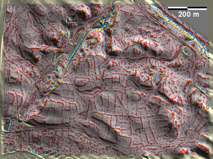
Am südöstlichen Stadtrand von Aarhus liegen im Torskov über dem Kattegatt gut ausgeprägte 'Celtic Fields' in stark reliefierter Jungmoränenlandschaft. Hier hat es 2015 Untersuchungen im Bereich zweier Stufenraine gegeben, die die Bewirtschaftungsphase in die erste Hälfte bzw. die Mitte des ersten vorchristlichen Jahrtausends datieren – die C14-Proben liegen im sog. "Hallstattplateau", einer Zeitspanne von ca. 800 BC bis ca. 400 BC, in der die C14-Daten auf Grund der in diesem Bereich sehr ungünstigen Kalibrationskurve ziemlich gleich ausfallen. OSL-Proben erbrachten ein um einige Jahrhunderte jüngeres Alter. Zahlreiche kleinzerscherbte Keramik bronze- bis eisenzeitlicher Machart, die mit Hausabfällen auf die Felder gelangten, machen wahrscheinlich, dass hier den C14-Daten eher zu trauen ist. On the south-eastern periphery of Aarhus, well-developed 'Celtic Fields' are located in Torskov above the Kattegat in a strongly relieved young moraine landscape. 2015, there have been investigations in the area of two step-rains that date the cultivation phase to the first half and the middle of the first pre-Christian millennium – the C14 samples lie in the so-called 'Hallstatt Plateau', a period from c. 800 BC to c. 400 BC, in which the C14 dates are approximately the same due to the very unfavourable calibration curve in this area. OSL samples yielded an age several centuries younger. Numerous small fragments of Bronze to Iron Age pottery, which found their way into the fields with domestic waste, make it likely that the C14 data can be trusted here. Weiter more...