'Celtic Fields' – Stiefkinder der
Archäologie Archaeology's stepchildren
Spuren urgeschichtlicher Beackerung in West-,
Mittel-, Ost- und Nordeuropa Traces of prehistoric farming in Western,
Central, Eastern and Northern Europe: Bredballe Storskov, Ostjütland-Süd
Weiter more...
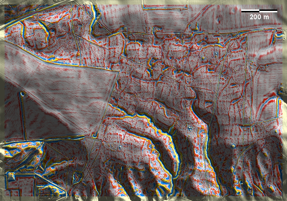
Im Storskov bei Bredballe nordöstlich von Vejle liegen Spuren von 'Celtic
Fields' auf einer Hochfläche, die nach Süden hin von zahlreichen Erosionstälern
in Richtung Vejle Fjord durchzogen wird. In den Talflanken reicht das Gefälle
der Parzellen bis 15%. Außerdem gibt es mehrere Grabhügel. In Storskov near
Bredballe northeast of Vejle, there are traces of 'Celtic Fields' on a plateau
that is crossed by numerous erosion valleys towards the south in the direction
of Vejle Fjord. In the valley flanks, the slope of the plots reaches 15%. There
are also several burial mounds.
Weiter more...
Daten © sdfi.dk. Wenn Sie diese Grafik herunterladen, müssen Sie zur Georeferenzierung mit Global
Mapper oder Mapinfo auch das TAB-File
laden und stets im gleichen Verzeichnis speichern. (Rechte Maustaste; Ziel
speichern unter... Bei Umbenennung darauf achten,
dass auch innerhalb des Tab-Files der Dateiname entsprechend umbenannt wird!)
If you download this graphic, you must also load the TAB-File
for georeferencing with Global Mapper or Mapinfo and save it always in
the same directory. (Right mouse button; save target as... When renaming, make
sure that the file name is also renamed within the tab file accordingly).
Grafik georeferenziert als GEOTIFF herunterladen oder als
KMZ-File für Benutzung
mit Locus Map + Smartphone oder Google Earth. Download georeferenced graphics
as GEOTIFF e.g. for Avenza Maps + Smartphone or as
KMZ-File for use with Locus
Map + Smartphone or Google Earth.
Zurück
Back Übersicht Ostjütland-Süd
Overview Eastern Jutland-South © Volker Arnold 2022