'Celtic Fields' – Stiefkinder der
Archäologie Archaeology's stepchildren
Spuren urgeschichtlicher Beackerung in West-,
Mittel-, Ost- und Nordeuropa Traces of prehistoric farming in Western,
Central, Eastern and Northern Europe: Mesing Sønderskov, Ostjütland-Süd
Weiter more...
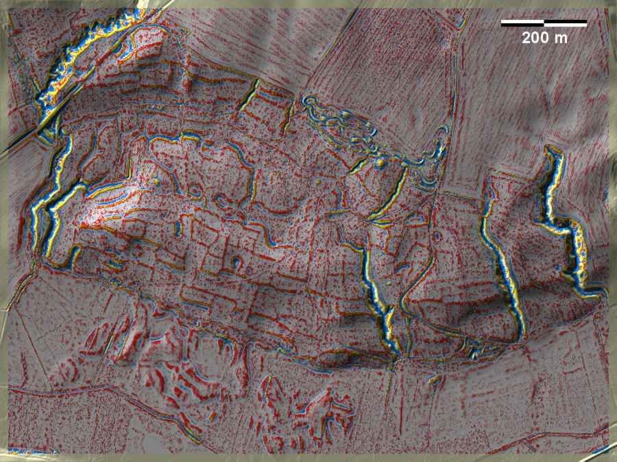
Mesing Sønderskov nördlich von Skanderborg liegt unmittelbar nördlich des
berühmten jüngereisenzeitlichen Opferplatzes von Illerup Ådal und ist voll von
gut ausgeprägten 'Celtic Fields'. Die pollenanalytischen Untersuchungen aus dem
allerdings 5 km weiter westlich gelegenen Ilsø deuten auf eine Bewirtschaftung in
der Mitte und zweiten Hälfte des ersten vorchristlichen Jahrtausends. Mesing
Sønderskov north of Skanderborg lies immediately north of the famous Late Iron
Age sacrificial site of Illerup Ådal and is full of well developed 'Celtic
Fields'. Pollen analysis from Ilsø, 5 km to the west however, indicates
cultivation in the middle and second half of the first millennium BC. Weiter more...
Daten © sdfi.dk. Wenn Sie diese Grafik herunterladen, müssen Sie zur Georeferenzierung mit Global
Mapper oder Mapinfo auch das TAB-File
laden und stets im gleichen Verzeichnis speichern. (Rechte Maustaste; Ziel
speichern unter... Bei Umbenennung darauf achten,
dass auch innerhalb des Tab-Files der Dateiname entsprechend umbenannt wird!)
If you download this graphic, you must also load the TAB-File
for georeferencing with Global Mapper or Mapinfo and save it always in
the same directory. (Right mouse button; save target as... When renaming, make
sure that the file name is also renamed within the tab file accordingly).
Grafik georeferenziert als GEOTIFF herunterladen oder als
KMZ-File für Benutzung
mit Locus Map + Smartphone oder Google Earth. Download georeferenced graphics
as GEOTIFF e.g. for Avenza Maps + Smartphone or as
KMZ-File for use with Locus
Map + Smartphone or Google Earth.
Zurück
Back Übersicht Ostjütland-Süd
Overview Eastern Jutland-South © Volker Arnold 2022