'Celtic Fields' – Stiefkinder der
Archäologie Archaeology's stepchildren
Spuren urgeschichtlicher Beackerung in West-,
Mittel-, Ost- und Nordeuropa Traces of prehistoric farming in Western,
Central, Eastern and Northern Europe: Sattrup-Vesterskov/Kollerup Skov, Ostjütland-Süd
Weiter more...
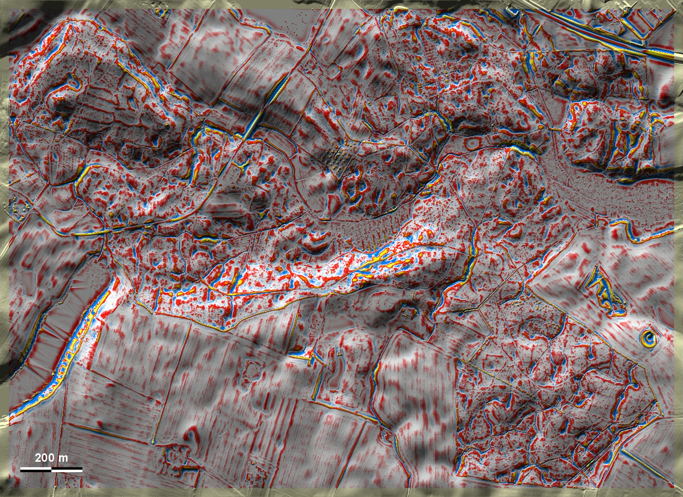
Im Sattrup-Vesterskov und Kollerup Skov nordwestlich von Horsens liegen 'Celtic
Fields' in sehr stark bewegtem Gelände. Sicher erkennbar und teilweise gut
ausgeprägt sind sie nur im Nordwesten, wo auch ein Grabhügel liegt, und im
Südosten der Grafik. In Sattrup-Vesterskov and Kollerup Skov northwest of
Horsens, 'Celtic Fields' are located in very strongly undulating terrain. They
are only clearly recognisable and partly well-defined in the northwest, where
there is also a burial mound, and in the southeast of the graphic. Weiter
more...
Daten © sdfi.dk. Wenn Sie diese Grafik herunterladen, müssen Sie zur Georeferenzierung mit Global
Mapper oder Mapinfo auch das TAB-File
laden und stets im gleichen Verzeichnis speichern. (Rechte Maustaste; Ziel
speichern unter... Bei Umbenennung darauf achten,
dass auch innerhalb des Tab-Files der Dateiname entsprechend umbenannt wird!)
If you download this graphic, you must also load the TAB-File
for georeferencing with Global Mapper or Mapinfo and save it always in
the same directory. (Right mouse button; save target as... When renaming, make
sure that the file name is also renamed within the tab file accordingly).
Grafik georeferenziert als GEOTIFF herunterladen oder als
KMZ-File für Benutzung
mit Locus Map + Smartphone oder Google Earth. Download georeferenced graphics
as GEOTIFF e.g. for Avenza Maps + Smartphone or as
KMZ-File for use with Locus
Map + Smartphone or Google Earth.
Zurück
Back Übersicht Ostjütland-Süd
Overview Eastern Jutland-South © Volker Arnold 2022