'Celtic Fields' – Stiefkinder der
Archäologie Archaeology's stepchildren
Spuren urgeschichtlicher Beackerung in West-,
Mittel-, Ost- und Nordeuropa Traces of prehistoric farming in Western,
Central, Eastern and Northern Europe: Dąbrowa Białostocka-SW, Nordost-Polen
Weiter more...
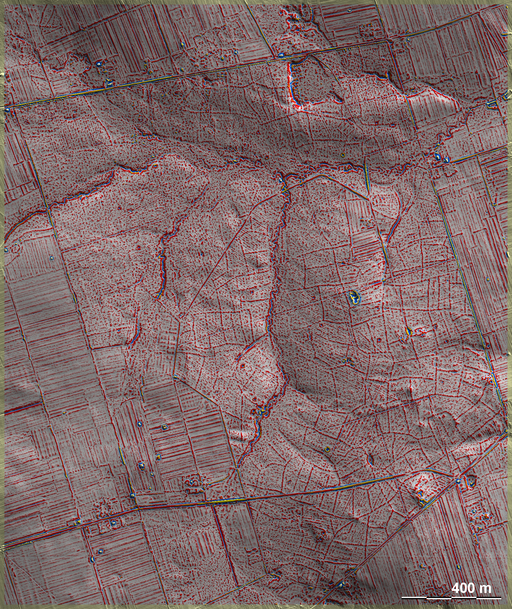
Ein Waldriegel erstreckt sich von den Waldgebieten nördlich von Białystok nach
Norden bis zur Höhe von Dąbrowa Białostocka und ist fast völlig mit 'Celtic
Fields' bedeckt – das flächenmäßig größte mir bekannte Vorkommen in Europa.
Südwestlich des Ortes ist das nördliche Ende dieses Waldriegels, wo die 'Celtic
Fields' vielfach am heutigen Waldrand enden, was bedeutet, dass die ursprünglich
bewirtschaftete Fläche noch größer war. Anschluss
nach Süden – A forest bar stretches from the forest areas north of
Białystok northwards to the height of Dąbrowa Białostocka and is almost
completely covered with 'Celtic Fields' – the largest occurrence I know of in
Europe in terms of area. South-west of the village is the northern end of this
woodland bar, where the 'Celtic Fields' in many cases end at the present forest
edge, which means that the originally cultivated area was even larger.
Connection to the south –
Weiter more...
Daten © geoportal.gov.pl. Wenn Sie diese Grafik herunterladen, müssen Sie zur Georeferenzierung mit Global
Mapper oder Mapinfo auch das TAB-File
laden und stets im gleichen Verzeichnis speichern. (Rechte Maustaste; Ziel
speichern unter... Bei Umbenennung darauf achten,
dass auch innerhalb des Tab-Files der Dateiname entsprechend umbenannt wird!)
If you download this graphic, you must also load the TAB-File
for georeferencing with Global Mapper or Mapinfo and save it always in
the same directory. (Right mouse button; save target as... When renaming, make
sure that the file name is also renamed within the tab file accordingly).
Grafik georeferenziert als GEOTIFF herunterladen z.B. für Avenza Maps + Smartphone oder als
KMZ-File für Benutzung
mit Locus Map + Smartphone oder Google Earth. Download georeferenced graphics
as GEOTIFF e.g. for Avenza Maps + Smartphone or as
KMZ-File for use with Locus
Map + Smartphone or Google Earth.
Zurück Back
Übersicht Polen-Nordost Overview Poland-Northeast Übersicht Gesamt-Polen
Overview Total Poland © Volker Arnold 2022