'Celtic Fields' – Stiefkinder der
Archäologie Archaeology's stepchildren
Spuren urgeschichtlicher Beackerung in West-,
Mittel-, Ost- und Nordeuropa Traces of prehistoric farming in Western,
Central, Eastern and Northern Europe: Stryjkowo-Süd, Nordost-Polen
Weiter more...
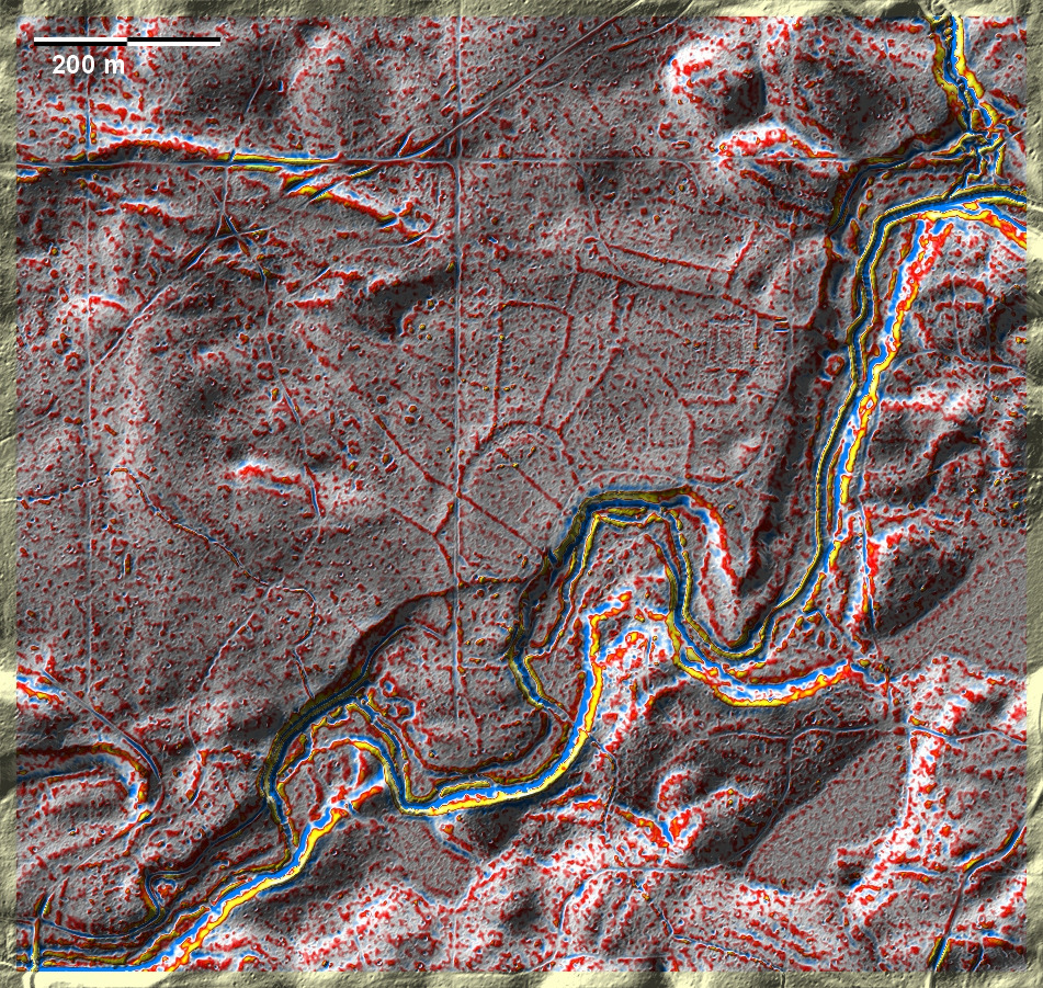
Südlich von Stryjkowo liegen in einem größeren Wald isolierte 'Celtic Fields',
die von einem deutlich erkennbaren Kernelement in Bildmitte ausgehen und etwa 16
ha umfassen, was für zwei bis drei Hofstellen ausreichend wäre.
South of Stryjkowo, isolated 'Celtic Fields' lie in a larger forest, starting
from a clearly recognisable core element in the centre of the picture and
covering about 16 ha, which would be sufficient for two to three farmsteads.
Weiter more...
Daten © geoportal.gov.pl. Wenn Sie diese Grafik herunterladen, müssen Sie zur Georeferenzierung mit Global
Mapper oder Mapinfo auch das TAB-File
laden und stets im gleichen Verzeichnis speichern. (Rechte Maustaste; Ziel
speichern unter... Bei Umbenennung darauf achten,
dass auch innerhalb des Tab-Files der Dateiname entsprechend umbenannt wird!)
If you download this graphic, you must also load the TAB-File
for georeferencing with Global Mapper or Mapinfo and save it always in
the same directory. (Right mouse button; save target as... When renaming, make
sure that the file name is also renamed within the tab file accordingly).
Grafik georeferenziert als GEOTIFF herunterladen z.B. für Avenza Maps + Smartphone oder als
KMZ-File für Benutzung
mit Locus Map + Smartphone oder Google Earth. Download georeferenced graphics
as GEOTIFF e.g. for Avenza Maps + Smartphone or as
KMZ-File for use with Locus
Map + Smartphone or Google Earth.
Zurück Back
Übersicht Polen-Nordost Overview Poland-Northeast Übersicht Gesamt-Polen
Overview Total Poland © Volker Arnold 2022