'Celtic Fields' – Stiefkinder der
Archäologie Archaeology's stepchildren
Spuren urgeschichtlicher Beackerung in West-,
Mittel-, Ost- und Nordeuropa Traces of prehistoric farming in Western,
Central, Eastern and Northern Europe: Człuchów-NW, Nordwest-Polen
Weiter more...
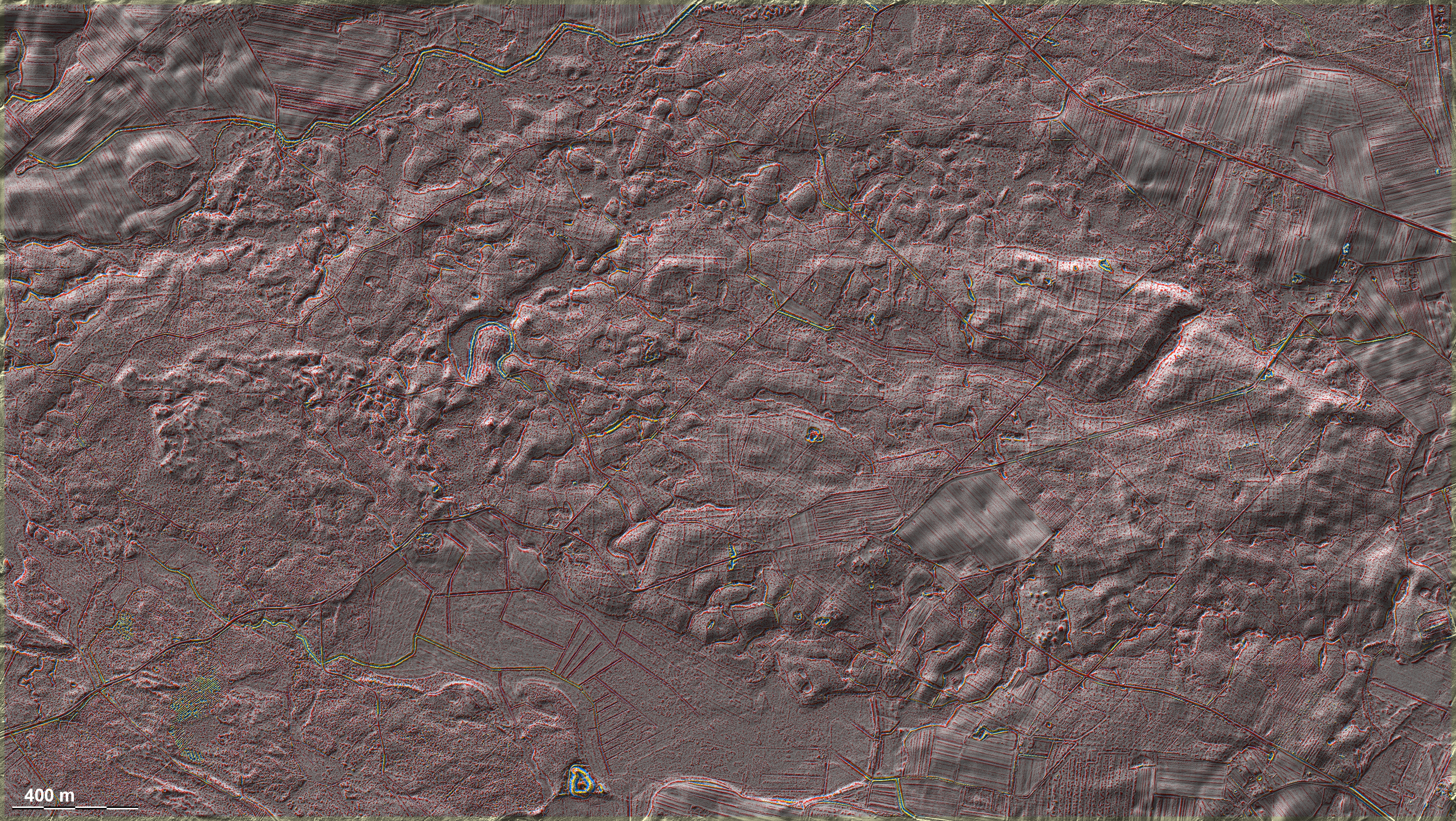
Nordwestlich von Człuchów liegen in einem großen Wald ausgedehnte
gekammerte 'Celtic Fields' vomTyp Przemęt, teilweise sehr deutlich ausgeprägt.
Dazu kommen im Südosten der Grafik eine größere Grabhügelgruppe sowie ganz im
Süden ein Burgwall. Northwest of Człuchów, in a large forest, there are
extensive, partly very distinctly pronounced chambered 'Celtic Fields' of the Przemęt type. In
addition, there is a larger group of burial mounds in the south-east of the
graphic and a fortification near the southern border. Weiter more...
Daten © geoportal.gov.pl. Wenn Sie diese Grafik herunterladen, müssen Sie zur Georeferenzierung mit Global
Mapper oder Mapinfo auch das TAB-File
laden und stets im gleichen Verzeichnis speichern. (Rechte Maustaste; Ziel
speichern unter... Bei Umbenennung darauf achten,
dass auch innerhalb des Tab-Files der Dateiname entsprechend umbenannt wird!) Data © geoportal.gov.pl. If you download this graphic, you must also load the
TAB file for georeferencing with Global Mapper or Mapinfo and save it always in
the same directory. (Right mouse button; save target as... When renaming, make
sure that the file name is also renamed within the tab file accordingly).
Grafik georeferenziert als GEOTIFF herunterladen z.B. für Avenza Maps + Smartphone oder als
KMZ-File für Benutzung
mit Locus Map + Smartphone oder Google Earth. Download georeferenced graphics
as GEOTIFF e.g. for Avenza Maps + Smartphone or as KMZ file for use with Locus
Map + Smartphone or Google Earth.
Zurück Back
Übersicht Polen-Nordwest Overview Poland-Northwest Übersicht Gesamt-Polen
Overview Total Poland © Volker Arnold 2022