'Celtic Fields' – Stiefkinder der
Archäologie Archaeology's stepchildren
Spuren urgeschichtlicher Beackerung in West-,
Mittel-, Ost- und Nordeuropa Traces of prehistoric farming in Western,
Central, Eastern and Northern Europe: Bronisławka-SW, Südost-Polen
Weiter more...
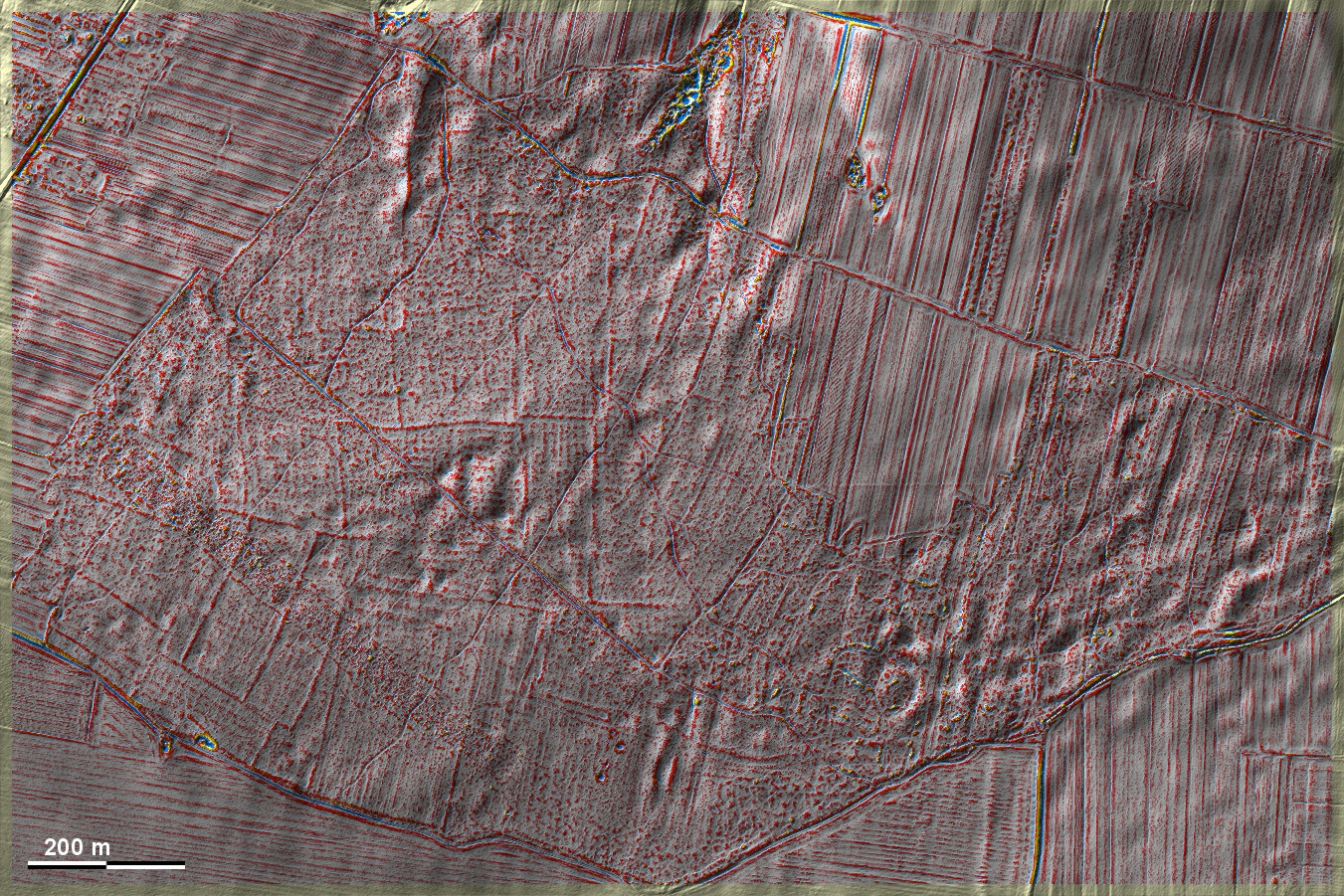
Südwestlich von Bronisławka liegen in einem kleineren Waldstück 'Celtic
Fields', die eine so enge, schwach ausgeprägte Kammerung aufweisen, dass ich sie
zum Typ Szczekotowo rechne. Von Nordosten greift eine fragmentarische
Langstreifenflur ein, die die 'Celtic Fields' erkennbar überlagert und sich so
als jünger zu erkennen gibt. Southwest of Bronisławka, in a small woodland
area, lie 'Celtic Fields', which have such a narrow, weakly pronounced
chambering that I classify them as Szczekotowo type. From the north-east, a
fragmentary long strip field encroaches, which obviously overlaps the 'Celtic
Fields' and thus reveals itself to be younger.
Weiter more...
Daten © geoportal.gov.pl. Wenn Sie diese Grafik herunterladen, müssen Sie zur Georeferenzierung mit Global
Mapper oder Mapinfo auch das TAB-File
laden und stets im gleichen Verzeichnis speichern. (Rechte Maustaste; Ziel
speichern unter... Bei Umbenennung darauf achten,
dass auch innerhalb des Tab-Files der Dateiname entsprechend umbenannt wird!)
If you download this graphic, you must also load the TAB-File
for georeferencing with Global Mapper or Mapinfo and save it always in
the same directory. (Right mouse button; save target as... When renaming, make
sure that the file name is also renamed within the tab file accordingly).
Grafik georeferenziert als GEOTIFF herunterladen z.B. für Avenza Maps + Smartphone oder als
KMZ-File für Benutzung
mit Locus Map + Smartphone oder Google Earth. Download georeferenced graphics
as GEOTIFF e.g. for Avenza Maps + Smartphone or as
KMZ-File for use with Locus
Map + Smartphone or Google Earth.
Zurück Back
Übersicht Polen-SE Overview Poland-SE Übersicht Gesamt-Polen
Overview Total Poland © Volker Arnold 2022