Spuren urgeschichtlicher Beackerung in West-, Mittel-, Ost- und Nordeuropa Traces of prehistoric farming in Western, Central, Eastern and Northern Europe: Czarny Wygon-West, Südost-Polen Weiter more...
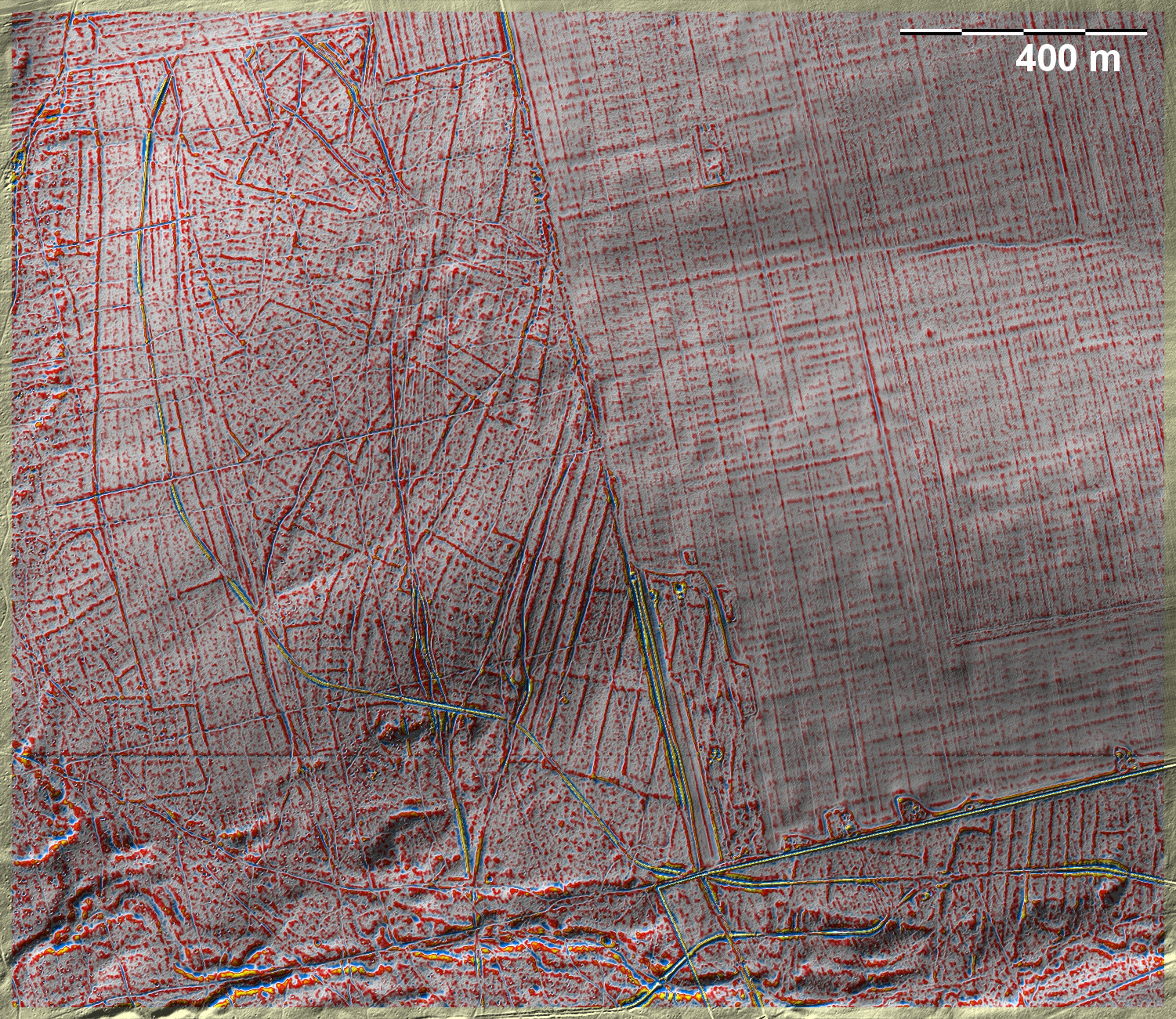
Westlich von Czarny Wygon liegen gekammerte 'Celtic Fields' vom Typ Przemęt in einem Waldstück, dessen nordöstlicher Teil neu aufgeforstet und dementsprechend ohne relevante Spuren ist. In der linken Bildhälfte durchziehen mehrere breite, teils quergeteilte Langstreifenparzellen die 'Celtic Fields', kappen sie und erweisen diese als älter. Wie die langgestreckten Parzellen im rechten unteren Bildteil zu den 'Celtic Fields' stehen, wird nicht ganz klar, auf jeden Fall werden letztere dort nicht gekappt. To the west of Czarny Wygon, chambered 'Celtic Fields' of the Przemęt type lie in a wooded area, the north-eastern part of which is newly afforested and accordingly without relevant traces. In the left half of the picture, several broad, partly transversely divided long strip plots cross the 'Celtic Fields', truncating them and proving them to be older. How the elongated plots in the lower right part of the picture relate to the 'Celtic Fields' is not entirely clear, in any case the latter are not cut by them there. Weiter more...