Spuren urgeschichtlicher Beackerung in West-, Mittel-, Ost- und Nordeuropa Traces of prehistoric farming in Western, Central, Eastern and Northern Europe: Zwierzyniec-Ost, Südost-Polen Weiter more...
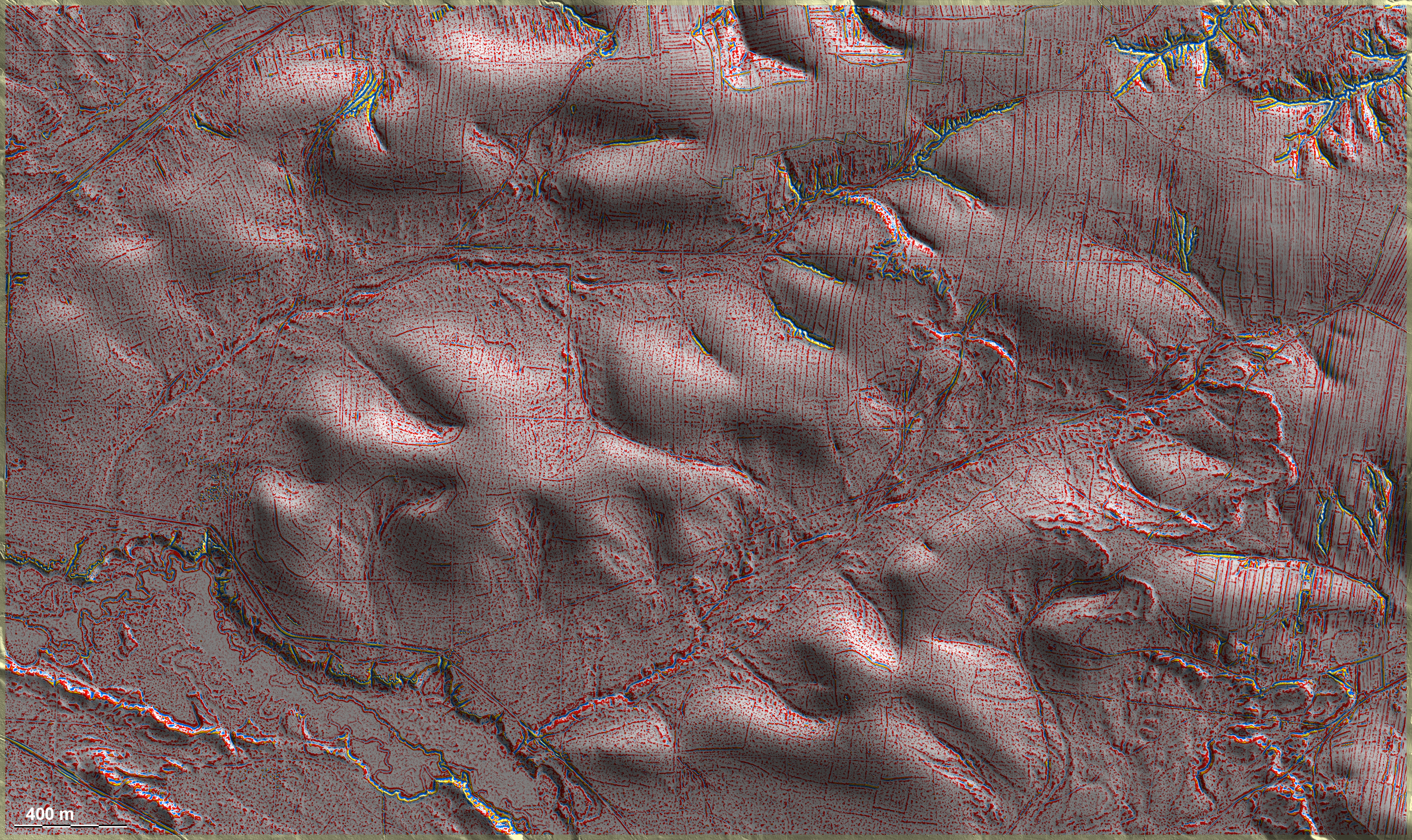
Rund um Zwierzyniec liegen im Hügelland zahlreiche Spuren früheren Ackerbaus unter Wald. Hier, östlich des Ortes, liegen ungewöhnlich groß parzellierte 'Celtic Fields' vor allem auf den Kuppen in Bildmitte und im Süden der Grafik, wo man auch schwache Spuren einer Kammerung vom Typ Przemęt erkennen kann. Nördlich schließt eine nord-südlich ausgerichtete Langstreifenflur an, deren Altersverhältnis zu den 'Celtic Fields' aus den Daten heraus nicht klar wird. Around Zwierzyniec there are numerous traces of former agriculture under forest in the hill country. Here, to the east of the village, there are unusually large parcelled 'Celtic Fields', especially on the hilltops in the centre of the picture and in the south of the graphic, where one can also recognise faint traces of a Przemęt-type chambering. To the north, there are north-south oriented long strip fields, whose age relationship to the 'Celtic Fields' is not clear from the data. Weiter more...