Spuren urgeschichtlicher Beackerung in West-, Mittel-, Ost- und Nordeuropa Traces of prehistoric farming in Western, Central, Eastern and Northern Europe: Bystrzanowice-West, Süd-Polen Weiter more...
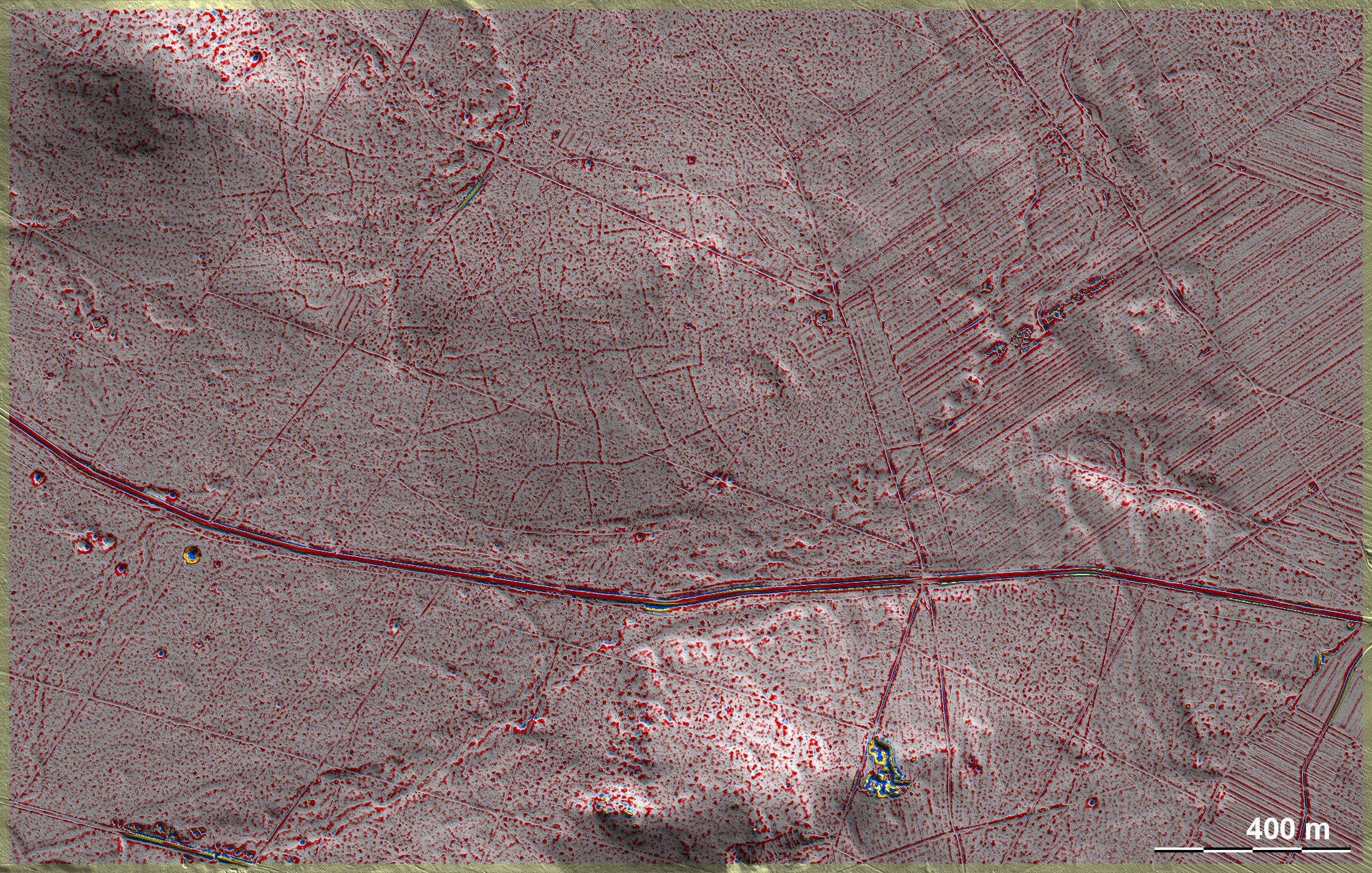
Diese 'Celtic Fields' westlich von Bystrzanowice machen einen planlos gewachsenen Eindruck. Wie so häufig, endet das System nicht an einem klaren Randwall. Die Schärfe der Parzellenränder spricht für eine nicht sehr lange Nutzung und auch dafür, dass sie in diesem Fall nicht nur durch Zusammenpflügen entstanden sind, sondern in dieser Form angelegt wurden. Kleinere "Pickel" tauchen im Nordosten des Systems auf sowie an verschiedenen Stellen südlich der Straße. Dabei könnte es sich z. B. um Steinhaufen oder spätere Kohlenmeiler handeln. Der kalkhaltige Untergrund wird durch Dolinen, besonders am Westrand, deutlich. – Die Kenntnis dieser Fundstelle verdanke ich den Amateurarchäologen (und Augenärzten) Paweł Banasiak, Katowice und Piotr Berezowski, Bielsko-Biała. These 'Celtic Fields' west of Bystrzanowice give the impression of having grown aimlessly. As is so often the case, the system does not end at a clear boundary wall. The sharpness of the edges of the plots indicates that they have not been used for very long and also that in this case they were not only created by ploughing together, but were laid out in this form. Smaller "pimples" appear in the north-east of the system and in various places south of the road. These could be cairns or later charcoal piles, for example. The calcareous underground is evident in sinkholes, especially on the western edge. – I owe the knowledge of this site to the amateur archaeologists (and ophthalmologists) Paweł Banasiak, Katowice and Piotr Berezowski, Bielsko-Biała. Weiter more...