Spuren urgeschichtlicher Beackerung in West-, Mittel-, Ost- und Nordeuropa Traces of prehistoric farming in Western, Central, Eastern and Northern Europe: Marzęcin-West, Süd-Polen Weiter more...
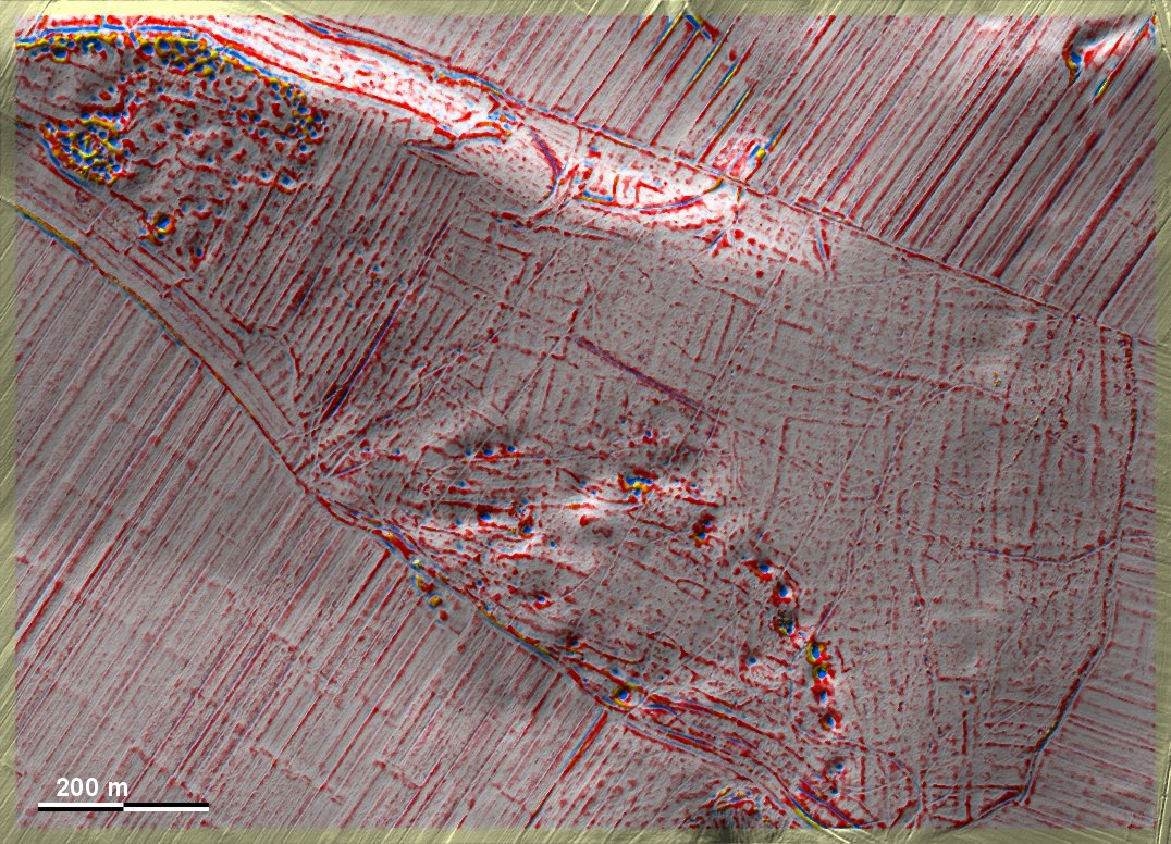
Westlich von Marzęcin finden sich im Ostteil eines Waldstücks auf einer Hügelkuppe 'Celtic Fields', die schwache Spuren einer Kammerung vom Typ Przemęt zeigen. Mitten hindurch verläuft eine Reihe von Dolinen, die auf den Kalkuntergrund und dessen Verkarstung hinweisen. Sedimente aus Dolinen sind wertvolle Geoarchive und können Hinweise auf das Alter und die Art der Bewirtschaftung geben. Westlich schließt sich eine Langstreifen- oder Wölbbeetflur an. – Die Kenntnis dieser Fundstelle verdanke ich den Amateurarchäologen (und Augenärzten) Paweł Banasiak, Katowice und Piotr Berezowski, Bielsko-Biała. To the west of Marzęcin, in the eastern part of a wooded area on a hilltop, there are 'Celtic Fields', which show faint traces of a Przemęt-type chambering. A series of sinkholes runs through them, indicating the limestone bedrock and its karstification. Sediments from sinkholes are valuable geoarchives and can give clues to the age and type of cultivation. Long strip or ridge-and-furrow fields adjoin to the west. - I owe the knowledge of this site to the amateur archaeologists (and ophthalmologists) Paweł Banasiak, Katowice and Piotr Berezowski, Bielsko-Biała. Weiter more...