Spuren urgeschichtlicher Beackerung in West-, Mittel-, Ost- und Nordeuropa Traces of prehistoric farming in Western, Central, Eastern and Northern Europe: Brodziszewo-West / Lipnica-NW, West-Polen Weiter more...
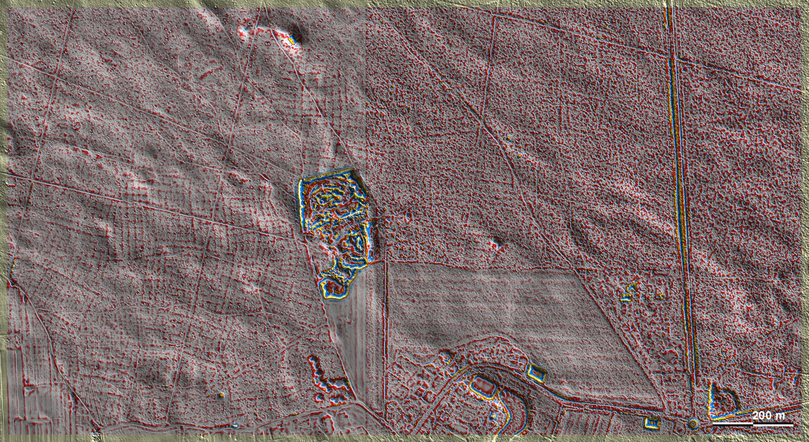
Hier bei Brodziszewo-West / Lipnica-NW stoßen zwei Bereiche mit verschieden aufgelösten Laserdaten hart aneinander. Die Grenze verläuft links der Bildmitte genau senkrecht. Im linken Bildteil ist die Qualität der Bodenpunkte gut genug, um gekammerte Parzellen des Typs Przemęt erkennen zu können. Teilweise sind dort auch übergeordnete Parzellenränder und ein vermutliches Hügelgrab zu sehen. Im rechten Bildteil sind die Spuren wegen des dort erheblich größeren Datenrauschens allenfalls zu erahnen (die Datenerhebung fand ein Jahr früher statt). In je gut 2 km Entfernung befinden sich nordöstlich zwei Burgwälle und östlich eine umfangreiche Grabhügelgruppe. Here at Brodziszewo-West / Lipnica-NW two areas with differently resolved laser data collide hardly. The boundary runs exactly vertically to the left of the image centre. In the left part of the image, the quality of the ground points is good enough to recognise chambered Przemęt-type plots. Partially, superordinate plot edges and a probable barrow are also visible there. In the right part of the image, the traces can at best be guessed at because of the considerably greater data noise there (the data collection took place a year earlier). At a distance of about 2 km each, there are two ring fortifications to the north-east and an extensive group of burial mounds to the east. Weiter more...