'Celtic Fields' – Stiefkinder der
Archäologie Archaeology's stepchildren
Spuren urgeschichtlicher Beackerung in West-,
Mittel-, Ost- und Nordeuropa Traces of prehistoric farming in Western,
Central, Eastern and Northern Europe: Chocz-Kuźnia-SW, West-Polen
Weiter more...
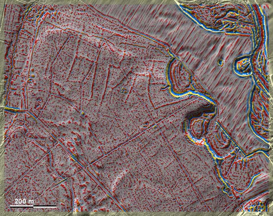
Südlich von Chocz und südwestlich von Kuźnia liegen auf dem Hochufer des
Prosnatals einige wenige 'Celtic Fields' sowie mindestens zwei Hügelgräber
unmittellbar westlich davon. Das bewirtschaftete Land umfasst ca. 16 ha und
dürfte zwei, höchstens drei Familien ernährt haben.
– 1.5 km nordwestlich liegt ein Ringwall. South of Chocz and southwest of
Kuźnia, on the high bank of the Prosna Valley, we find a few 'Celtic Fields' as
well as at least two tumuli immediately to the west.The cultivated land covers
about 16 ha and probably supported two, at most three families. – A ring
fortification lies 1.5 km to the northwest.
Weiter more...
Daten © geoportal.gov.pl. Wenn Sie diese Grafik herunterladen, müssen Sie zur Georeferenzierung mit Global
Mapper oder Mapinfo auch das TAB-File
laden und stets im gleichen Verzeichnis speichern. (Rechte Maustaste; Ziel
speichern unter... Bei Umbenennung darauf achten,
dass auch innerhalb des Tab-Files der Dateiname entsprechend umbenannt wird!)
If you download this graphic, you must also load the TAB-File
for georeferencing with Global Mapper or Mapinfo and save it always in
the same directory. (Right mouse button; save target as... When renaming, make
sure that the file name is also renamed within the tab file accordingly).
Grafik georeferenziert als GEOTIFF herunterladen z.B. für Avenza Maps + Smartphone oder als
KMZ-File für Benutzung
mit Locus Map + Smartphone oder Google Earth. Download georeferenced graphics
as GEOTIFF e.g. for Avenza Maps + Smartphone or as
KMZ-File for use with Locus
Map + Smartphone or Google Earth.
Zurück Back
Übersicht Polen-West Overview Poland-West Übersicht Gesamt-Polen
Overview Total Poland © Volker Arnold 2022