'Celtic Fields' – Stiefkinder der
Archäologie Archaeology's stepchildren
Spuren urgeschichtlicher Beackerung in West-,
Mittel-, Ost- und Nordeuropa Traces of prehistoric farming in Western,
Central, Eastern and Northern Europe: Pniewy-Süd, West-Polen
Weiter more...
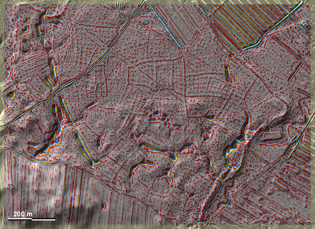
Südlich von Pniewy erstrecken sich in einem Waldstück gekammerte 'Celtic Fields'
vom Typ Przemęt. Ihre Unregelmäßigkeit scheint teilweise der Geländeform geschuldet zu
sein. In der Südhälfte der Grafik sind die Spuren, vor allem der Kammerung, auf
Grund des dort sehr bewegten Geländes kaum ausgeprägt. South of Pniewy,
chambered 'Celtic Fields' of the Przemęt type extend in a wooded area. Their
irregularity seems to be partly due to the shape of the terrain. In the southern
half of the diagram, the traces, especially of the chambering, are hardly
pronounced due to the very undulating terrain there.
Weiter more...
Daten © geoportal.gov.pl. Wenn Sie diese Grafik herunterladen, müssen Sie zur Georeferenzierung mit Global
Mapper oder Mapinfo auch das TAB-File
laden und stets im gleichen Verzeichnis speichern. (Rechte Maustaste; Ziel
speichern unter... Bei Umbenennung darauf achten,
dass auch innerhalb des Tab-Files der Dateiname entsprechend umbenannt wird!)
If you download this graphic, you must also load the TAB-File
for georeferencing with Global Mapper or Mapinfo and save it always in
the same directory. (Right mouse button; save target as... When renaming, make
sure that the file name is also renamed within the tab file accordingly).
Grafik georeferenziert als GEOTIFF herunterladen z.B. für Avenza Maps + Smartphone oder als
KMZ-File für Benutzung
mit Locus Map + Smartphone oder Google Earth. Download georeferenced graphics
as GEOTIFF e.g. for Avenza Maps + Smartphone or as
KMZ-File for use with Locus
Map + Smartphone or Google Earth.
Zurück Back
Übersicht Polen-West Overview Poland-West Übersicht Gesamt-Polen
Overview Total Poland © Volker Arnold 2022