'Celtic Fields' – Stiefkinder der
Archäologie Archaeology's stepchildren
Spuren urgeschichtlicher Beackerung in West-,
Mittel- und Nordeuropa Traces of prehistoric farming in Western,
Central, Eastern and Northern Europe: Gram Storskov, Süd-Jütland
Weiter more...
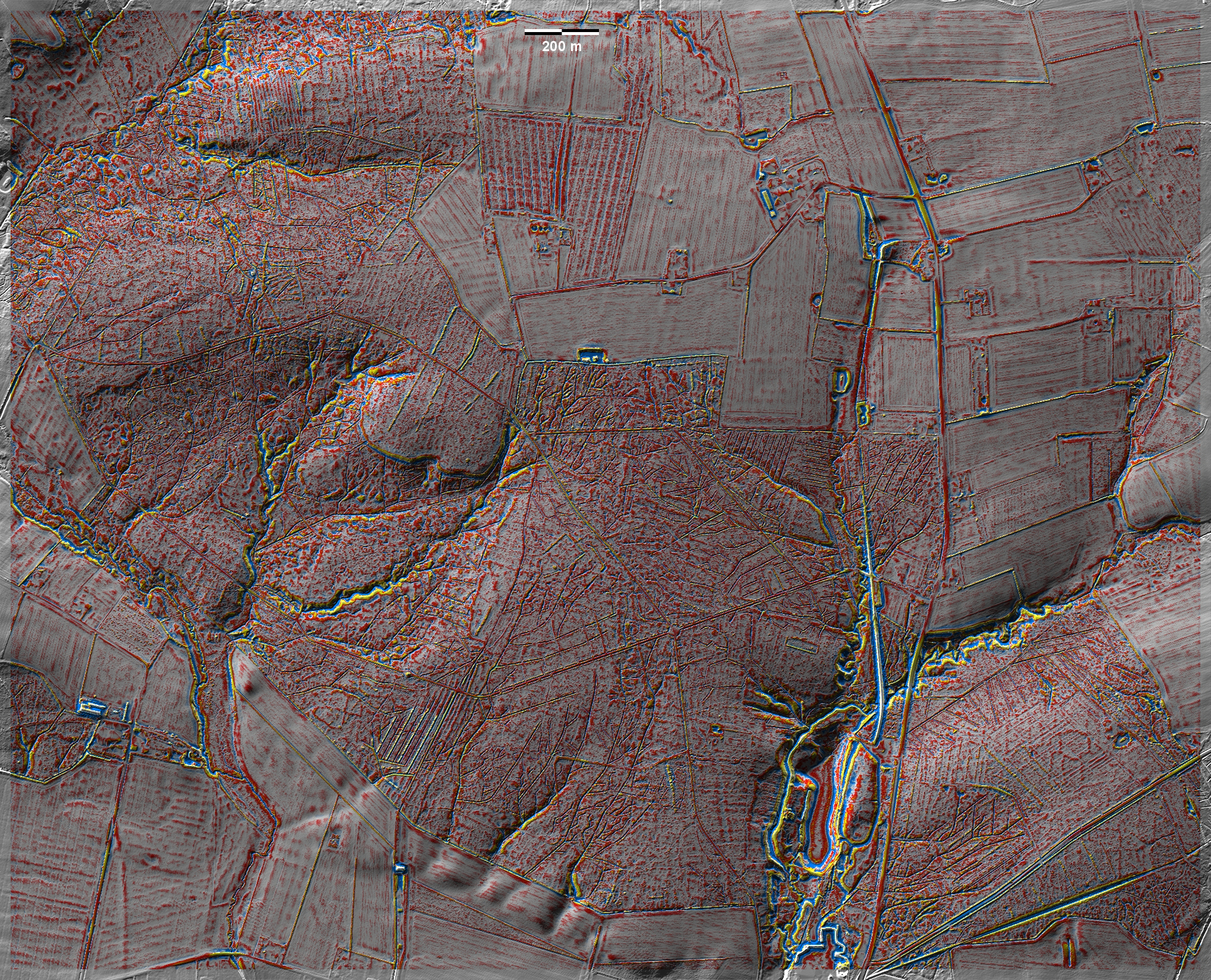
Im Storskov bei Gram finden sich auf einer Altmoränenhöhe fragmentarische und
schwach ausgeprägte 'Celtic Fields', am deutlichsten im Nordwesten und Südosten
der Grafik. Forstmaßnahmen haben vielerots zu störenden Stubbenwällen geführt.
Grabhügel scheinen hier zu fehlen. In Storskov near Gram, fragmentary and
weakly pronounced 'Celtic Fields' are found on an old moraine elevation, most
clearly in the northwest and southeast of the graph. Forestry activities have
led to disturbing stump walls in many spots. Burial mounds seem to be absent
here.
Weiter more...
Daten © sdfi.dk. Wenn Sie diese Grafik herunterladen, müssen Sie zur Georeferenzierung mit Global
Mapper oder Mapinfo auch das TAB-File
laden und stets im gleichen Verzeichnis speichern. (Rechte Maustaste; Ziel
speichern unter... Bei Umbenennung darauf achten,
dass auch innerhalb des Tab-Files der Dateiname entsprechend umbenannt wird!)
If you download this graphic, you must also load the TAB-File
for georeferencing with Global Mapper or Mapinfo and save it always in
the same directory. (Right mouse button; save target as... When renaming, make
sure that the file name is also renamed within the tab file accordingly).
Grafik georeferenziert als GEOTIFF herunterladen oder als
KMZ-File für Benutzung
mit Locus Map + Smartphone oder Google Earth. Download georeferenced graphics
as GEOTIFF e.g. for Avenza Maps + Smartphone or as
KMZ-File for use with Locus
Map + Smartphone or Google Earth.
Zurück
Back Übersicht Südjütland Overview
South Jutland © Volker Arnold 2022