Spuren urgeschichtlicher Beackerung in West-, Mittel- und Nordeuropa Traces of prehistoric farming in Western, Central, Eastern and Northern Europe: Marbæk, Süd-Jütland Weiter more...
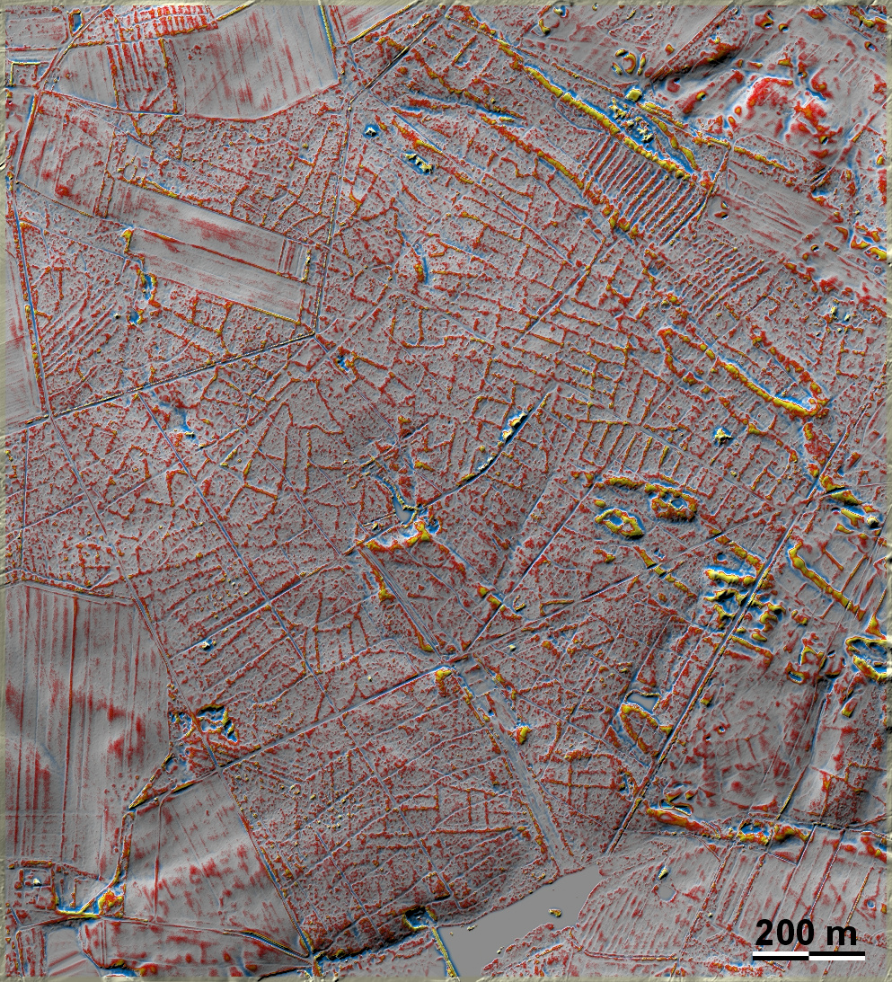
Marbæk Plantage, eine aufgeforstete ehemalige Heide am Nordwestrand von Esbjerg, liegt auf einer teilweise mit Dünen überzogenen Altmoräne dicht an einer Nordseebucht. Hier liegen 'Celtic Fields' in deutlich ausgeprägter Form. Im Nordosten, Norden und Nordwesten grenzen sie an kleinere Bereiche mit Wölbbeeten. Nur bei den Wölbbeeten am Westrand der Grafik oberhalb der Bildmitte ist erkennbar, dass sie die älteren 'Celtic Fields' überlagert haben und somit jünger sind. Der halbmondförmige Parzellenrand etwas südwestlich der Bildmitte könnte als Kernelement gedeutet werden. Marbæk Plantage, a reforested former heath on the north-western edge of Esbjerg, lies on a partly dune-covered old moraine close to a North Sea bay. Here 'Celtic Fields' lie in pronounced form. To the north-east, north and north-west they border on smaller areas of ridge-and-furrow beds. Only the beds on the western edge of the diagram above the centre of the image can be seen to have overlapped the older 'Celtic Fields' and are therefore younger. The crescent-shaped edge of the plot slightly southwest of the centre of the image could be interpreted as a core element. Weiter more...