Spuren urgeschichtlicher Beackerung in West-, Mittel-, Ost- und Nordeuropa Traces of prehistoric farming in Western, Central, Eastern and Northern Europe: Estvad-Hjelm Hede-NE, West-Jütland Weiter more...
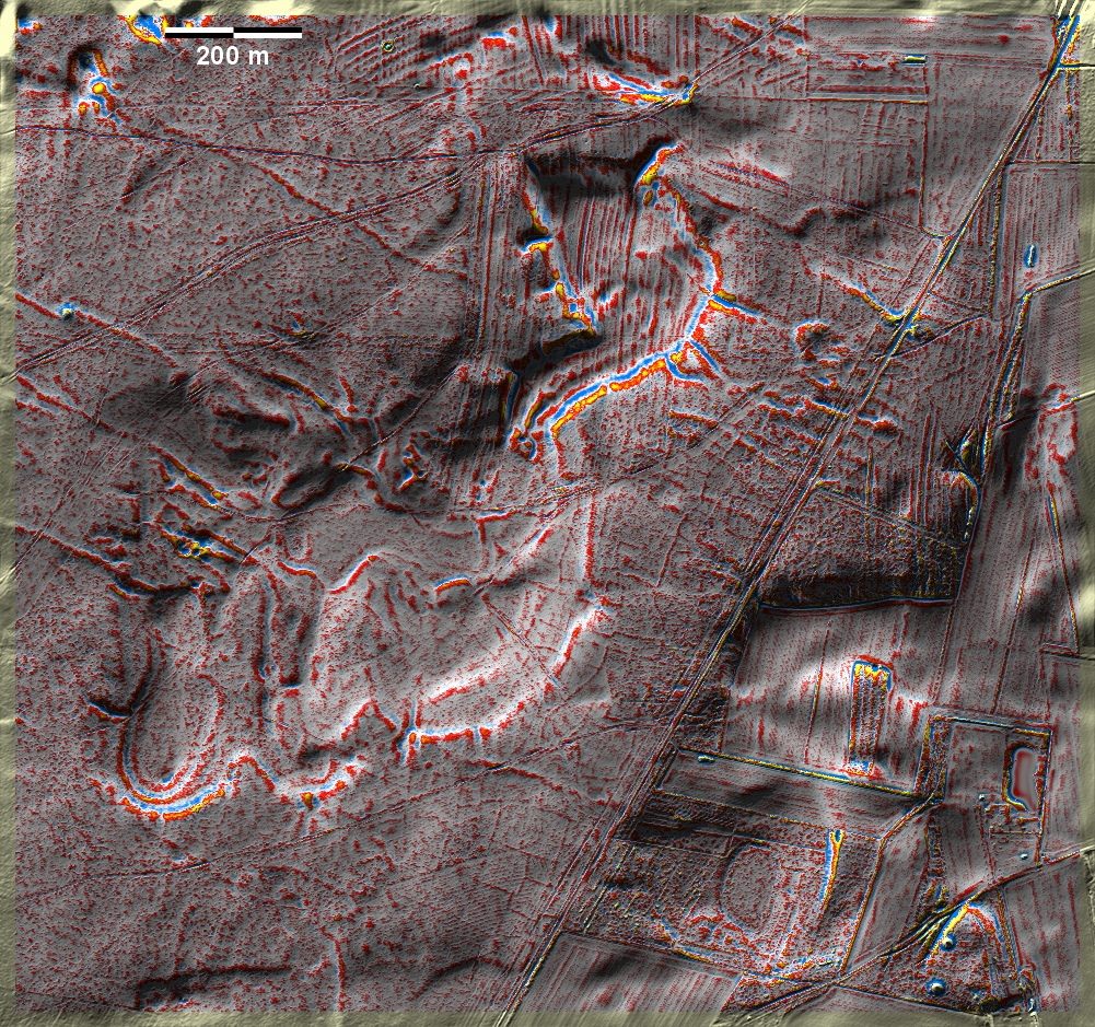
Im nordöstlichen, nicht aufgeforsteten Teil der Hjelm Hede bei Estvad südwestlich von Skive finden sich schwache Spuren von 'Celtic Fields' vor allem westlich längs des von NE nach SW die Grafik querenden Weges. Fraglich und noch schemenhafter sind weitere Spuren in Nordwesten der Grafik. Östlich des Weges reichen nordsüdlich verlaufende Wölbbeete an die "Celtic Fields" heran. Ganz im Südosten zwei Grabhügel sowie einer im Nordwesten. In the northeastern, non-forested part of Hjelm Hede near Estvad southwest of Skive, there are faint traces of 'Celtic Fields' mainly to the west along the path crossing the graphic from NE to SW. Further traces to the north-west of the graphic are questionable and even more indistinct. East of the path, ridge-and-furrow beds running north-south approach the 'Celtic Fields'. Two burial mounds in the far southeast and one in the northwest. Weiter more...