Spuren urgeschichtlicher Beackerung in West-, Mittel-, Ost- und Nordeuropa Traces of prehistoric farming in Western, Central, Eastern and Northern Europe: Boes Skov, Ostjütland-Süd Weiter more...
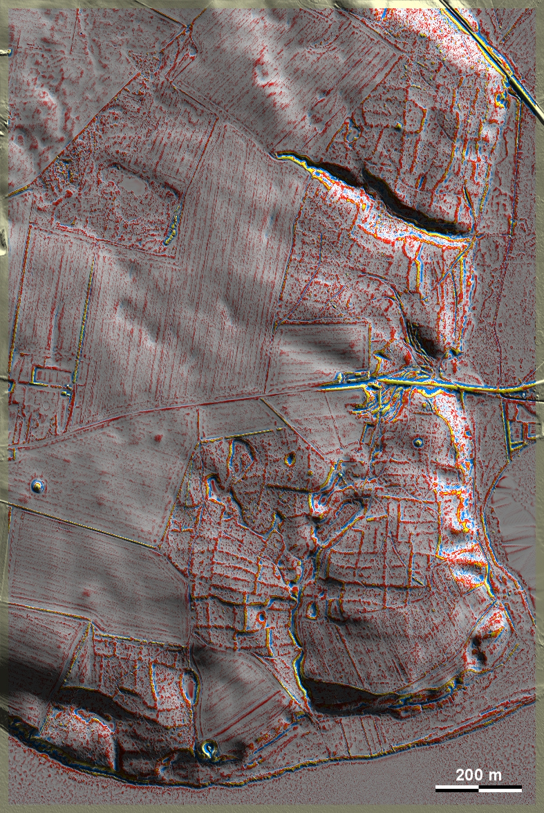
Im Boes Skov unweit der bedeutenden römisch-kaiserzeitlichen Fundstellen Alken Enge und Illerup Ådal westlich von Skanderborg liegen zahlreiche, überwiegend gut ausgeprägte 'Celtic Fields', die im anschließenden heutige Ackerland weitestgehend beseitigt sind. 2016 wurden im Südwesten der Grafik Bereiche mit überpflügten 'Celtic Fields' untersucht, aber auch erhaltene Stufenraine im östlich angrenzenden Wald. Die Keramikfunde sprechen für eine Bewirtschaftung in der Mitte oder zweiten Hälfte des ersten vorchristlichen Jahrtausends. Dieses passt gut zu einer Landöffnungsphase, die durch Pollenanalyse im 3 km östlich liegenden Ilsø-See nachgewiesen wurde. In Boes Skov, not far from the important Roman-aged sites of Alken Enge and Illerup Ådal west of Skanderborg, there are numerous, mostly well-developed 'Celtic Fields', which have been largely eliminated in the adjoining present-day farmland. In 2016, areas with ploughed-over Celtic Fields were investigated in the south-west of the graphic, but also surviving stepped ridges in the adjacent forest to the east. The pottery finds suggest cultivation in the middle or second half of the first pre-Christian millennium. This fits well with a land-opening phase detected by pollen analysis in Lake Ilsø 3 km to the east. Weiter more...