'Celtic Fields' – Stiefkinder der
Archäologie Archaeology's stepchildren
Spuren urgeschichtlicher Beackerung in West-,
Mittel-, Ost- und Nordeuropa Traces of prehistoric farming in Western,
Central, Eastern and Northern Europe: Jelling Skov, Ostjütland-Süd
Weiter more...
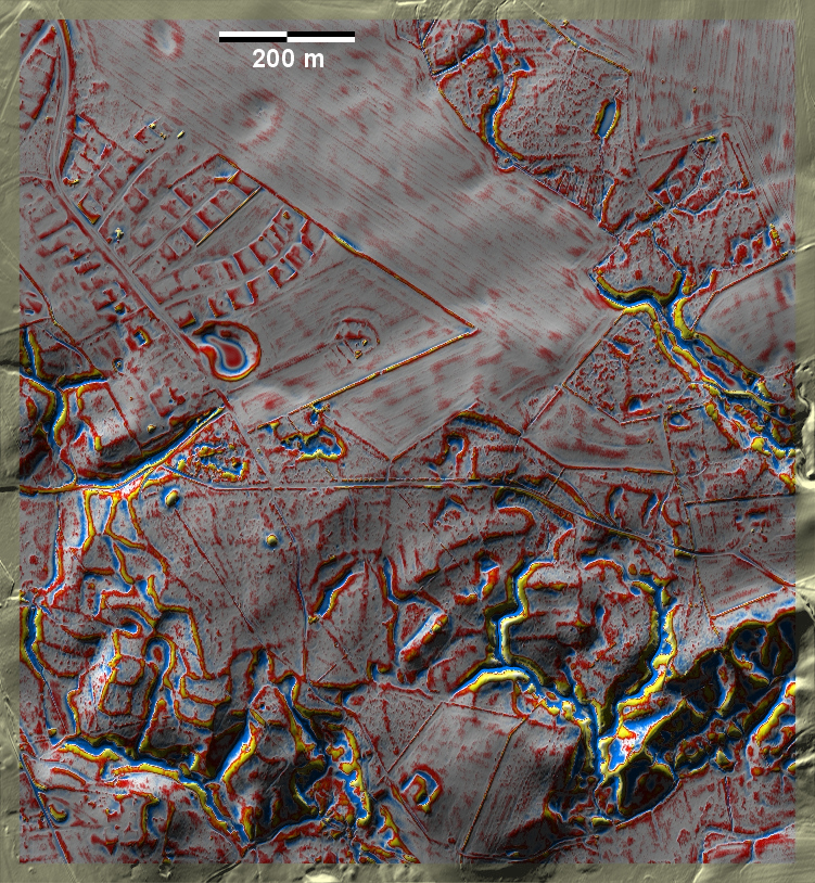
Im Jelling Skov nordwestlich von Vejle finden sich
'Celtic Fields' fast nur als deutliche Terrassenstufen an den Hängen zur Grejs
Å, während sie in den Waldresten der nördlich anschließenden Hochfläche nur als
schwach ausgeprägte Fragmente erkennbar sind. Dort gibt es auch wenige
Grabhügel. In Jelling Skov northwest of Vejle, 'Celtic Fields' are almost
only found as distinct terrace steps on the slopes to Grejs Å, while they are
only recognisable as faint fragments in the forest remnants of the upland area
to the north. Few burial mounds can also be found there. Weiter
more...
 |
 |
|
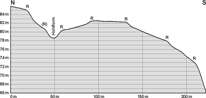
Jelling Skov, gemittelter Schnitt N-S averaged section N-S |
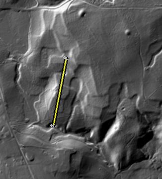
Jelling Skov, Lage des Schnitts Position of the section |
Daten © sdfi.dk. Wenn Sie diese Grafik herunterladen, müssen Sie zur Georeferenzierung mit Global
Mapper oder Mapinfo auch das TAB-File
laden und stets im gleichen Verzeichnis speichern. (Rechte Maustaste; Ziel
speichern unter... Bei Umbenennung darauf achten,
dass auch innerhalb des Tab-Files der Dateiname entsprechend umbenannt wird!)
If you download this graphic, you must also load the TAB-File
for georeferencing with Global Mapper or Mapinfo and save it always in
the same directory. (Right mouse button; save target as... When renaming, make
sure that the file name is also renamed within the tab file accordingly).
Grafik georeferenziert als GEOTIFF herunterladen oder als
KMZ-File für Benutzung
mit Locus Map + Smartphone oder Google Earth. Download georeferenced graphics
as GEOTIFF e.g. for Avenza Maps + Smartphone or as
KMZ-File for use with Locus
Map + Smartphone or Google Earth.
Zurück
Back Übersicht Ostjütland-Süd
Overview Eastern Jutland-South © Volker Arnold 2022