'Celtic Fields' – Stiefkinder der
Archäologie Archaeology's stepchildren
Spuren urgeschichtlicher Beackerung in West-,
Mittel-, Ost- und Nordeuropa Traces of prehistoric farming in Western,
Central, Eastern and Northern Europe: Henne-Dyreby Plantage, West-Jütland
Weiter more...
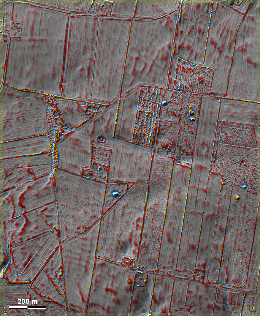
Um die Dyreby Plantage bei Henne nordwestlich von Varde gibt es etwas oberhalb
der Bildmitte zwei winzige Reste einer einst größeren Flur mit 'Celtic Fields',
deren überpflügte Spuren im heutigen Ackerland nördlich und südlich noch
erkennbar sind. Der westliche, gut ausgeprägte Rest liegt in einem dreieckigen
Heidestück, der östliche, durch Rodungsarbeiten äußerst beschädigt, in einer
Aufforstung. Ringsum mehrere Grabhügel. At Dyreby Plantation near Henne,
north-west of Varde, there are two tiny remains of a once larger field of
'Celtic Fields' just above the centre of the image, the overploughed traces of
which are still visible in today's farmland to the north and south.The western
remnant lies in a triangular piece of heath an is well pronounced, the eastern
one, extremely damaged by clearing work, in an afforestation. Several burial
mounds all around.
Weiter more...
 |
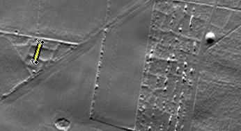 |
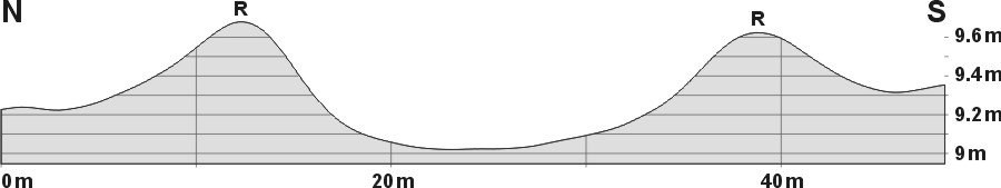
| Schnitt durch eine Parzelle
mit besonders hohen Randwällen Section through a plot with
particularly high rim walls |
Lage des Schnittes Position
of section |
Daten © sdfi.dk. Wenn Sie diese Grafik herunterladen, müssen Sie zur Georeferenzierung mit Global
Mapper oder Mapinfo auch das TAB-File
laden und stets im gleichen Verzeichnis speichern. (Rechte Maustaste; Ziel
speichern unter... Bei Umbenennung darauf achten,
dass auch innerhalb des Tab-Files der Dateiname entsprechend umbenannt wird!)
If you download this graphic, you must also load the TAB-File
for georeferencing with Global Mapper or Mapinfo and save it always in
the same directory. (Right mouse button; save target as... When renaming, make
sure that the file name is also renamed within the tab file accordingly).
Grafik georeferenziert als GEOTIFF herunterladen oder als
KMZ-File für Benutzung
mit Locus Map + Smartphone oder Google Earth. Download georeferenced graphics
as GEOTIFF e.g. for Avenza Maps + Smartphone or as
KMZ-File for use with Locus
Map + Smartphone or Google Earth.
Zurück
Back Übersicht Westjütland Overview
Jutland-West © Volker Arnold 2023