Spuren urgeschichtlicher Beackerung in West-, Mittel-, Ost- und Nordeuropa Traces of prehistoric farming in Western, Central, Eastern and Northern Europe: Heroldsberg-Saugarten-Ost, Bayern-West Bavaria-West Weiter more...
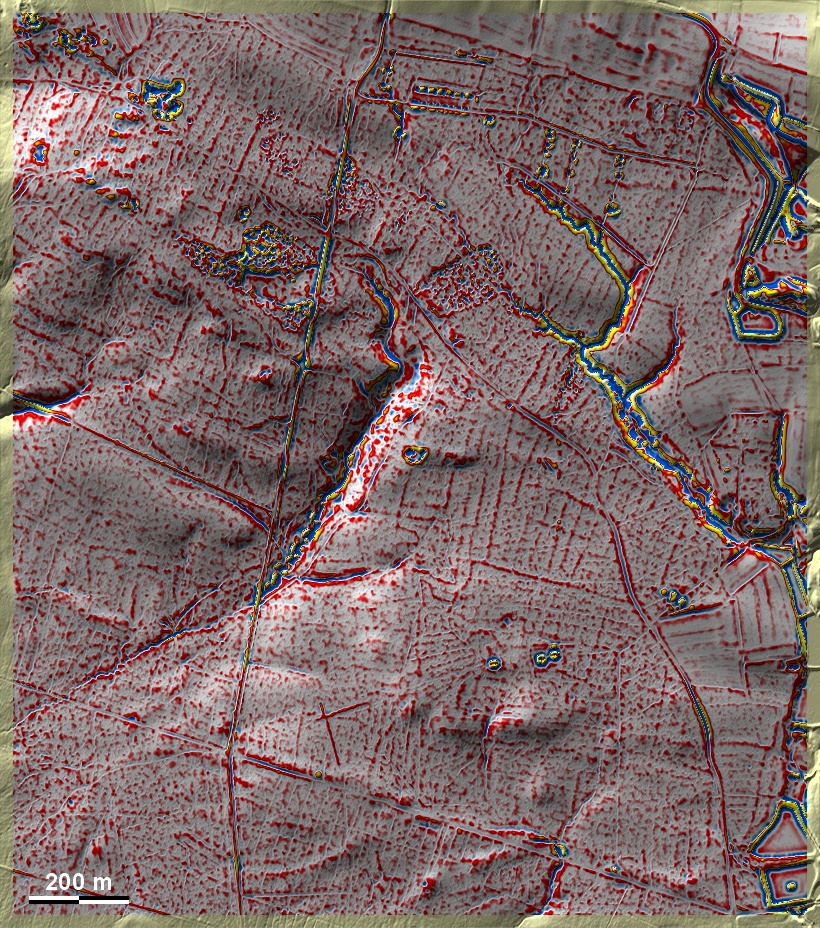
Im Ostteil des Waldbezirks Saugarten bei Heroldsberg im Nürnberger Reichswald liegen überwiegend auf Sandboden 'Celtic Fields'. Da Spuren übergeordneter Parzellen und (neben Langfeldern) Ansätze einer Kammerung zu beobachten sind, können sie in den Umkreis des Typs Przemęt eingeordnet werden. Einzelne Grabhügel; die im Südosten der Grafik am Waldweg gehören der Frühlatènezeit an. Dem Namen nach dienten die Grubenfelder an Nordrand der Entnahme von Ton zur Herstellung von Gusstiegeln. In the eastern part of the Saugarten forest district near Heroldsberg in the Nuremberg Reichswald, 'Celtic Fields' lie predominantly on sandy soil. Since traces of superior plots and (besides long fields) rudiments of a chambering can be observed, they can be classified in the periphery of the Przemęt type. Individual burial mounds; the one in the south-east of the graphic on the forest path belong to the Early Latène period. According to the name, the pit fields on the northern edge served to extract clay for the production of melting pots. Weiter more...