'Celtic Fields' – Stiefkinder der
Archäologie Archaeology's stepchildren
Spuren urgeschichtlicher Beackerung in West-,
Mittel-, Ost- und Nordeuropa Traces of prehistoric farming in Western,
Central, Eastern and Northern Europe: Königsforst-Nord, Nordrhein-Westfalen
North Rhine-Westphalia
Weiter more...

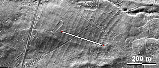
Die Spuren von 'Celtic Fields' im Norden des Königsforsts südöstlich von Köln
beschränken sich auf den Norden und den Süden der Grafik. Die Spuren
langgestreckter, ca. 25 m breiter Parzellen im Norden sind zwar fragmentarisch, erinnern aber
stark an meinen Typ
Sachsenhausen. Im Südwesten der Grafik liegt auf der Terrassenkante nördlich
eines Taleinschnittes eine Grabhügelgruppe. The traces of 'Celtic Fields' in
the north of the Königsforst southeast of Cologne are limited to the north and
south of the graphic. Although the traces of elongated, approx. 25 m wide plots in the north are
fragmentary, they are strongly reminiscent of my
Sachsenhausen type.
In the south-west of the graphic there is a group of burial mounds on the
terrace edge to the north of a valley incision.
Weiter more...
 |
 |
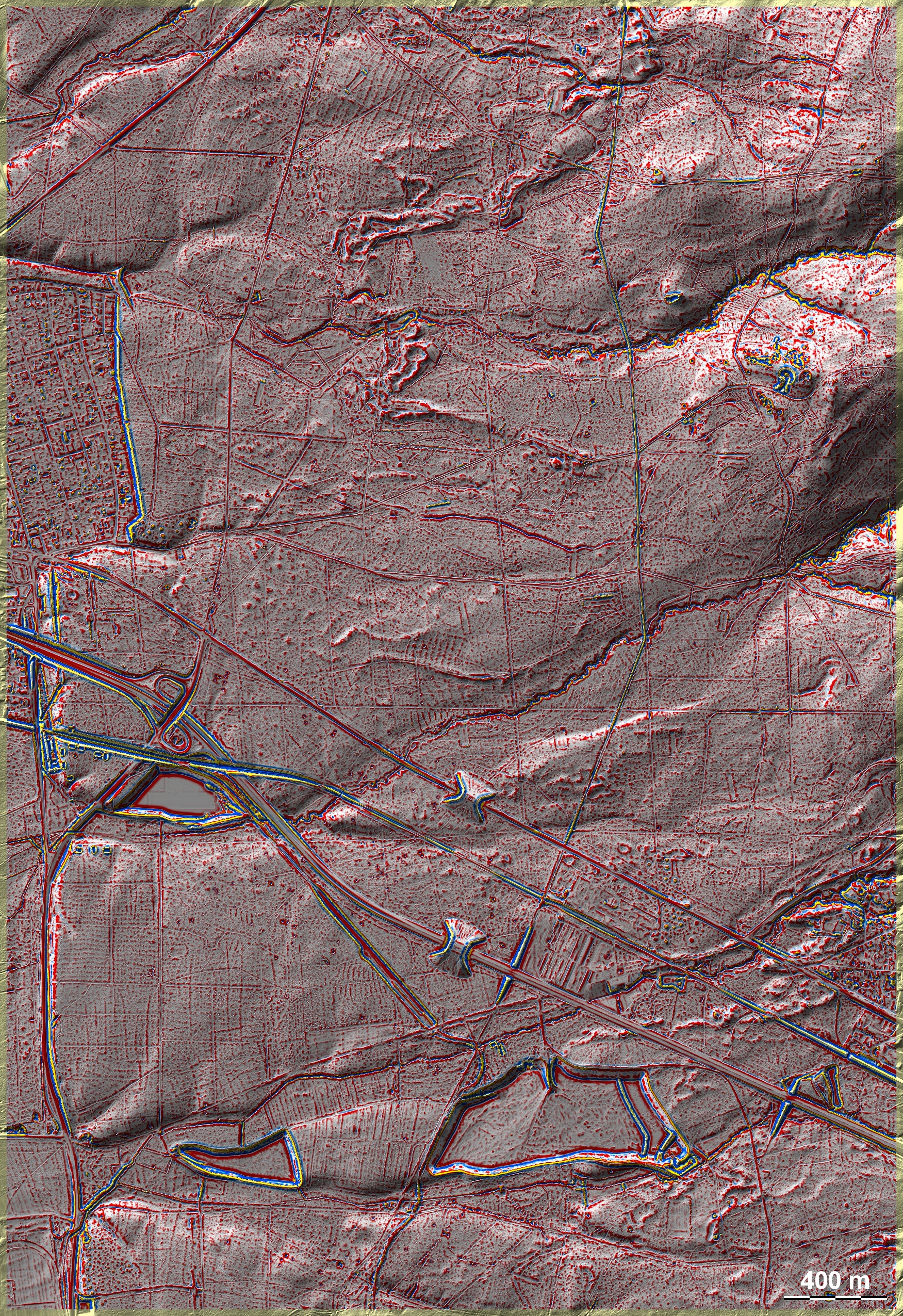
Schnitt
W-E durch zahlreiche Parzellen, 10-fach überhöht. Die Deutlichkeit ihrer Ausprägung
nimmt von Westen nach Osten ab. Die maximale Höhendifferenz zwischen
Dämmen und Mulden überschreitet selten 20 cm.
Section W-E through numerous plots, ten times exaggerated. The distinctness of their
pronounciation decreases from west to east. The maximum height
difference between embankments and troughs rarely exceeds 20 cm. |
|
Lage des Schnittes
Position of the section |
Daten www.geoportal.nrw. Wenn Sie
diese Grafik herunterladen, müssen Sie zur Georeferenzierung mit Global Mapper
oder Mapinfo auch das
TAB-File laden
und stets im gleichen Verzeichnis speichern (oder den gesamten
Königsforst +
TAB-File). (Rechte Maustaste; Ziel speichern
unter... Bei Umbenennung darauf achten, dass auch innerhalb des Tab-Files der
Dateiname entsprechend umbenannt wird!) Data © www.geoportal.nrw. If you
download this graphic, you must also load the
TAB-File for
georeferencing with Global Mapper or Mapinfo and save it always in the same
directory (or the entire Königsforst
+ TAB-File). (Right mouse button; save target as... When renaming, make sure that
the file name is also renamed within the tab file accordingly).
Grafik georeferenziert als
GEOTIFF
herunterladen z.B. für Avenza Maps + Smartphone oder als
KMZ-File für
Benutzung mit Locus Map + Smartphone oder Google Earth. Download
georeferenced graphics as
GEOTIFF
e.g. for Avenza Maps + Smartphone or as
KMZ-File for
use with Locus Map + Smartphone or Google Earth.
Zurück Back
Übersicht Nordrhein-Westfalen Overview
North Rhine-Westphalia ©
Volker Arnold 2024