Spuren urgeschichtlicher Beackerung in West-, Mittel-, Ost- und Nordeuropa Traces of prehistoric farming in Western, Central, Eastern and Northern Europe: Wolfskuiler Heide, Nordrhein-Westfalen North Rhine-Westphalia Weiter more...

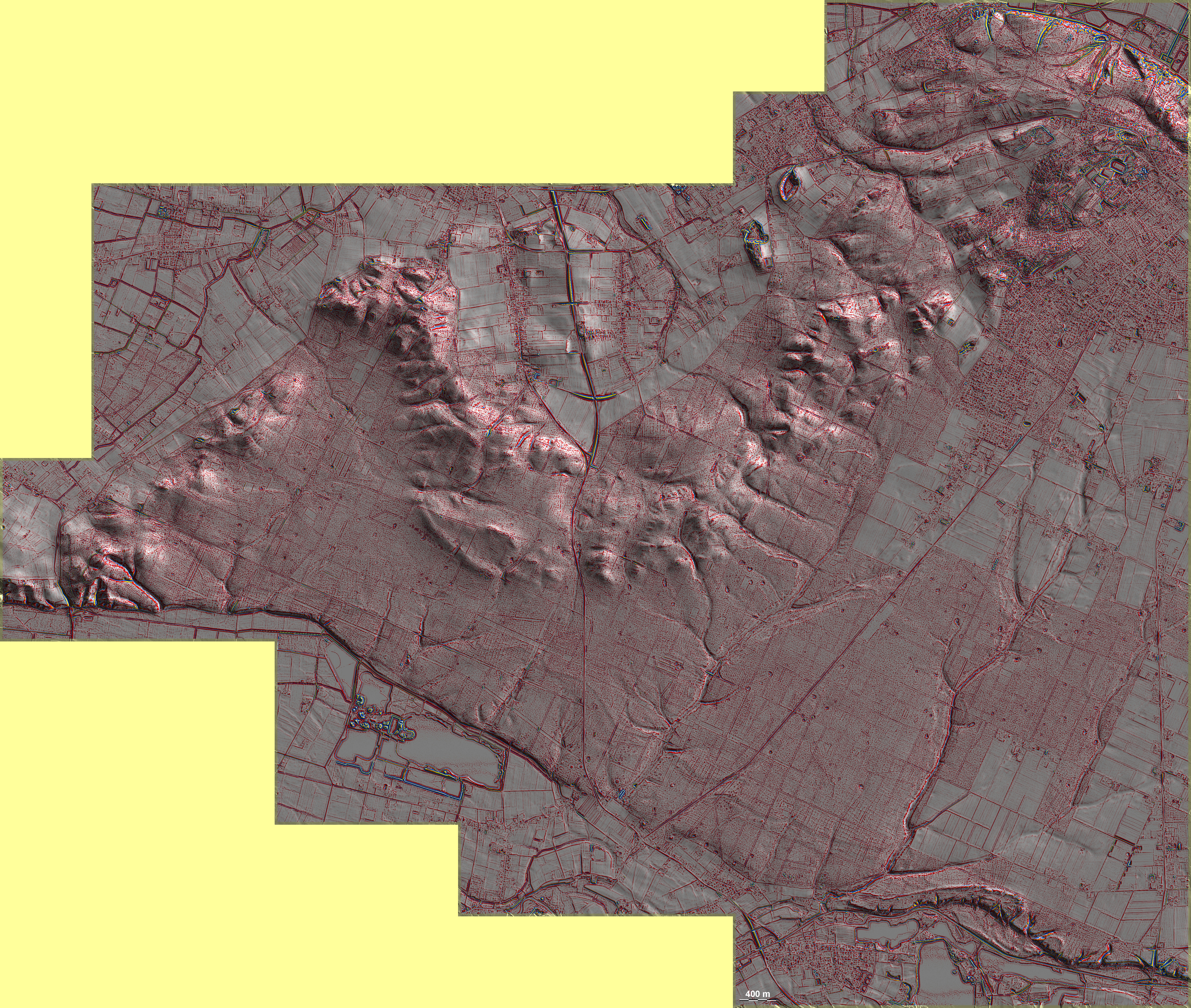
Der südliche Teil des Klever Reichswalds, die Wolfskuiler Heide, ist voller ganz schwach ausgeprägter 'Celtic Fields', die sich auch noch östlich und westlich außerhalb der Grafik fortsetzen. Unglücklicherweise liegen sie hier parallel zu den Spuren der forstlichen Maßnahmen und sind deswegen auch in der Grafik nur mit Mühe erkennbar (Bildmitte und Südosten der Grafik). Längs der Terrassenkante liegen Grabhügel in zwei lockeren Gruppen. In der westlichen Gruppe tauchen auch die für die ältere vorrömische Eisenzeit charakteristischen Dämme auf, dort auch ein Altwegefächer. Bei einer kleinen Gruppe langschmaler Rechtecke im Nordosten der Grafik wäre zu prüfen, ob es sich um römerzeitliche oder vorrömische Grabgärten handeln könnte. The southern part of the Kleve Reichswald, the Wolfskuiler Heide, is full of very faint 'Celtic Fields', which also continue to the east and west outside the graphic. Unfortunately, they lie parallel to the traces of the forestry measures and are therefore difficult to recognise in the graphic (centre and south-east of the graphic). Burial mounds lie in two loose groups along the edge of the terrace. In the western group, the embankments characteristic of the older pre-Roman Iron Age also appear, as well as an ancient road fan. A small group of long narrow rectangles in the north-east of the graphic should be examined to see whether they could be Roman or pre-Roman burial gardens. Weiter more...