Spuren urgeschichtlicher Beackerung in West-, Mittel-, Ost- und Nordeuropa Traces of prehistoric farming in Western, Central, Eastern and Northern Europe: Store Vildmose-Grishøjgård Krat, Nordjütland Weiter more...
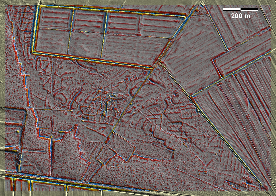
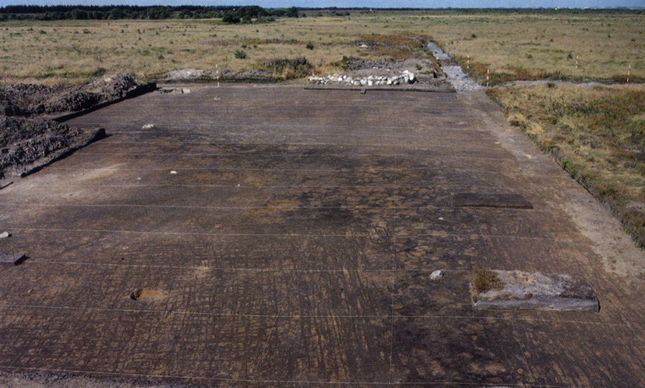
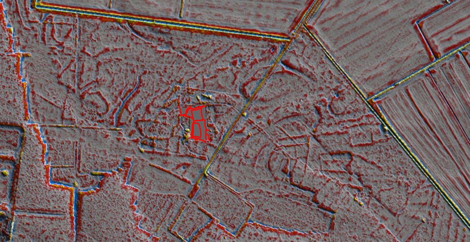
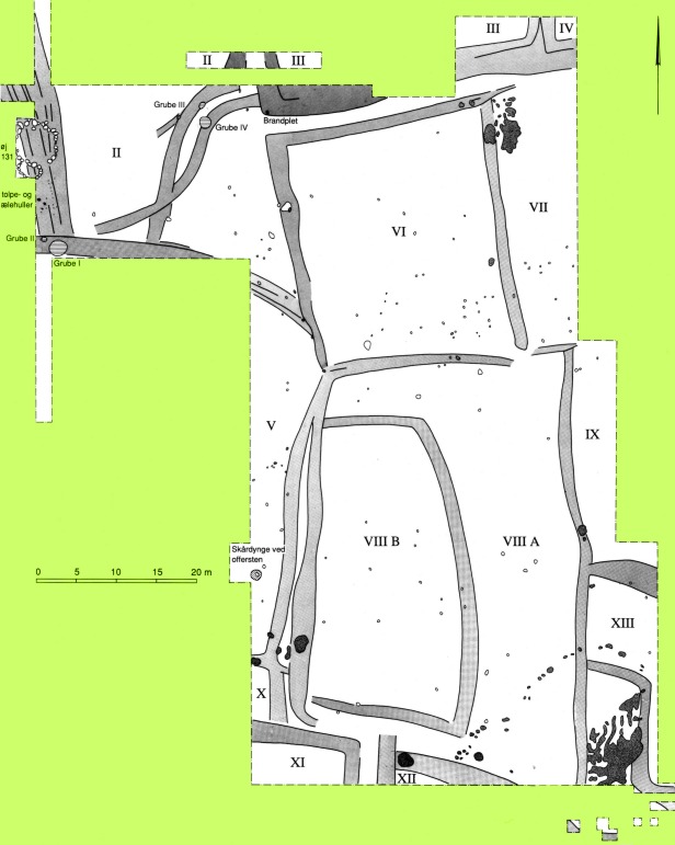
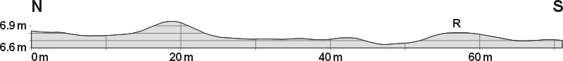
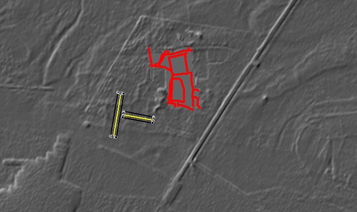
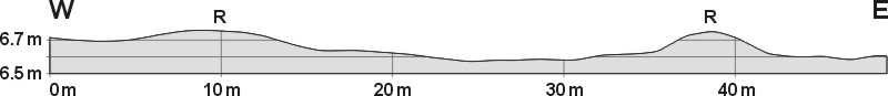
Im heutigen Grishøjgård Krat im Store Vildmose westlich von Brønderslev wurden anlässlich der damaligen Moorkultivierung durch Viggo Nielsen um 1970 auf gehobenem ehemaligen Meeresgrund mehrere ältereisenzeitliche Ackerparzellen ausgegraben, die ein Jahrtausend nach deren Brachfallen vom wachsenden Store Vildmose überdeckt und konserviert waren. In der Lasergrafik fällt das damalige Grabungareal durch ein ziemliches Chaos in Bildmitte auf. Die Spuren ringsum sind zunächst verwirrend: am auffälligsten sind die Abbaukanten an den letzten Hochmoorresten sowie die Gräben und Kultivierungsspuren im heutigen Wirtschaftsland. Es ist aber schwierig und manchmal unmöglich, die Ränder der 'Celtic-Fields'-Parzellen von den modernen Abbauspuren des Moores zu unterscheiden. Die ausführliche Publikation der Grabungen in Buchform 1993 machte es möglich, die Grabungsergebnisse mit den Laserdaten zu synchronisieren. Wie der Autor selbst zugibt, war die Grabungsmethode, die auf die Dokumentation der Ardspuren abzielte, wenig geeignet, um erhöhte Parzellenränder zu erkennen. Wo er solche beobachten konnte, gibt er eine Höhe von ca. 10 cm an, was gut zu den benachbarten Schnitten nach Laserdaten (unten) passt. In today's Grishøjgård Krat in Store Vildmose west of Brønderslev, several Early Iron Age field plots were excavated around 1970 on the raised former seabed during the bog cultivation by Viggo Nielsen, which were covered and preserved by the growing Store Vildmose a millennium after they had fallen into disuse. In the laser graphic, the former excavation area is conspicuous for its chaos in the centre of the image. The traces all around are confusing at first: most noticeable are the quarrying edges on the last remnants of the raised bog and the ditches and cultivation traces in the present-day farmland. However, it is difficult and sometimes impossible to distinguish the edges of the Celtic Fields plots from the modern extraction traces of the bog. The detailed publication of the excavations in a book form in 1993 made it possible to synchronise the excavation results with the laser data. As the author himself admits, the excavation method, which aimed at documenting ard marks, was not very suitable for identifying raised plot edges. Where he was able to observe such, he gives a height of about 10 cm, which fits well with the neighbouring sections according to laser data (below). Weiter more...