'Celtic Fields' – Stiefkinder der
Archäologie Archaeology's stepchildren
Spuren urgeschichtlicher Beackerung in West-,
Mittel-, Ost- und Nordeuropa Traces of prehistoric farming in Western,
Central, Eastern and Northern Europe: Samsø-Brattingsborg Skov
Weiter more...
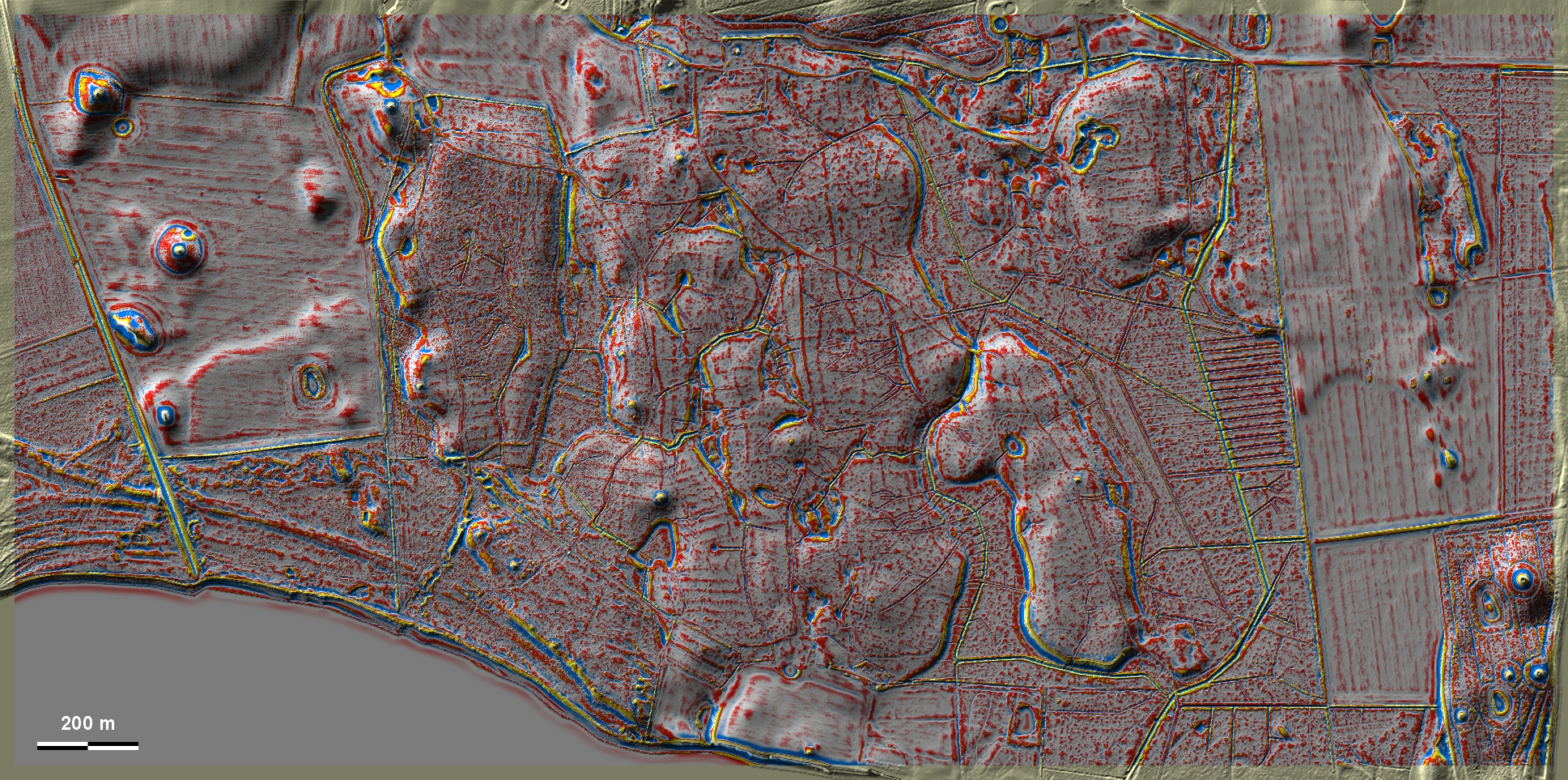
Im Brattingsborg Skov auf der Insel Samsø im Kattegatt liegen 'Celtic Fields',
die trotz ihrer Anpassung an das unregelmäßige Gelände eine Bevorzugung
langschmaler paralleler Parzellen erkennen lassen. Dazwischen ein Langbett und
mehrere Grabhügel, deren Wirkung zum Teil durch ihre Lage auf kleinen isolierten
Anhöhen verstärkt wird. In Brattingsborg Skov on the island of Samsø in the
Kattegat lie 'Celtic Fields' which, despite their adaptation to the irregular
terrain, reveal a preference for long narrow parallel plots. In between, there
is a long bed and several burial mounds, the effect of which is partly enhanced
by their location on small isolated heights. Weiter
more...
Daten © sdfi.dk. Wenn Sie diese Grafik herunterladen, müssen Sie zur Georeferenzierung mit Global
Mapper oder Mapinfo auch das TAB-File
laden und stets im gleichen Verzeichnis speichern. (Rechte Maustaste; Ziel
speichern unter... Bei Umbenennung darauf achten,
dass auch innerhalb des Tab-Files der Dateiname entsprechend umbenannt wird!)
If you download this graphic, you must also load the TAB-File
for georeferencing with Global Mapper or Mapinfo and save it always in
the same directory. (Right mouse button; save target as... When renaming, make
sure that the file name is also renamed within the tab file accordingly).
Grafik georeferenziert als GEOTIFF herunterladen oder als
KMZ-File für Benutzung
mit Locus Map + Smartphone oder Google Earth. Download georeferenced graphics
as GEOTIFF e.g. for Avenza Maps + Smartphone or as
KMZ-File for use with Locus
Map + Smartphone or Google Earth.
Zurück
Back Übersicht Ostjütland-Süd
Overview Eastern Jutland-South © Volker Arnold 2022