Spuren urgeschichtlicher Beackerung in West-, Mittel-, Ost- und Nordeuropa Traces of prehistoric farming in Western, Central, Eastern and Northern Europe: Białowieza-Narewka-SE, Nordost-Polen Weiter more...
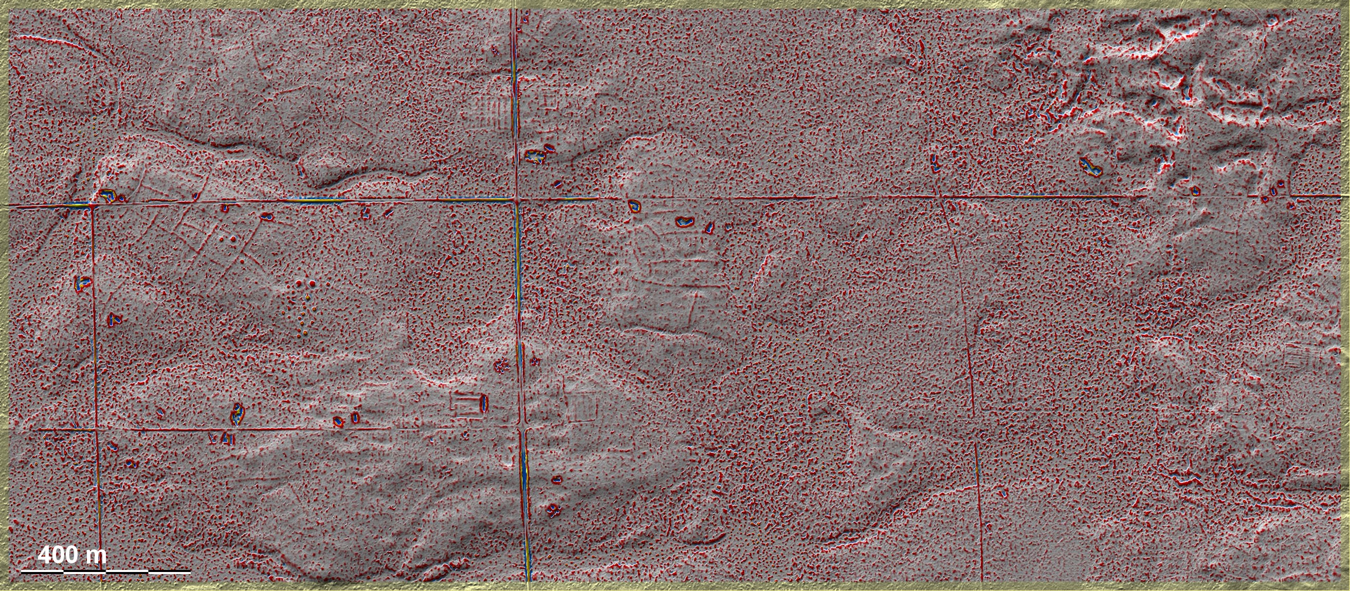
In dem riesigen Waldgebiet der Białowieza liegen südöstlich von Narewka mehrere kleinere Areale mit 'Celtic Fields'. Sie sind in den Laserdaten durch geringeres Grundrauschen von den übrigen Flächen unterschieden, was sowohl an der planierenden ehemaligen ackerbaulichen Nutzung wie auch der erhöhten Lage und damit anderer Waldzusammensetzung liegen mag oder einer Kombination dieser Faktoren. Die Grabhügelgruppe im Westteil der Grafik liegt teils in, teils außerhalb der Feldmark und dürfte mit hoher Wahrscheinlichkeit den Nutzern der Felder zuzuordnen sein. – Die Kenntnis dieser Fundstelle verdanke ich den Amateurarchäologen (und Augenärzten) Paweł Banasiak, Katowice und Piotr Berezowski, Bielsko-Biała. In the huge forest area of the Białowieza, southeast of Narewka, there are several smaller areas with 'Celtic Fields'. They are distinguished from the other areas in the LIDAR data by lower background noise, which may be due to the levelling former agricultural use as well as the elevated position and thus different forest composition, or a combination of these factors. The group of burial mounds in the western part of the diagram lies partly in and partly outside the fieldmark and is most likely to be attributed to the users of the fields. - I owe the knowledge of this site to the amateur archaeologists (and ophthalmologists) Paweł Banasiak, Katowice and Piotr Berezowski, Bielsko-Biała. Weiter more...