Spuren urgeschichtlicher Beackerung in West-, Mittel-, Ost- und Nordeuropa Traces of prehistoric farming in Western, Central, Eastern and Northern Europe: Studzieńczyna-Nord, Nordost-Polen Weiter more...
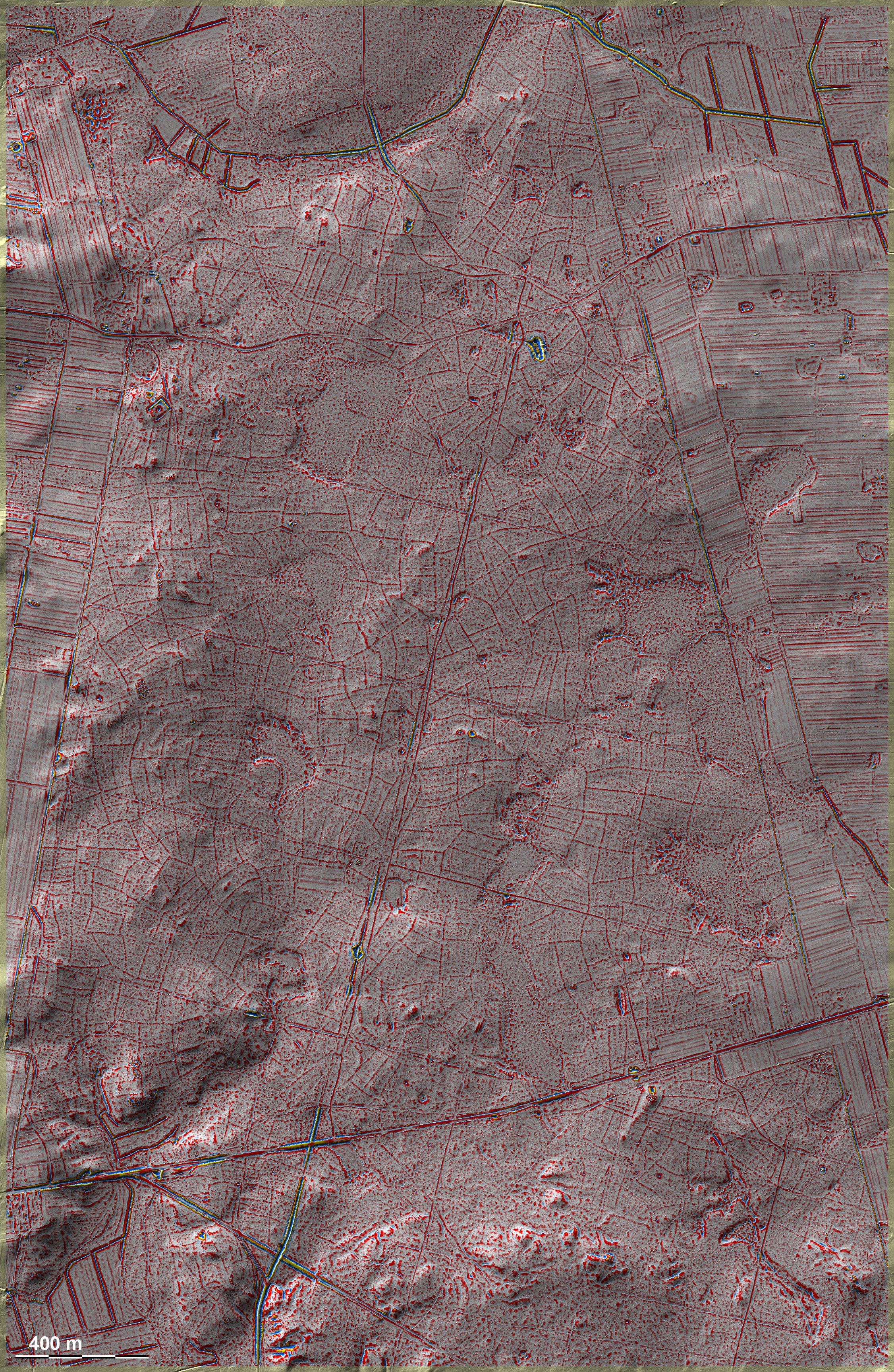
Nördlich von Studzieńczyna setzt sich der Waldriegel mit den vielen 'Celtic Fields' fort. Hier hat die frühere Bewirtschaftung fast nur die Moore ausgeklammert. Die Parzellierung bricht am heutigen Waldrand ab, was bedeutet, dass die einstige Ausdehnung der Parzellen noch größer war. Ein schwach geschängelter langer Rain durchquert den Wald ím Norden der Grafik von West nach Ost und biegt zuletzt in südöstliche Richtung um. Nördlicher / südlicher Anschluss. To the north of Studzieńczyna, the woodland belt with the many 'Celtic Fields' continues. Here, the former cultivation almost only excluded the bogs. A weakly meandering long embankment and parcel rim crosses the forest in the north of the graphic from west to east and finally turns in a south-easterly direction. The parcelling breaks off at the present forest edge, which means that the former extent of the plots was even larger. Northern / southern connection. Weiter more...