Spuren urgeschichtlicher Beackerung in West-, Mittel- und Nordeuropa Traces of prehistoric farming in Western, Central, Eastern and Northern Europe: Milanów-NE-Czarny Las, Ost-Polen Weiter more...
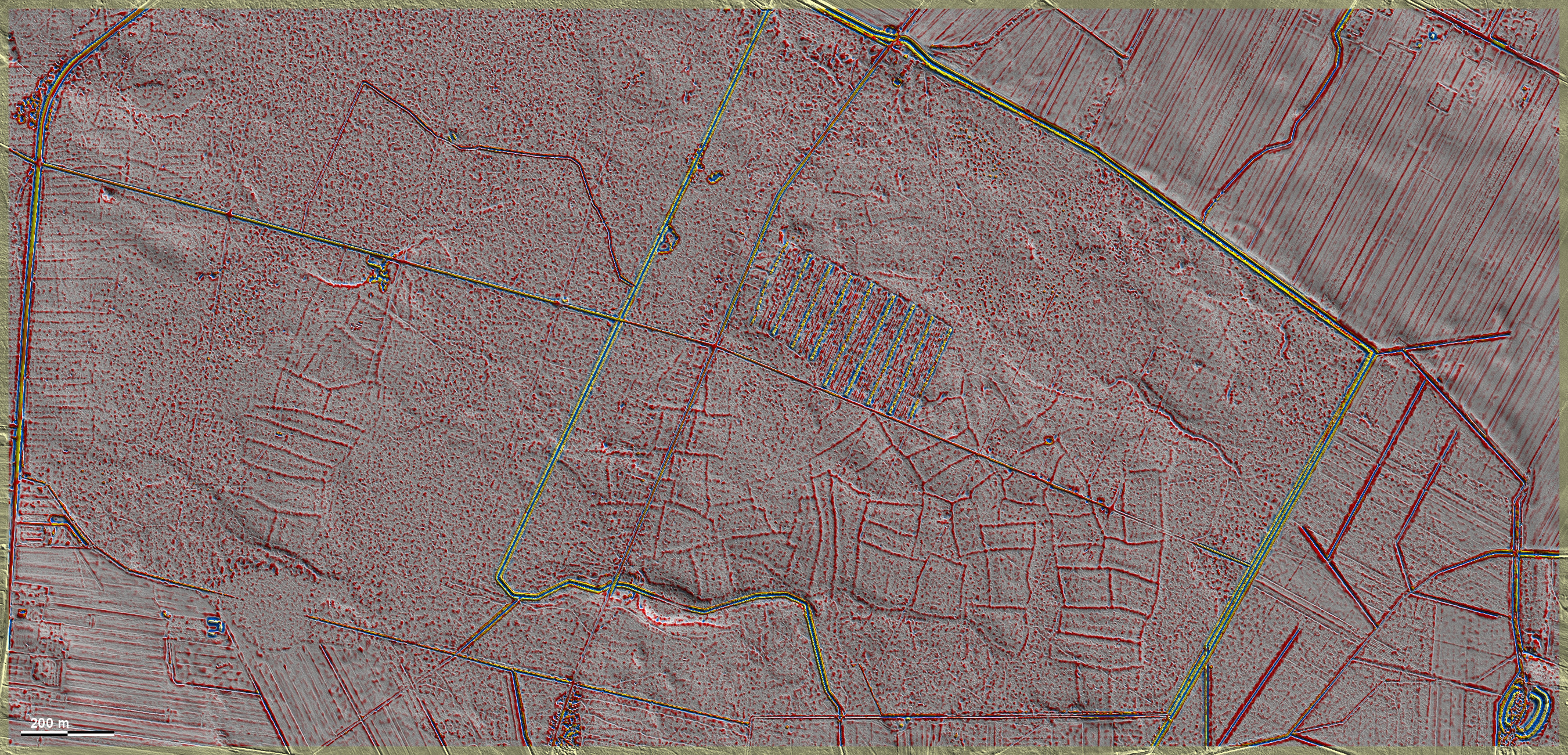
Im Czarny Las nordöstlich von Milanów liegen gut ausgeprägte 'Celtic Fields' in der Nähe des Ringwalls mit doppelter Umwallung, mit dem sie in Zusammenhang stehen könnten, vor allem weil sowohl die Parzellen als auch der Ringwall in weiter Umgebung keine Parallelen haben. Die sorglos angelegten Parzellen meines Böhmischen Typs scheinen ganz schwache Spuren einer Kammerung zu zeigen. Auch in einem südöstlich anschließenden Waldstück außerhalb der Grafik finden sich weitere 'Celtic Fields', die allerdings nur schwach ausgeprägt sind. Der Horodek genannte Ringwall enthält Funde des Frühmittelalters. In Czarny Las, north-east of Milanów, well pronounced 'Celtic Fields' lie close to a ring wall with double ramparts, with which they could be connected, especially as both the plots and the ring wall have no parallels in the wider area. These carelessly laid out plots of my Bohemian type seem to show very faint traces of chambering. There are also more 'Celtic Fields' in an adjoining woodland area to the south-east, outside the diagram, but they are only faintly pronounced. The ring wall called Horodek contains artefacts from the early Middle Ages. Weiter more..
.

Schnitt West (N-S), 10-fach überhöht. Die Randwälle (R) lassen teilweise sehr schwache begleitende Vertiefungen von Erdentnahmen erkennen. Auffällig auch die gelegentliche leichte Aufwölbung des Parzelleninnenraums.
Section west (N-S), 10x exaggerated. Some of the edge embankments (R) show very faint accompanying depressions from soil removal. The occasional slight bulging of the interior of the plot is also striking.
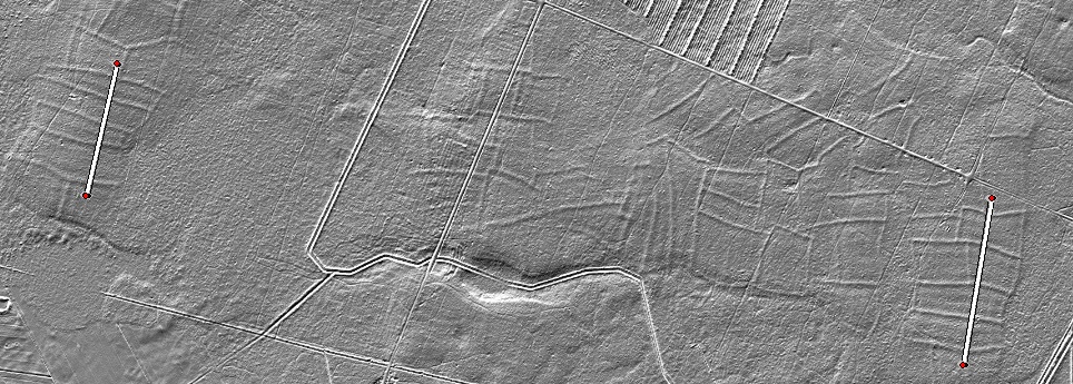
Lage der Schnitte Position of the sections

Auch der Schnitt Ost lässt die oben erwähnten Besonderheiten erkennen. Die Wallhöhen liegen um 15 cm. The eastern section also shows the special features mentioned above. The embankment heights are around 15 cm.