'Celtic Fields' – Stiefkinder der
Archäologie Archaeology's stepchildren
Spuren urgeschichtlicher Beackerung in West-,
Mittel-, Ost- und Nordeuropa Traces of prehistoric farming in Western,
Central, Eastern and Northern Europe: Somianka (Bug), Ost-Polen
Weiter more...
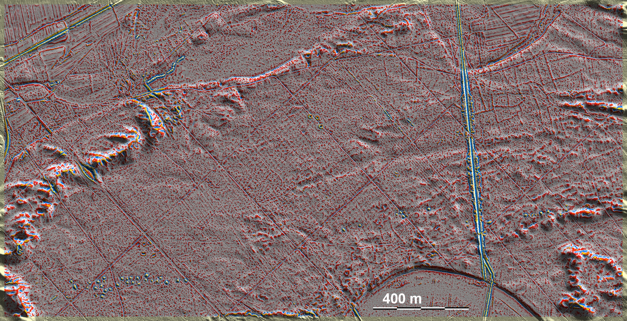
Südöstlich von Somianka liegen erhöht über der Bug-Niederung 'Celtic Fields' im
nordöstlichen Teil der Grafik. Geringe Spuren gibt es aber auch im Nordwesten
sowie im Süden oberhalb des Maßstabes. Weiterhin durchziehen zwei ost-westlich
orientierte Grabhügelreihen die Südhälfte der Grafik. South-east of Somianka,
elevated above the Bug lowland, are 'Celtic Fields' in the north-eastern part of
the diagram. There are also small traces in the north-west and in the south
above the scale. Furthermore, two east-west oriented rows of tumuli pervade the
southern half of the graphic.
Weiter more...
Daten © geoportal.gov.pl. Wenn Sie diese Grafik herunterladen, müssen Sie zur Georeferenzierung mit Global
Mapper oder Mapinfo auch das TAB-File
laden und stets im gleichen Verzeichnis speichern. (Rechte Maustaste; Ziel
speichern unter... Bei Umbenennung darauf achten,
dass auch innerhalb des Tab-Files der Dateiname entsprechend umbenannt wird!)
Data © geoportal.gov.pl. If you download this graphic, you must also load the
TAB file for
georeferencing with Global Mapper or Mapinfo and save it always in the same
directory. (Right mouse button; save target as... When renaming, make sure that
the file name is also renamed within the tab file accordingly).
Grafik georeferenziert als GEOTIFF herunterladen z.B. für Avenza Maps + Smartphone oder als
KMZ-File für Benutzung
mit Locus Map + Smartphone oder Google Earth. Download georeferenced graphics
as GEOTIFF e.g. for
Avenza Maps + Smartphone or as
KMZ file for use with Locus Map + Smartphone or Google Earth.
Zurück
Back
Übersicht Polen-Ost Overview Poland-East Übersicht Gesamt-Polen
Overview Total Poland © Volker Arnold 2022