Spuren urgeschichtlicher Beackerung in West-, Mittel-, Ost- und Nordeuropa Traces of prehistoric farming in Western, Central, Eastern and Northern Europe: Goseck-West, Sachsen-Anhalt Saxony-Anhalt Weiter more...
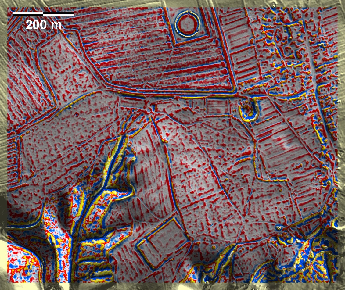
Westlich von Goseck, unweit der berühmten dreitorigen altneolithischen Kreisgrabenanlage (Rekonstruktion im Norden der Grafik), liegen in Waldresten Fragmente von 'Celtic Fields'. Trotz der eher mäßigen Ausprägung lassen sich Wallreste übergeordneter Parzellen sowie Spuren der Unterteilung in gleicher Ausrichtung wie in Schleberode-West, Neue Göhle feststellen, womit auch diese Fragmente zum Typ Przemęt zu rechnen sind. Eine erste Untersuchung der Bewirtschaftungsspuren soll ergebnislos verlaufen sein. To the west of Goseck, not far from the famous three-door Old Neolithic circular ditch (reconstruction in the north of the graphic), fragments of 'Celtic Fields' can be found in the remains of woodland. In spite of the rather modest pronounciation of the site, remains of embankments of superordinate plots and traces of subdivision in the same orientation as in Schleberode-West, Neue Göhle can be identified, which means that these fragments also belong to the Przemęt type. An initial investigation of the cultivation traces is said to have been unsuccessful. Weiter more...