'Celtic Fields' – Stiefkinder der
Archäologie Archaeology's stepchildren
Spuren urgeschichtlicher Beackerung in West-,
Mittel-, Ost- und Nordeuropa Traces of prehistoric farming in Western,
Central, Eastern and Northern Europe: Litzendorf-SW, Bayern-Nord Bavaria-North
Weiter more...
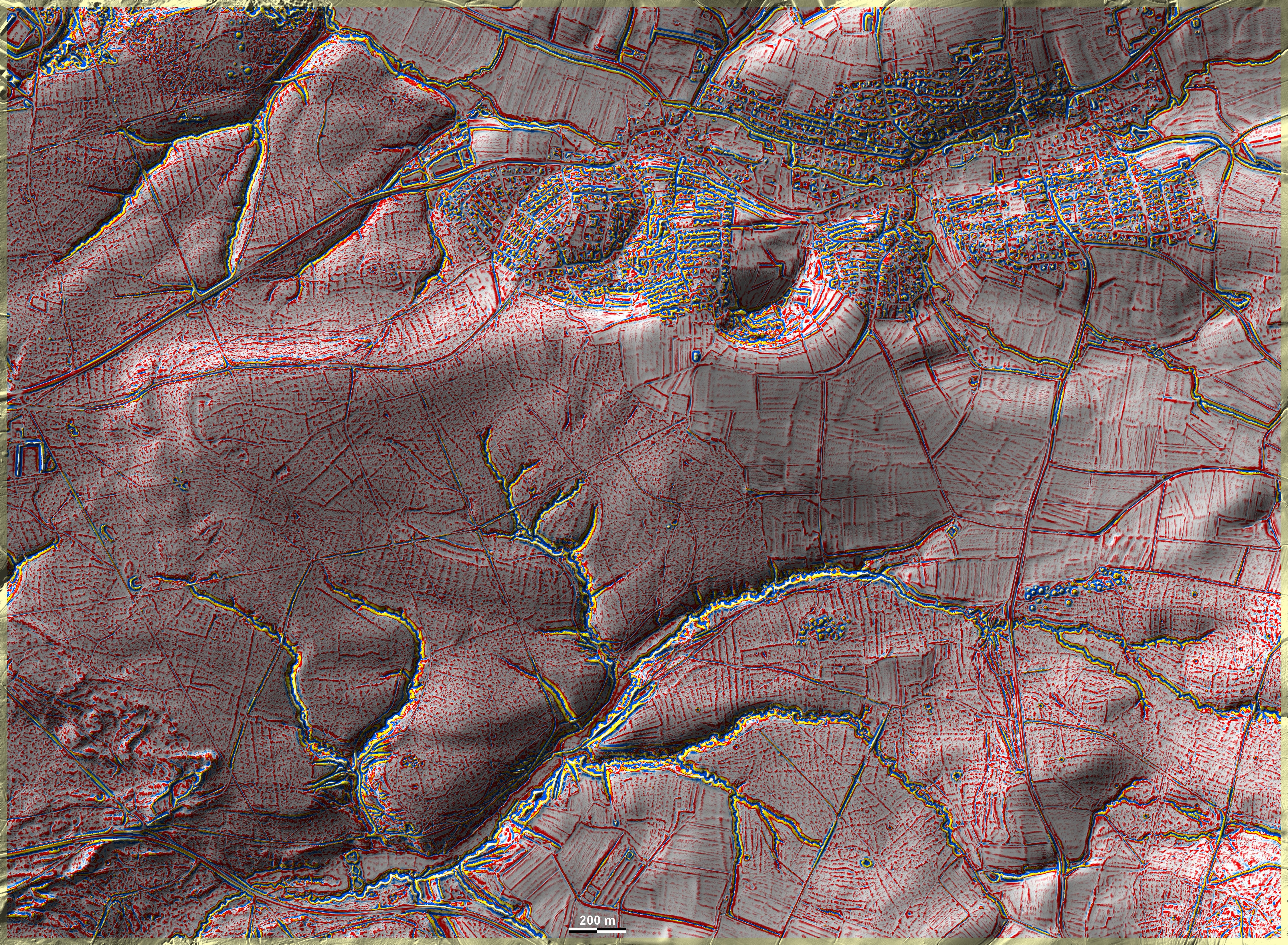
In den Waldungen westlich, südlich und südöstlich von Litzendorf bei Bamberg
liegen auf überwiegend sandigen, teils auch lehmigen Böden Spuren von 'Celtic
Fields', die meistens ein etwas chaotisches Layout zeigen. Spuren
übergeordnerter Parzellen sind erkennbar sowie eine sekundäre Unterteilung in
Langfelder, teils auch in der Art vom Typ Przemęt. Im Nordwesten eine, im Südosten zwei Grabhügelgruppen. Die östlichste
enthält Bestattungen der Hallstatt- bis Frühlatènezeit; einige der dort
ausgegrabenen Hügel sind rekonstruiert. In the woodlands to the west, south
and south-east of Litzendorf near Bamberg, there are traces of 'Celtic Fields'
on predominantly sandy, partly also loamy soils, which mostly show a somewhat
chaotic layout. Traces of superordinate plots are recognisable as well as a
secondary subdivision into long fields, partly also of the Przemęt type. In the northwest one, in the southeast
two groups of barrows. The easternmost contains burials of the Hallstatt to
Early Latène period; some of the mounds excavated there have been reconstructed.
Weiter more...
|
|
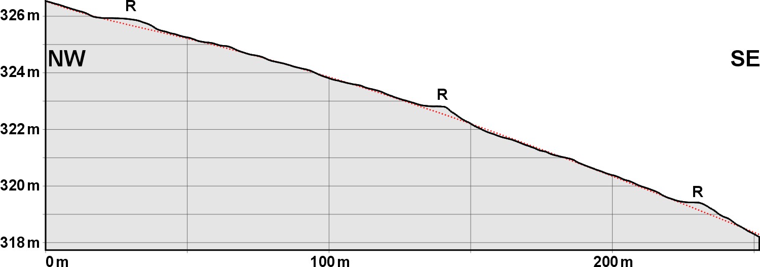
Schnitt NW-SE. Die rote Linie
deutet die ursprüngliche Oberfläche an. Section NW-SE. The red
line indicates the original surface.
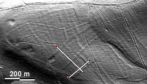
Lage der Schnitte Position of the sections
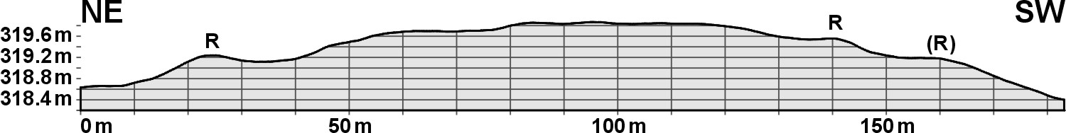
Schnitt NE-SW, 10-fach überhöht.
Section NE-SW, 10 times exaggerated. |
|
 |
Daten © BVV/geodaten.bayern.de. Wenn Sie
diese Grafik herunterladen, müssen Sie zur Georeferenzierung mit Global Mapper
oder Mapinfo auch das
TAB-File laden
und stets im gleichen Verzeichnis speichern. (Rechte Maustaste; Ziel speichern
unter... Bei Umbenennung darauf achten, dass auch innerhalb des Tab-Files der
Dateiname entsprechend umbenannt wird!) Data © BVV/geodaten.bayern.de. If you
download this graphic, you must also load the
TAB-File for
georeferencing with Global Mapper or Mapinfo and save it always in the same
directory. (Right mouse button; save target as... When renaming, make sure that
the file name is also renamed within the tab file accordingly).
Grafik georeferenziert als
GEOTIFF
herunterladen z.B. für Avenza Maps + Smartphone oder als
KMZ-File für
Benutzung mit Locus Map + Smartphone oder Google Earth. Download
georeferenced graphics as
GEOTIFF
e.g. for Avenza Maps + Smartphone or as
KMZ-File for
use with Locus Map + Smartphone or Google Earth.
Zurück Back
Übersicht Bayern-Nord Overview Bavaria-North
Übersicht Bayern Overview Bavaria ©
Volker Arnold 2022