Spuren urgeschichtlicher Beackerung in West-, Mittel-, Ost- und Nordeuropa Traces of prehistoric farming in Western, Central, Eastern and Northern Europe: Ochsenfurter Forst, Bayern-Nord Bavaria-North Weiter more...
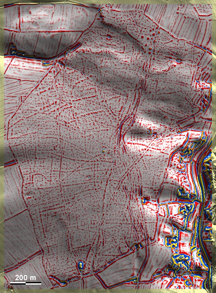
Der Ochsenfurter Forst liegt in der Südspitze des Maindreiecks über dem Fluss auf Löss- und Lehmböden. Er ist durchsetzt von 'Celtic Fields', die Spuren übergeordneter Parzellen sowie Spuren sekundärer Unterteilungen aufweisen und somit zumindest in das Umfeld des Typs Przemęt gehören. In Bildmitte ein Grabhügel; eine Hügelgruppe im Norden datiert in die mittlere Bronzezeit. Von dort aus durchquert ein gefächerter Altweg nach Süden den Wald, der die 'Celtic Fields' durchschneidet. The Ochsenfurt Forest is located in the southern tip of the Maindreieck above the river on loess and clay soils. It is interspersed with 'Celtic Fields', which show traces of superior plots as well as traces of secondary subdivisions and thus belong at least to the environment of the Przemęt type. In the centre of the picture a burial mound; a group of mounds to the north dates to the Middle Bronze Age. From there, a fanned ancient road to the south crosses the forest that cuts through the 'Celtic Fields'. Weiter more...