Spuren urgeschichtlicher Beackerung in West-, Mittel-, Ost- und Nordeuropa Traces of prehistoric farming in Western, Central, Eastern and Northern Europe: Roßdorf-Forst Hauptsmoor-Salzlecke, Bayern-Nord Bavaria-North Weiter more...
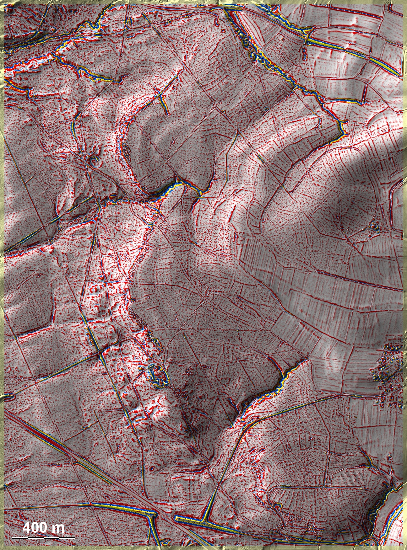
Der Forst Hauptsmoor bei Roßdorf liegt östlich von Bamberg auf den Ausläufern der Fränkisch-Oberpfälzer Alb zum Pegnitztal. Um den Waldbezirk Salzlecke liegen auf unterschiedlichen, überwiegend sandigen Böden zahlreiche, eher chaotische Spuren ehemaliger Beackerung sowie Pingenfelder längs der Trias-Jura-Schichtstufe. Vor allem in Nordosten und Südosten deuten sich Spuren übergeordneter Parzellen und Andeutungen einer Kammerung an, womit die Spuren mit Vorbehalt zu den 'Celtic Fields' vom Typ Przemęt zu stellen wären. Einige Grabhügel am Südrand der Grafik, eine Gruppe mit hallstattzeitlichen Bestattungen in der Mitte des Ostrandes. The Hauptsmoor forest near Roßdorf is located east of Bamberg on the foothills of the Franconian Upper Palatinate Alb towards the Pegnitz valley. Around the forest district Salzlecke there are numerous, rather chaotic traces of former cultivation on different, predominantly sandy soils as well as ping fields along the Triassic-Jurassic strata. Especially in the northeast and southeast, there are traces of superior plots and hints of chambering, which would place the traces, with reservations, among the 'Celtic Fields' of the Przemęt type. Some burial mounds on the southern edge of the graphic, a group with Hallstatt burials in the middle of the eastern edge. Weiter more...