Spuren urgeschichtlicher Beackerung in West-, Mittel-, Ost- und Nordeuropa Traces of prehistoric farming in Western, Central, Eastern and Northern Europe: Amtmannsdorf-Birkach, Bayern-Ost Bavaria-East Weiter more...
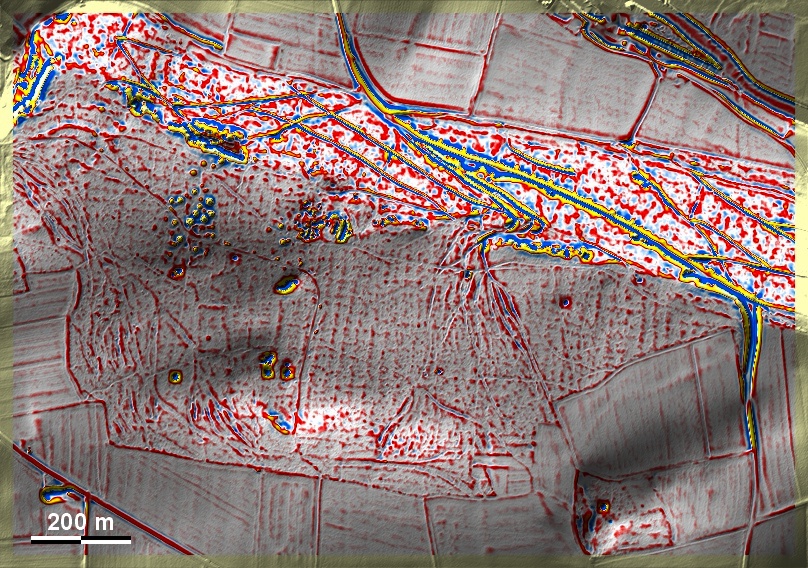
In der Birkach bei Amtmannsdorf finden sich auf der Albhochfläche 'Celtic Fields' auf Lehm- und Schluffböden über Jurakalken. Trotz ihrer schwachen Ausprägung können sie dem gekammerten Typ Przemęt zugeordnet werden. Sie werden von zwei Altwegefächern durchschnitten. Hier würde sich eine Untersuchung der Dolinen lohnen, um in diesen Sedimentfallen Aufschlüsse über Zeit und Art der Bewirtschaftung zu gewinnen. Die Hügelgruppen datieren in die Bronze- und Hallstattzeit. In the Birkach near Amtmannsdorf, 'Celtic Fields' are found on the Alb plateau on loam and silt soils over Jurassic limestones. Despite their weak expression, they can be assigned to the chambered Przemęt type. They are intersected by two ancient road fans. Here, an investigation of the sinkholes would be worthwhile in order to gain information about the time and type of cultivation in these sediment traps. The tumuli groups date to the Bronze and Hallstatt periods. Weiter more...