'Celtic Fields' – Stiefkinder der
Archäologie Archaeology's stepchildren
Spuren urgeschichtlicher Beackerung in West-,
Mittel-, Ost- und Nordeuropa Traces of prehistoric farming in Western,
Central, Eastern and Northern Europe: Garsdorf-Sackelberg, Bayern-Ost Bavaria-East
Weiter more...
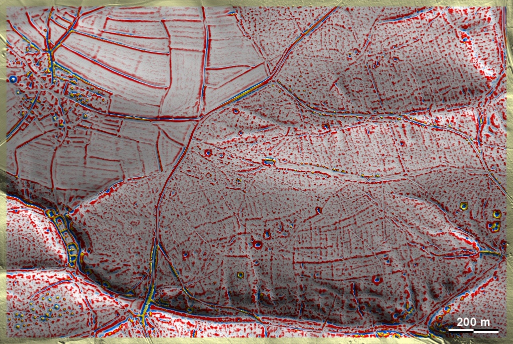
Auf dem Sackelberg bei Garsdorf liegen unspezifische alte Spuren einer Beackerung, die
nach Süden zum Hang hin teilweise deutliche Terrassenstufen ausgebildet hat.
Sie liegen auf schluffigen bis tonigen, zum Hang hin sandigen Böden. Im
Südwesten der Grafik eine Grabhügelgruppe. On the Sackelberg near Garsdorf
there are unspecific old traces of a cultivation, which in part has formed clear
terraces towards the south on the slope. They lie on silty to clayey
soils, sandy towards the slope. In the southwest of the graphic, a group of
tumuli.
Weiter more...
Daten © BVV/geodaten.bayern.de. Wenn Sie
diese Grafik herunterladen, müssen Sie zur Georeferenzierung mit Global Mapper
oder Mapinfo auch das
TAB-File laden
und stets im gleichen Verzeichnis speichern. (Rechte Maustaste; Ziel speichern
unter... Bei Umbenennung darauf achten, dass auch innerhalb des Tab-Files der
Dateiname entsprechend umbenannt wird!) Data © BVV/geodaten.bayern.de. If you
download this graphic, you must also load the
TAB-File for
georeferencing with Global Mapper or Mapinfo and save it always in the same
directory. (Right mouse button; save target as... When renaming, make sure that
the file name is also renamed within the tab file accordingly).
Grafik georeferenziert als
GEOTIFF
herunterladen z.B. für Avenza Maps + Smartphone oder als
KMZ-File für
Benutzung mit Locus Map + Smartphone oder Google Earth. Download
georeferenced graphics as
GEOTIFF
e.g. for Avenza Maps + Smartphone or as
KMZ-File for
use with Locus Map + Smartphone or Google Earth.
Zurück Back
Übersicht Bayern-Ost Overview Bavaria-East
Übersicht Bayern Overview Bavaria ©
Volker Arnold 2022