Spuren urgeschichtlicher Beackerung in West-, Mittel-, Ost- und Nordeuropa Traces of prehistoric farming in Western, Central, Eastern and Northern Europe: Töging-Schwedenberg, Bayern-Ost Bavaria-East Weiter more...
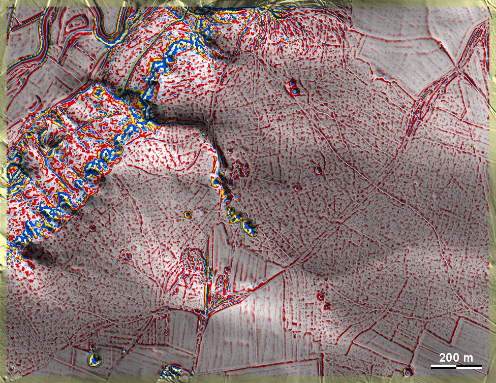
Auf dem Schwedenberg gegenüber von Dietfurt-Töging an der Altmühl liegen überwiegend schwache Spuren von 'Celtic Fields' im Wald auf Sandlehm- und Sandböden über Jurakalken. Vor allem nordöstlich der Bildmitte zeichnen sich gekammerte 'Celtic Fields' vom Typ Przemęt ab, wenn auch teilweise von einem großen Altwegefächer gestört. Die Dolinen dort könnten als Sedimentfallen Hinweise zur Datierung und Nutzung der Felder geben. Ein weiterer Altweg läuft diagonal von Südwest, wo auch eine kleine Grabhügelgruppe liegt, nach Nordost. On the Schwedenberg opposite Dietfurt-Töging on the Altmühl, there are predominantly faint traces of 'Celtic Fields' in the forest on sandy loam and sandy soils over Jurassic limestones. Especially to the north-east of the centre of the picture, chambered 'Celtic Fields' of the Przemęt type can be observed, although partly disturbed by a large fan of an ancient road. The sinkholes there could provide clues to the dating and use of the fields as sediment traps. Another ancient road runs diagonally from the southwest, where there is also a small group of barrows, to the northeast. Weiter more...