Spuren urgeschichtlicher Beackerung in West-, Mittel-, Ost- und Nordeuropa Traces of prehistoric farming in Western, Central, Eastern and Northern Europe: Dünzelbach-Leinbühl, Bayern-Süd Bavaria-South Weiter more...
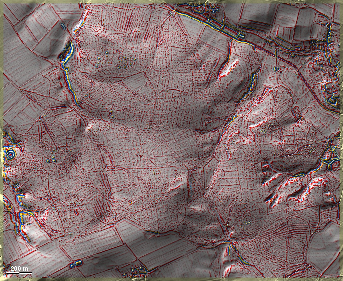
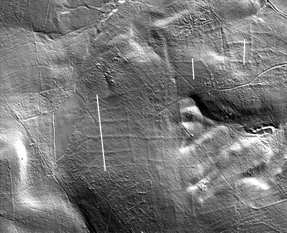
Am Leinbühl bei Moorenweis-Dünzelbach liegen im Wald fragmentarische, teils deutlich ausgeprägte 'Celtic Fields' auf Lösslehm, großenteils östlich der Bildmitte. Im Nordwesten und Westen drei Grabhügelgruppen und ein angeblich frühmittelalterlicher Ringwall. Wölbbeete im Norden und Südosten. Die Grabhügel nahe des Ringwalls stammen aus der Hallstattzeit. Die streifenartigen Spuren nördlich der Bildmitte scheinen auf moderne Forstwirtschaft zurückzugehen. Eine (schlecht erhaltene) Römerstraße durchzieht den Wald von Nordwest nach Südost. Leider scheint es keinen eindeutigen Überschneidungsbefund zwischen der Straße und den 'Celtic Fields' zu geben. – Die Kenntnis dieser Stelle verdanke ich Ulrich Bähr, Schöngeising. At Leinbühl near Moorenweis-Dünzelbach there are fragmentary, partly pronounced 'Celtic Fields' on loess loam in the forest, mostly to the east of the centre of the picture. To the northwest and west, three groups of tumuli and an alleged early medieval ring wall. Ridge-and-furrow beds to the north and south-east. The barrows near the ring wall date from the Hallstatt period. The strip-like traces north of the centre of the picture seem to date back to modern forestry. A (poorly preserved) Roman road crosses the forest from northwest to southeast. Unfortunately, there seems no clear overlap between the road and the 'Celtic Fields'. – I owe the knowledge of this site to Ulrich Bähr, Schöngeising. Weiter more...