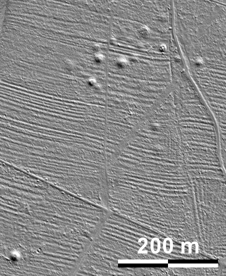
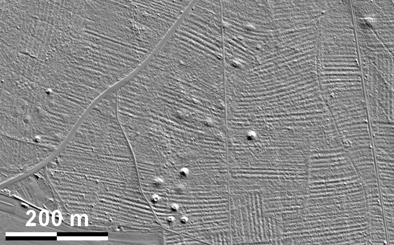
Spuren urgeschichtlicher Beackerung in West-, Mittel-, Ost- und Nordeuropa Traces of prehistoric farming in Western, Central, Eastern and Northern Europe: Gauting-Nordost-Kasten, Bayern-Süd Bavaria-South Weiter more...
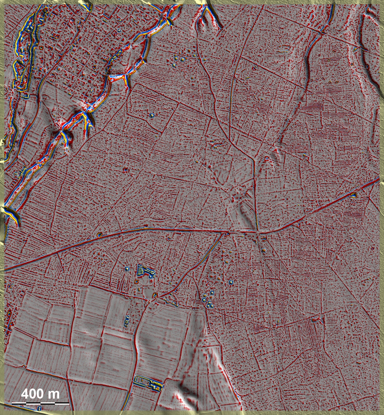
Als eines von zahlreichen Beispielen sei hier die mittelalterliche Feldmark im Bereich des ehemaligen Forsthauses Kasten nordöstlich von Gauting in der südlichen Müncher Schotterebene vorgestellt. Es scheint sich um die nahezu komplette Wölbbeet-Feldmark eines aufgelassenen Dorfes zu handen. Um den Standort des Forsthauses etwas östlich der Bildmitte setzen die Spuren aus. Benno Gantner konnte jüngst nachweisen, dass dort das im 11. Jh erstmals erwähnte und Ende des 13. Jh. als öd bezeichnete Dorf Stadelaren gelegen hatte. Im Bereich des einzelnen Grabhügels im Nordwesten der Grafik hat die Anlage der Wölbbeete möglicherweise ältere 'Celtic Fields' noch nicht ganz verschwinden lassen. Die übrigen Grabhügelgruppen stammen aus der Hallstattzeit. As one of numerous examples, the medieval fieldmark in the area of the former forester's lodge Kasten northeast of Gauting in the southern Munich gravel plain is presented here. It seems to be the almost complete ridge-and-furrow fields of an abandoned village. Around the site of the forester's lodge a little to the east of the centre of the picture, the traces disappear. Benno Gantner was recently able to prove that the village of Stadelaren, first mentioned in the 11th century and described as deserted at the end of the 13th century, had been located there. In the area of the single barrow to the north-west of the diagram, the construction of the ridge-and-furrow beds may not yet have completely eliminated older 'Celtic Fields'. The other groups of barrows date from the Hallstatt period. Weiter more...