Spuren urgeschichtlicher Beackerung in West-, Mittel-, Ost- und Nordeuropa Traces of prehistoric farming in Western, Central, Eastern and Northern Europe: Berolzheimer Wald, Bayern-West Bavaria-West Weiter more...
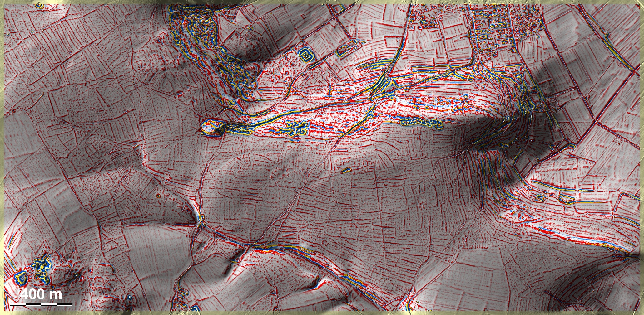
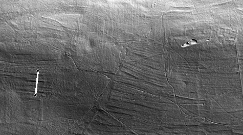
Der Berolzheimer Wald ist ein Teil der nördlichen Stufe der Fränkischen Alb und liegt auf Mergelkalk, der nicht zur Höhlen- und Dolinenbildung neigt. Hier sind auch die Hangneigungen etwas sanfter als auf dem Plattenkalk. Entsprechend sind die zahlreichen Spuren älterer Beackerung hier als Terrassen ausgeprägt, die zu allen Zeiten ähnlich ausgebildet sein dürften. Nur in den kleinräumigen flachen Hochlagen gibt es fragmentarische 'Celtic Fields'. Die ausgedehnten Beackerungsspuren im Westen der Grafik ähneln den historischen des Umfeldes, wie sie aus dem Kataster der 1. Hälfte des 19. Jhs. hervorgehen. Diese Art von "Langfeldern" halte ich, wie in Strüth-Herrenwald, für mittelalterlich. – Links der Bildmitte eine Deponie, oben in Bildmitte ein Burgstall. The Berolzheimer Wald is part of the northern stage of the Franconian Alb and lies on marl limestone, which does not tend to form caves and sinkholes. Here the slopes are also somewhat gentler than on the Plattenkalk. Correspondingly, the numerous traces of older cultivation are pronounced here as terraces, which are likely to have been similarly formed at all times. Only in the small-scale flat uplands exist fragmentary 'Celtic Fields'. The extensive traces of cultivation in the west of the graphic are similar to the historical ones in the surrounding area as they appear from the cadastre of the first half of the 19th century. I consider this type of "long fields", as in Strüth-Herrenwald, to be medieval. – To the left of the centre of the picture a dump, at the top in the centre of the picture a castle site. Weiter more...