'Celtic Fields' – Stiefkinder der
Archäologie Archaeology's stepchildren
Spuren urgeschichtlicher Beackerung in West-,
Mittel-, Ost- und Nordeuropa Traces of prehistoric farming in Western,
Central, Eastern and Northern Europe: Lübben-Bukoitza, Brandenburg/Berlin
Weiter more...
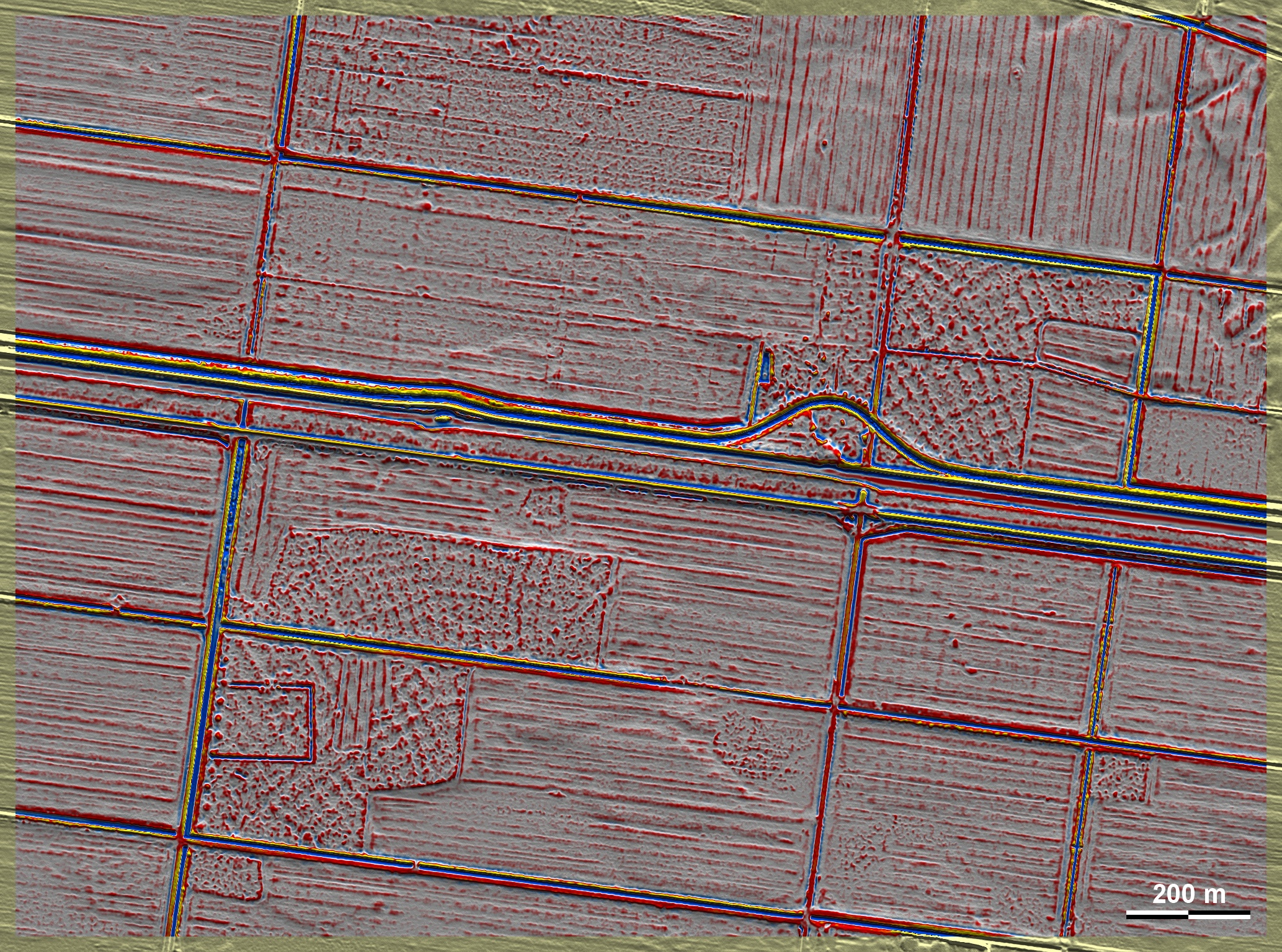
Moritz Kaliner entdeckte in den Daten um die Aussiedlung Bukoitza südöstlich von
Lübben im Spreewald Fragmente von 'Celtic Fields', die dem Typ
Przemęt
angehören, obwohl hier die Ränder übergeordneter Parzellen wohl wegen der
Fragentierung nicht einwandfrei erkennbar sind. Moritz Kaliner discovered
fragments of ‘Celtic Fields’ in the data around the Bukoitza settlement
south-east of Lübben in the Spreewald, which belong to the
Przemęt
type,
although the edges of superordinate plots are probably not clearly recognisable
here due to the fragmentation.
Weiter more...
|
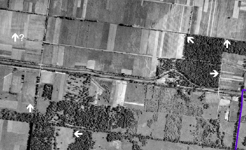 |
Im Luftbild von 1953 sind im Umfeld noch weitere
Spuren erkennbar, die sich durch Trockenheit oder Überpflügen heller
als die Umgebung abheben. In the
aerial photograph from 1953, further traces can be seen in the
neighbourhood, which stand out brighter than the surrounding area
due to dryness or ploughing.
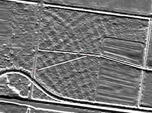 |

Schnitt SW-NE durch 6 Teilparzellen. Die "Randwälle" erreichen eine
Höhe von gut 15 cm.
Section SW-NE through 6 subplots. The ‘edge embankments’ reach a
height of a good 15 cm. |
Lage des Schnittes
Position of section
|
Daten © GeoBasis-DE / LGB. Wenn Sie
diese Grafik herunterladen, müssen Sie zur Georeferenzierung mit Global Mapper
oder Mapinfo auch das
TAB-File laden
und stets im gleichen Verzeichnis speichern. (Rechte Maustaste; Ziel speichern
unter... Bei Umbenennung darauf achten, dass auch innerhalb des Tab-Files der
Dateiname entsprechend umbenannt wird!) Data © GeoBasis-DE / LGB. If you
download this graphic, you must also load the
TAB-File for
georeferencing with Global Mapper or Mapinfo and save it always in the same
directory. (Right mouse button; save target as... When renaming, make sure that
the file name is also renamed within the tab file accordingly).
Grafik georeferenziert als
GEOTIFF
herunterladen z.B. für Avenza Maps + Smartphone oder als
KMZ-File für
Benutzung mit Locus Map + Smartphone oder Google Earth. Download
georeferenced graphics as
GEOTIFF
e.g. for Avenza Maps + Smartphone or as
KMZ-File for
use with Locus Map + Smartphone or Google Earth.
Zurück Back
Übersicht Brandenburg/Berlin Overview
Brandenburg/Berlin ©
Volker Arnold 2024