Spuren urgeschichtlicher Beackerung in West-, Mittel-, Ost- und Nordeuropa Traces of prehistoric farming in Western, Central, Eastern and Northern Europe: Roznika-NW, Süd-Polen Weiter more...
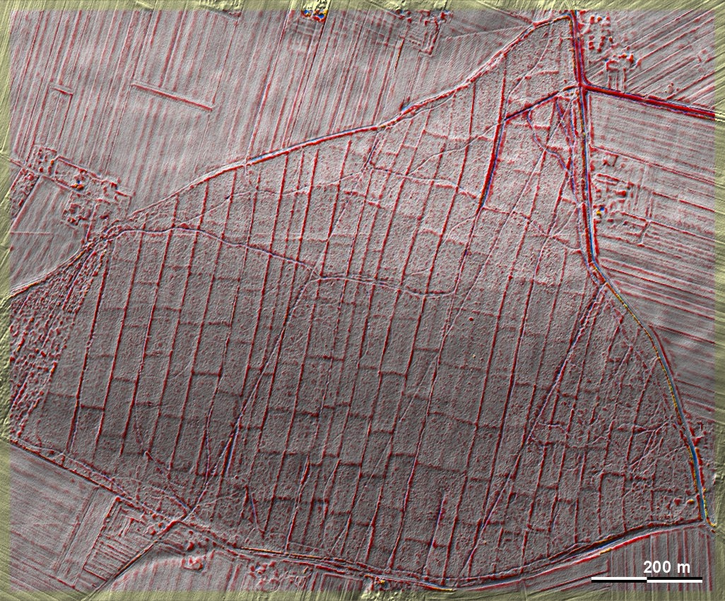
In einem kleinen Waldstück nordwestlich von Roznika liegt eine Langstreifenflur, die (sekundär?) quergeteilt ist. Hier wird übrigens auch deutlich, dass es neben normalen Streifenbreiten von ca. 50 m auch benachbarte halbe Streifenbreiten gibt, bei denen die Quereinteilungen nicht immer konform gehen. Diese Flurform halte ich für früh- bis hochmittelalterlich, ohne dies durch konkrete Daterungen stützen zu können. – Die Kenntnis dieser Fundstelle verdanke ich den Amateurarchäologen (und Augenärzten) Paweł Banasiak, Katowice und Piotr Berezowski, Bielsko-Biała. In a small piece of forest northwest of Roznika there is a long strip field that is (secondarily?) cross-divided. Besides normal strip widths of about 50 m, it is also clear here that there are also neighbouring half strip widths where the transverse divisions do not always conform. I consider this type of field to be early to high medieval, without being able to support this with concrete dating. - I owe the knowledge of this site to the amateur archaeologists (and ophthalmologists) Paweł Banasiak, Katowice and Piotr Berezowski, Bielsko-Biała. Weiter more...